MyTopo
Long Valley Nebraska US Topo Map
Couldn't load pickup availability
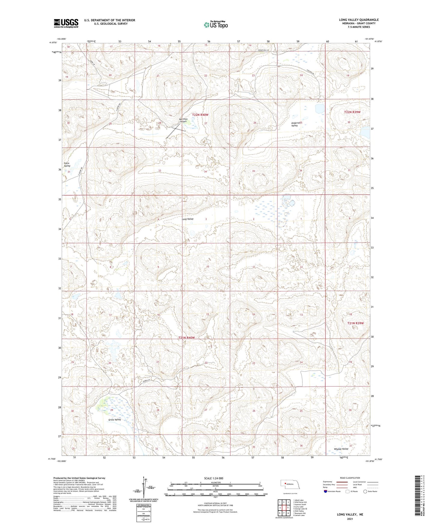
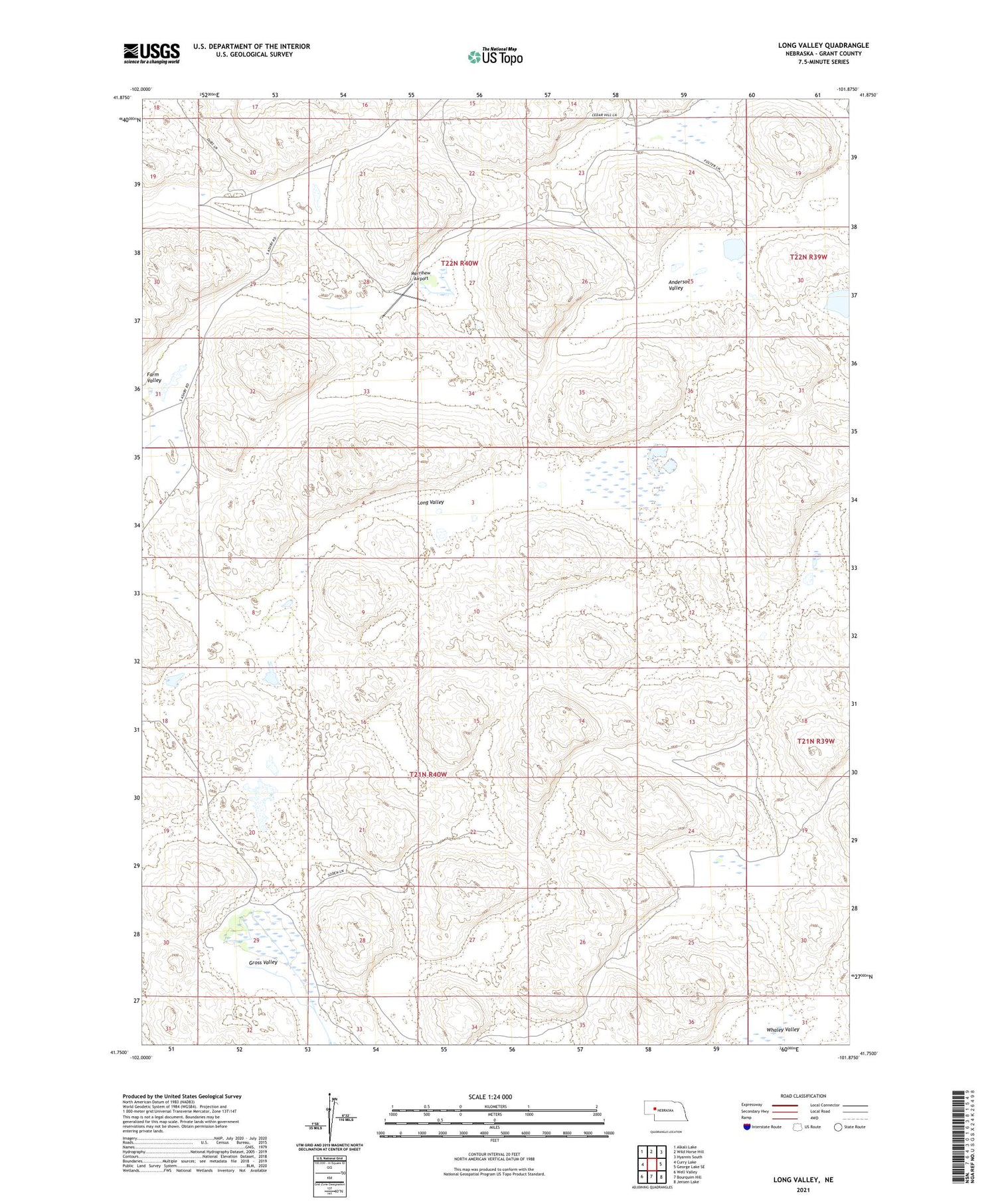
2021 topographic map quadrangle Long Valley in the state of Nebraska. Scale: 1:24000. Based on the newly updated USGS 7.5' US Topo map series, this map is in the following counties: Grant. The map contains contour data, water features, and other items you are used to seeing on USGS maps, but also has updated roads and other features. This is the next generation of topographic maps. Printed on high-quality waterproof paper with UV fade-resistant inks.
Quads adjacent to this one:
West: Curry Lake
Northwest: Alkali Lake
North: Wild Horse Hill
Northeast: Hyannis South
East: George Lake SE
Southeast: Jensen Lake
South: Bourquim Hill
Southwest: Well Valley
Contains the following named places: Anderson Valley, Bob Merrihew Ranch, Boots Ranch, Burgess Ranch, Farm Valley School, Gross Valley, Hawthorne Lake, Long Valley, Lowe Ranch, Lowes Camp, Merrihew Airport, Merrihew Ranch, Merry Airport, Minor-Adams Ranch, Whaley Valley