MyTopo
Monowi Nebraska US Topo Map
Couldn't load pickup availability
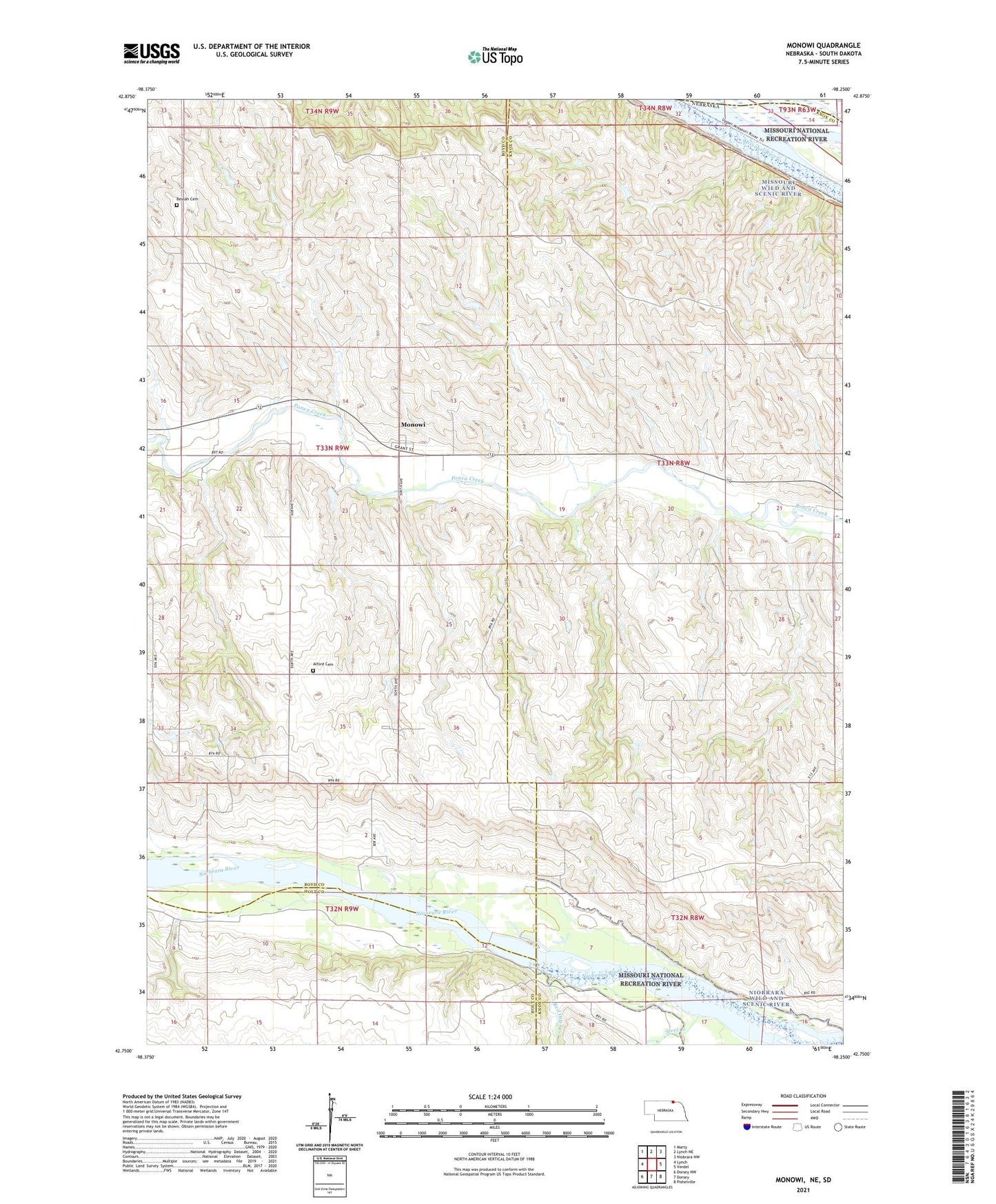
2021 topographic map quadrangle Monowi in the state of Nebraska. Scale: 1:24000. Based on the newly updated USGS 7.5' US Topo map series, this map is in the following counties: Knox, Boyd, Holt, Charles Mix. The map contains contour data, water features, and other items you are used to seeing on USGS maps, but also has updated roads and other features. This is the next generation of topographic maps. Printed on high-quality waterproof paper with UV fade-resistant inks.
Quads adjacent to this one:
West: Lynch
Northwest: Marty
North: Lynch NE
Northeast: Niobrara NW
East: Verdel
Southeast: Pishelville
South: Dorsey
Southwest: Dorsey NW
Contains the following named places: Alford Cemetery, Beulah Cemetery, Flanders Dam, Flanders Reservoir, Masdon School, Monowi, Monowi Post Office, Pleasant Hill School, Red Otter Creek, School Number 101 West, School Number 26, School Number 41, School Number 42, School Number 89, Steel Creek, Township of Bush, Verdel School, Village of Monowi