MyTopo
Lynch Nebraska US Topo Map
Couldn't load pickup availability
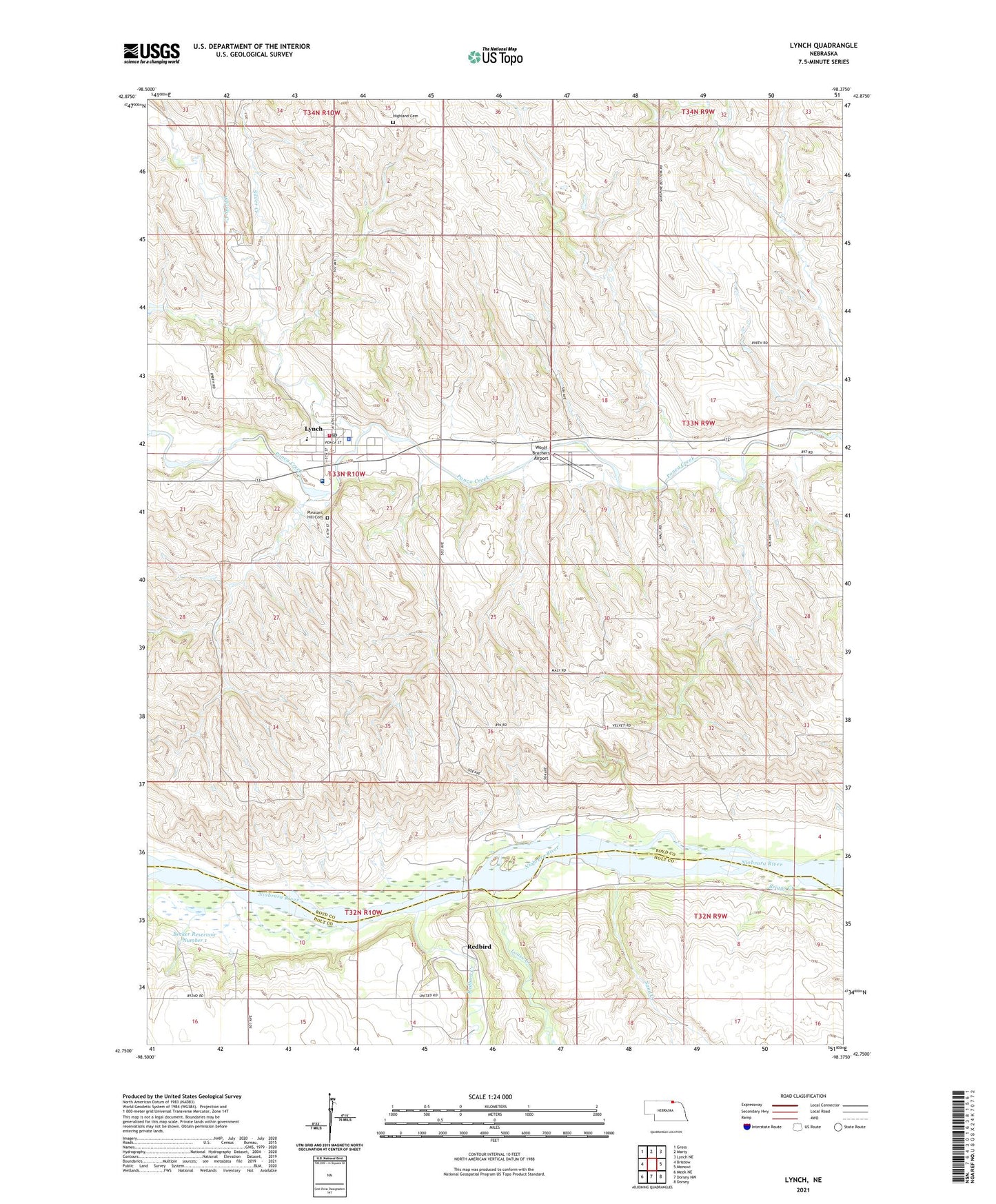
2021 topographic map quadrangle Lynch in the state of Nebraska. Scale: 1:24000. Based on the newly updated USGS 7.5' US Topo map series, this map is in the following counties: Boyd, Holt. The map contains contour data, water features, and other items you are used to seeing on USGS maps, but also has updated roads and other features. This is the next generation of topographic maps. Printed on high-quality waterproof paper with UV fade-resistant inks.
Quads adjacent to this one:
West: Bristow
Northwest: Gross
North: Marty
Northeast: Lynch NE
East: Monowi
Southeast: Dorsey
South: Dorsey NW
Southwest: Meek NE
This map covers the same area as the classic USGS quad with code o42098g4.
Contains the following named places: Becker Reservoir Number 1, Briggs Creek, Highland Cemetery, Louse Creek, Lynch, Lynch City Police Department, Lynch Medical Clinic, Lynch Post Office, Lynch Public Schools, Lynch Village Library, Lynch Volunteer Fire Department, Niobrara Valley Hospital, Pleasant Hill Cemetery, Redbird, Redbird Creek, Redbird Post Office, Redbird Public School, Sand Creek, School Number 39, School Number 63, School Number 64, School Number 67, Silver Creek, Township of Lynch, United Methodist Church, Village of Lynch, Wesleyan Church, Whisky Creek, Woolf Brothers Airport, ZIP Code: 68746