
MyTopo
Mullen Nebraska US Topo Map
Couldn't load pickup availability
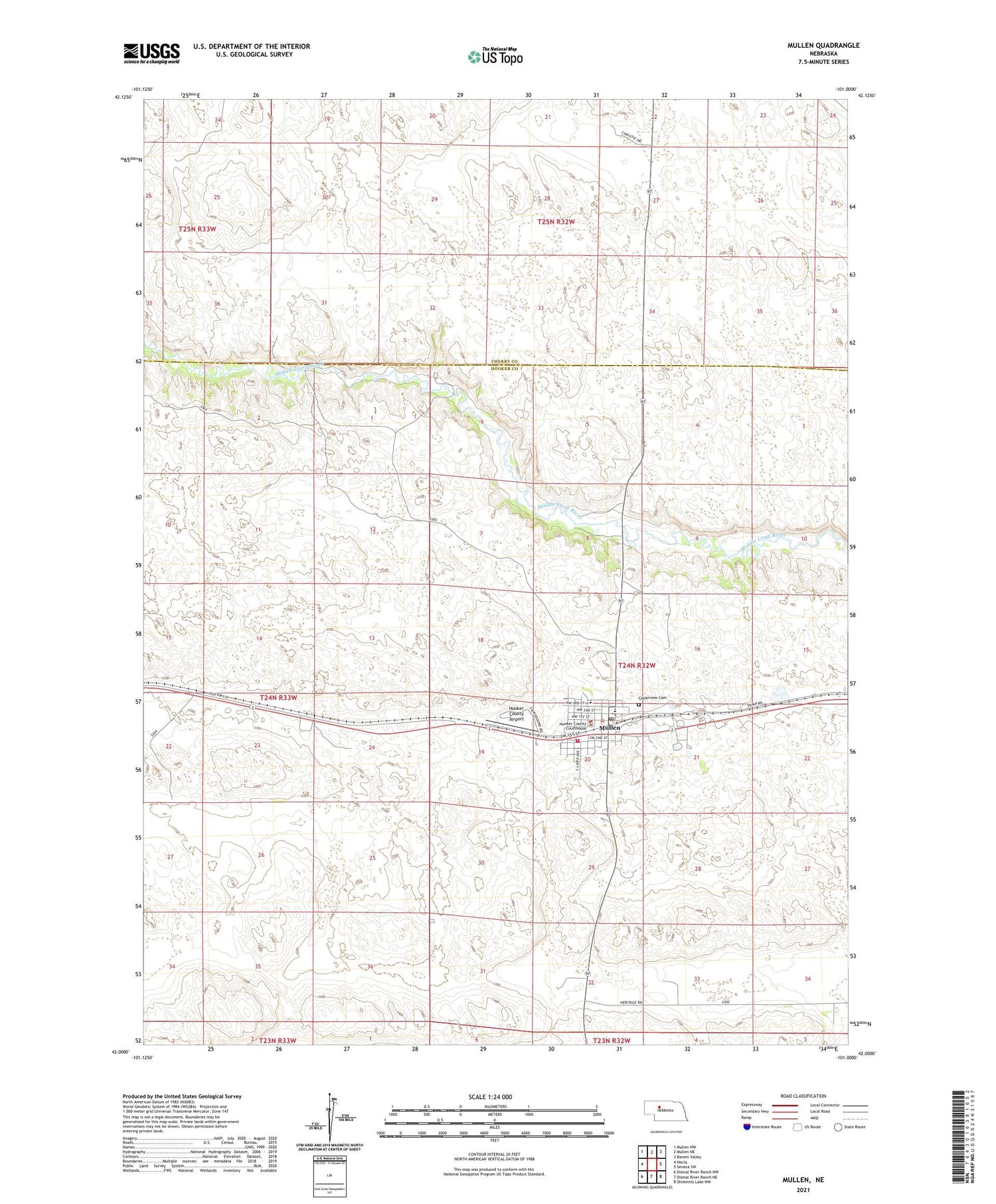
2021 topographic map quadrangle Mullen in the state of Nebraska. Scale: 1:24000. Based on the newly updated USGS 7.5' US Topo map series, this map is in the following counties: Hooker, Cherry. The map contains contour data, water features, and other items you are used to seeing on USGS maps, but also has updated roads and other features. This is the next generation of topographic maps. Printed on high-quality waterproof paper with UV fade-resistant inks.
Quads adjacent to this one:
West: Hecla
Northwest: Mullen NW
North: Mullen NE
Northeast: Barent Valley
East: Seneca SW
Southeast: Shimmins Lake NW
South: Dismal River Ranch NE
Southwest: Dismal River Ranch NW
Contains the following named places: Assembly of God Church, Barnaby School, Cedarview Cemetery, Harding School, Hooker County Airport, Hooker County Courthouse, Hooker County Fair Grounds, Hooker County Library, Hooker County Sheriff's Office, Lariat Auditorium, Lee Boyer Ranch, Morris Ranch, Mullen, Mullen Ambulance Service, Mullen City Park, Mullen Dental Associates Center, Mullen Elementary School, Mullen Golf Club, Mullen High School, Mullen Post Office, Mullen Volunteer Fire Department, Pioneer Memorial Nursing Home, Saint Josephs Episcopal Church, Saint Marys Catholic Church, Sandhills Family Medicine, Swimming Pool Park, United Methodist Church, Village of Mullen, Wright City Trailer Court


