MyTopo
Nemaha Nebraska US Topo Map
Couldn't load pickup availability
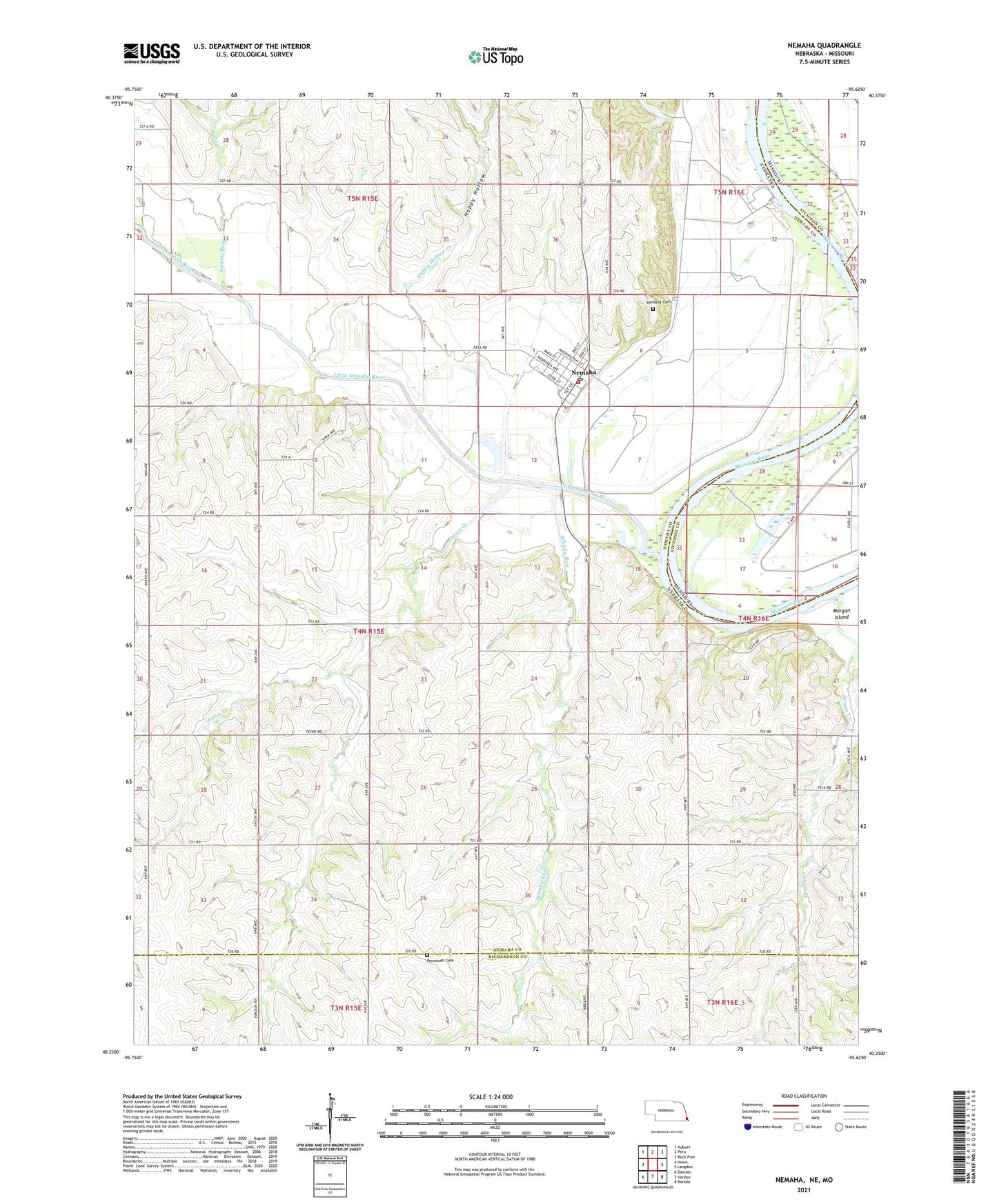
2021 topographic map quadrangle Nemaha in the state of Nebraska. Scale: 1:24000. Based on the newly updated USGS 7.5' US Topo map series, this map is in the following counties: Nemaha, Richardson, Atchison. The map contains contour data, water features, and other items you are used to seeing on USGS maps, but also has updated roads and other features. This is the next generation of topographic maps. Printed on high-quality waterproof paper with UV fade-resistant inks.
Quads adjacent to this one:
West: Howe
Northwest: Auburn
North: Peru
Northeast: Rock Port
East: Langdon
Southeast: Barada
South: Verdon
Southwest: Dawson
Contains the following named places: Aspinwall Post Office, Cooper Emergency Medical Response Team, Cooper Spur, Deroin Creek, Happy Hollow, Jarvis Creek, Little Nemaha River, Maple Grove School, Nemaha, Nemaha Cemetery, Nemaha Christian Church, Nemaha Election Precinct, Nemaha Elevator Company Elevator, Nemaha Post Office, Nemaha Rescue Squad, Nemaha Volunteer Fire Department District 4, Penniwell Cemetery, Prairie Union Baptist Church, Swartz Run, Township of Nemaha, United Methodist Church, Village of Nemaha, Whisky Run, ZIP Code: 68414