MyTopo
Langdon Missouri US Topo Map
Couldn't load pickup availability
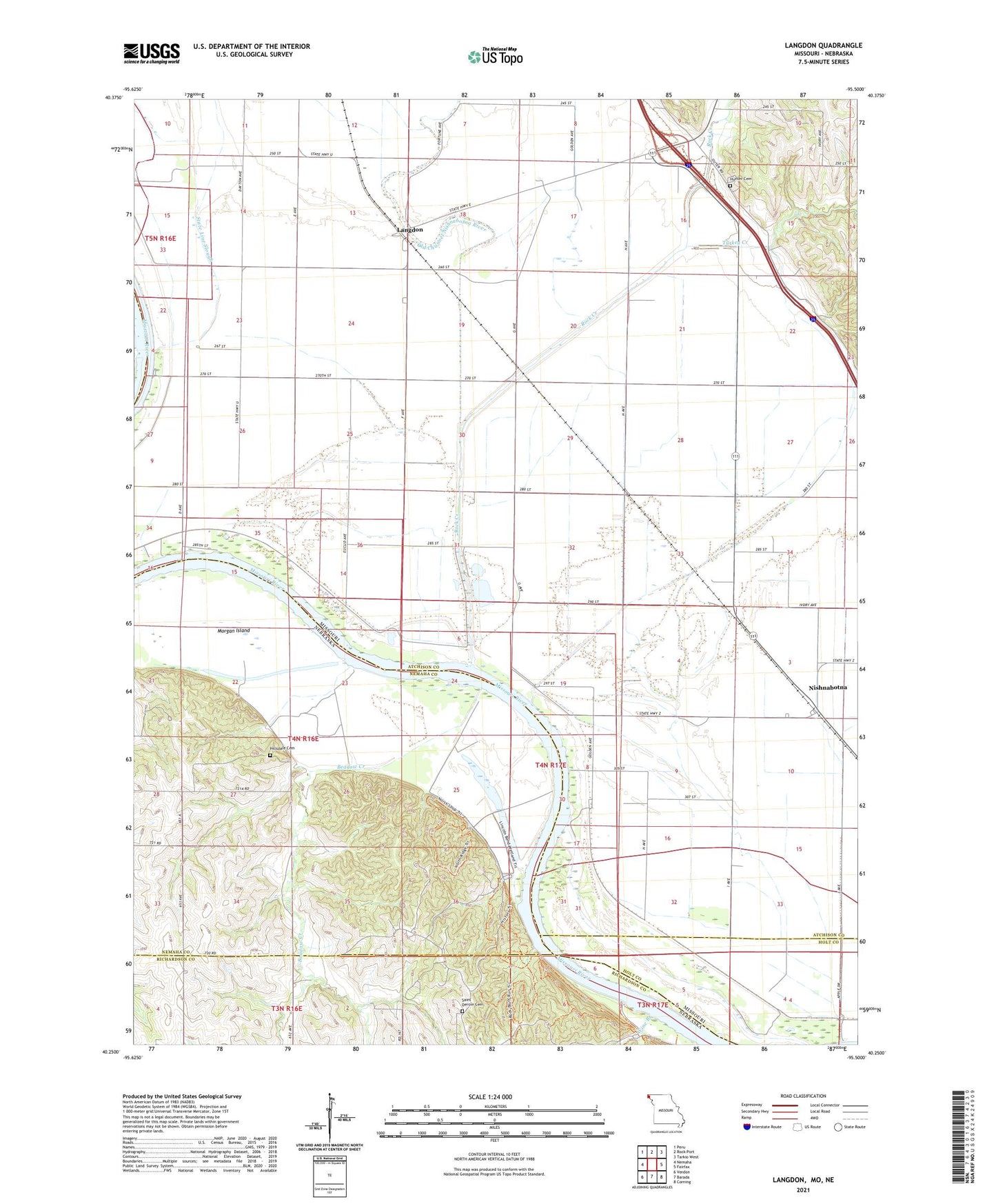
2021 topographic map quadrangle Langdon in the states of Missouri, Nebraska. Scale: 1:24000. Based on the newly updated USGS 7.5' US Topo map series, this map is in the following counties: Atchison, Nemaha, Richardson, Holt. The map contains contour data, water features, and other items you are used to seeing on USGS maps, but also has updated roads and other features. This is the next generation of topographic maps. Printed on high-quality waterproof paper with UV fade-resistant inks.
Quads adjacent to this one:
West: Nemaha
Northwest: Peru
North: Rock Port
Northeast: Tarkio West
East: Fairfax
Southeast: Corning
South: Barada
Southwest: Verdon
Contains the following named places: Beadow Creek, Bend Center School, Cooper School, Excelsior School, Hillsdale Cemetery, Hoot Owl Bend Public Access, Hunter Cemetery, Indian Cave State Park, Indian Cave State Park Trails, Langdon, Langdon Bend Public Access, Langdon School, Lincoln School, Luhrs Landing Strip, Morgan Island, Nishnabotna, Old Channel Nishnabotna River, Rock Creek, Rock Creek Ditch, Saint Deroin, Saint Deroin Cemetery, Saint Deroin Post Office, Saint Peters Church, State Line Slough, Township of Benton, Turkey Creek, West Bend School