MyTopo
Norman Nebraska US Topo Map
Couldn't load pickup availability
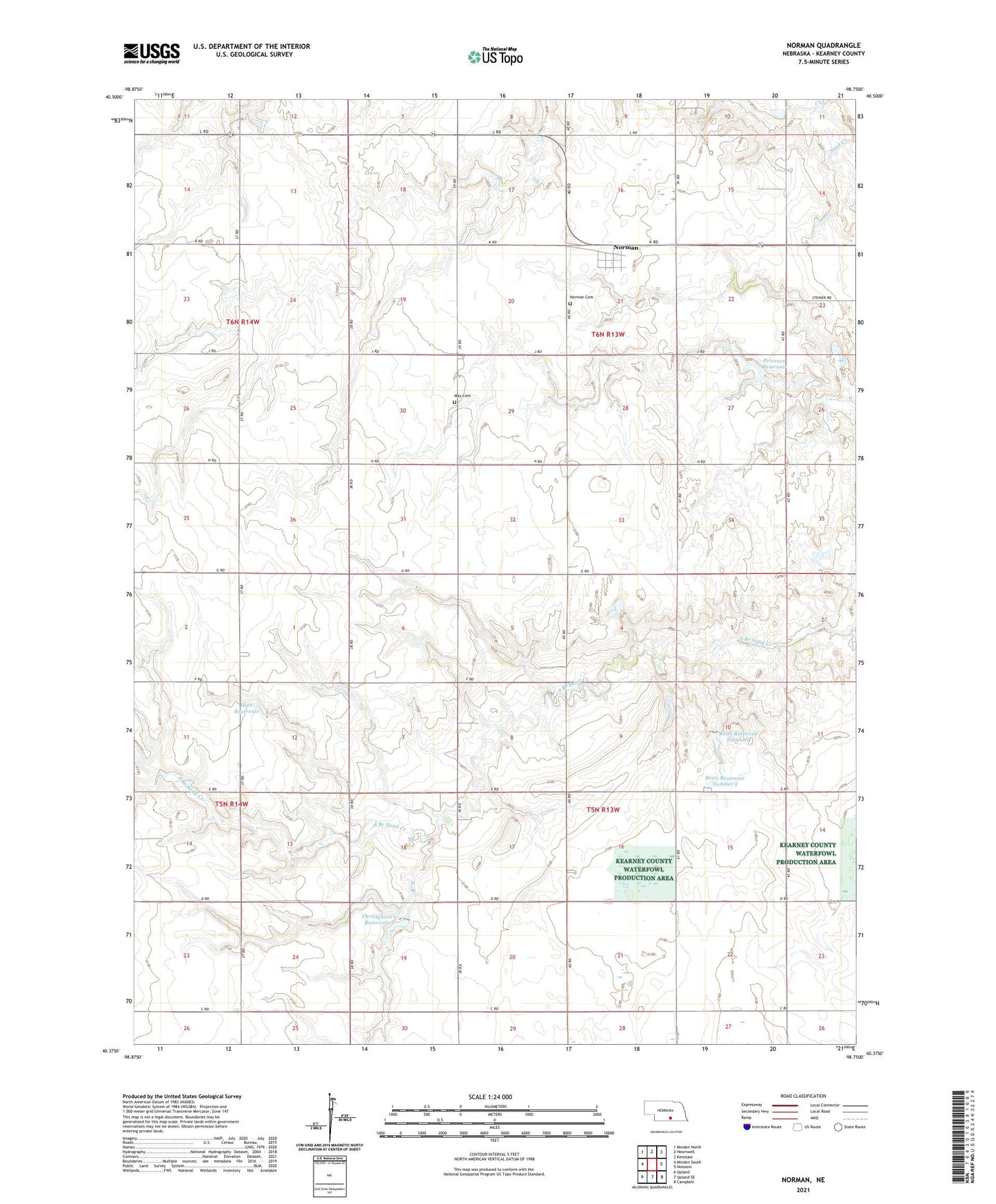
2021 topographic map quadrangle Norman in the state of Nebraska. Scale: 1:24000. Based on the newly updated USGS 7.5' US Topo map series, this map is in the following counties: Kearney. The map contains contour data, water features, and other items you are used to seeing on USGS maps, but also has updated roads and other features. This is the next generation of topographic maps. Printed on high-quality waterproof paper with UV fade-resistant inks.
Quads adjacent to this one:
West: Minden South
Northwest: Minden North
North: Heartwell
Northeast: Kenesaw
East: Holstein
Southeast: Campbell
South: Upland SE
Southwest: Upland
Contains the following named places: Christensen Dam, Christensen Reservoir, Hieb Dam, Hieb Reservoir, May Cemetery, Norman, Norman Cemetery, Norman Post Office, Osco Church, Osco Post Office, Petersen Dam, Petersen Reservoir, Reiss Dam Number 1, Reiss Dam Number 2, Reiss Reservoir Number 1, Reiss Reservoir Number 2, South Branch Sand Creek, Township of Grant, Township of May, Village of Norman, Youngson Lagoon Nat Wildlife Mgt Area