MyTopo
Kenesaw Nebraska US Topo Map
Couldn't load pickup availability
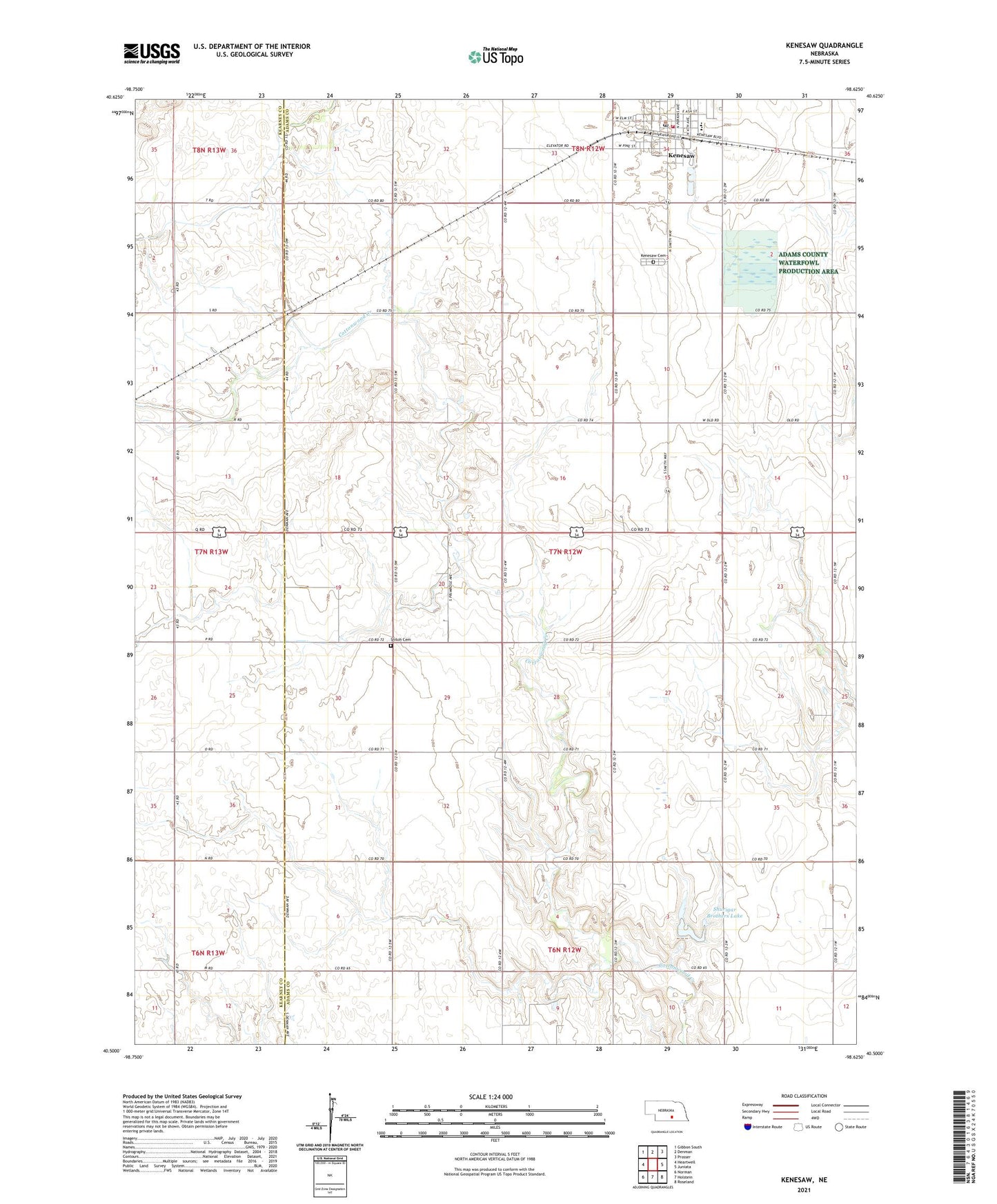
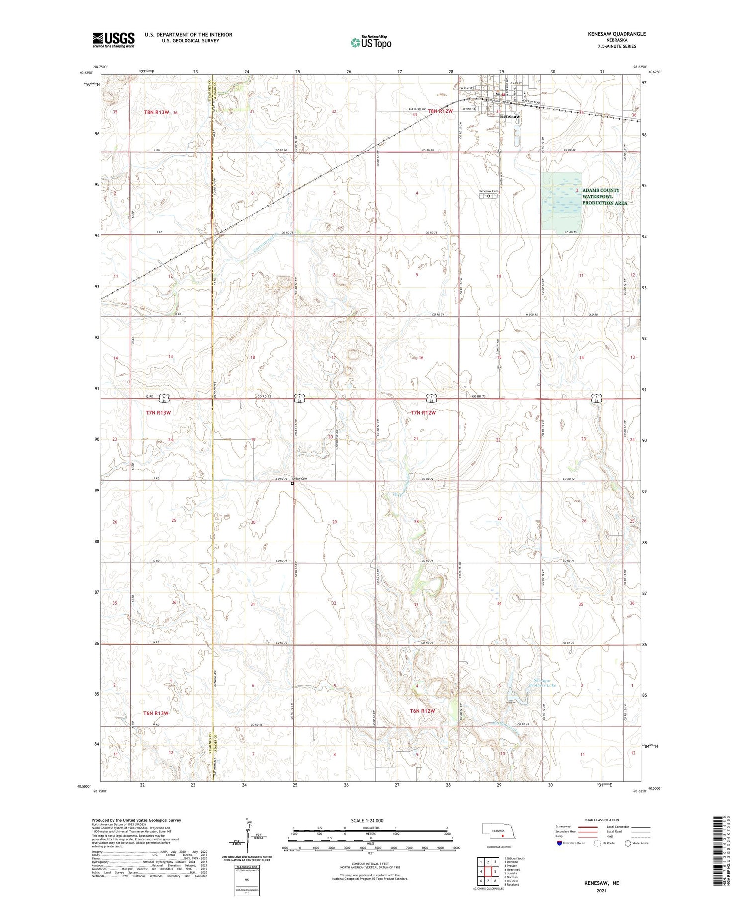
2021 topographic map quadrangle Kenesaw in the state of Nebraska. Scale: 1:24000. Based on the newly updated USGS 7.5' US Topo map series, this map is in the following counties: Adams, Kearney. The map contains contour data, water features, and other items you are used to seeing on USGS maps, but also has updated roads and other features. This is the next generation of topographic maps. Printed on high-quality waterproof paper with UV fade-resistant inks.
Quads adjacent to this one:
West: Heartwell
Northwest: Gibbon South
North: Denman
Northeast: Prosser
East: Juniata
Southeast: Roseland
South: Holstein
Southwest: Norman
This map covers the same area as the classic USGS quad with code o40098e6.
Contains the following named places: Adams County Waterfowl Production Area, Haven Home of Kenesaw, Kenesaw, Kenesaw Cemetery, Kenesaw Lutheran Church, Kenesaw Post Office, Kenesaw Presbyterian Church, Kenesaw Public Schools, Kenesaw Volunteer Fire Department, Sacred Heart Catholic Church, Sand Hill, Shiloh Cemetery, Shurigar Bros Dam, Shurigar Brothers Lake, Township of Wanda, United Methodist Church, Village of Kenesaw, Zion Church