MyTopo
Oliver Reservoir Nebraska US Topo Map
Couldn't load pickup availability
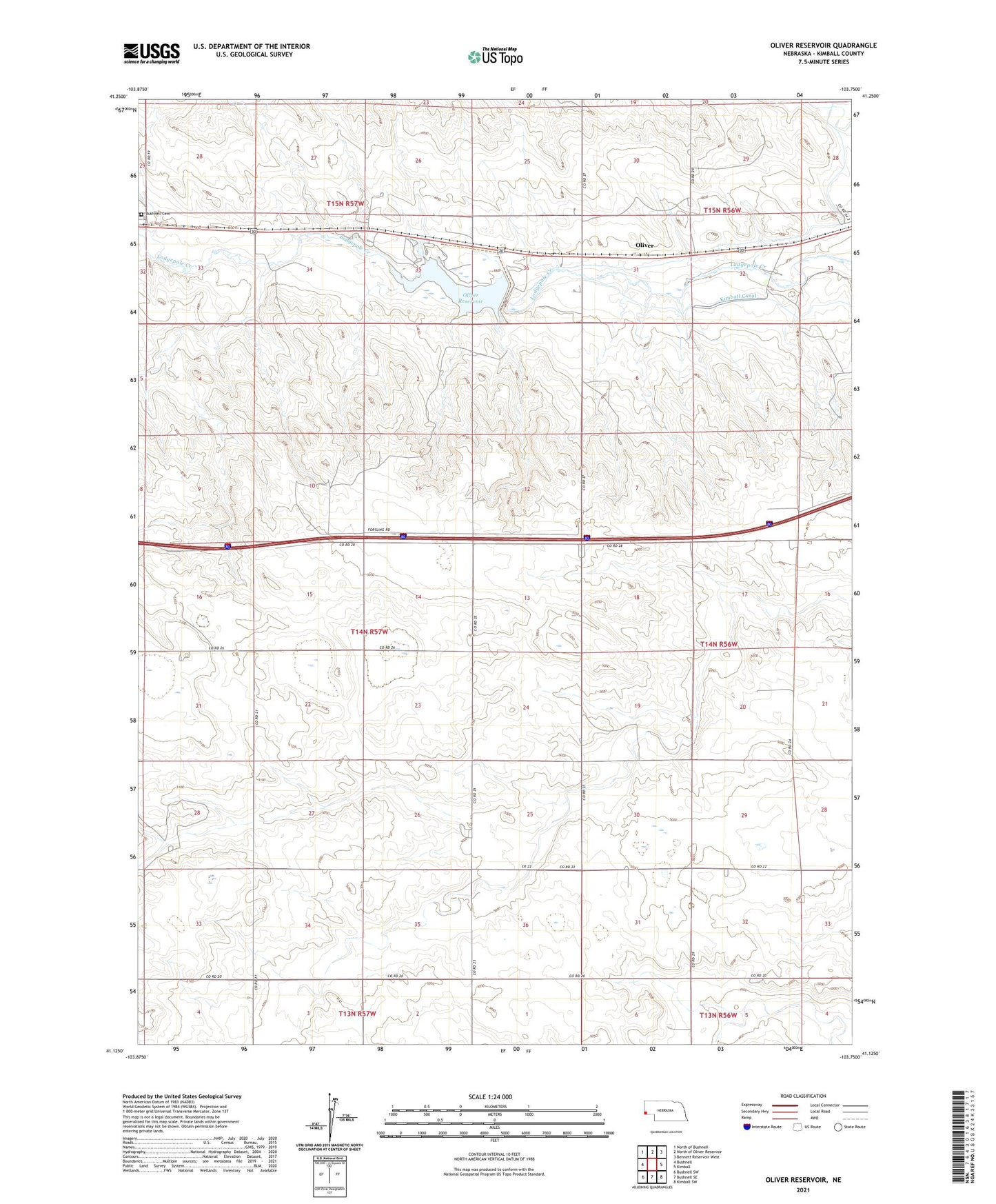
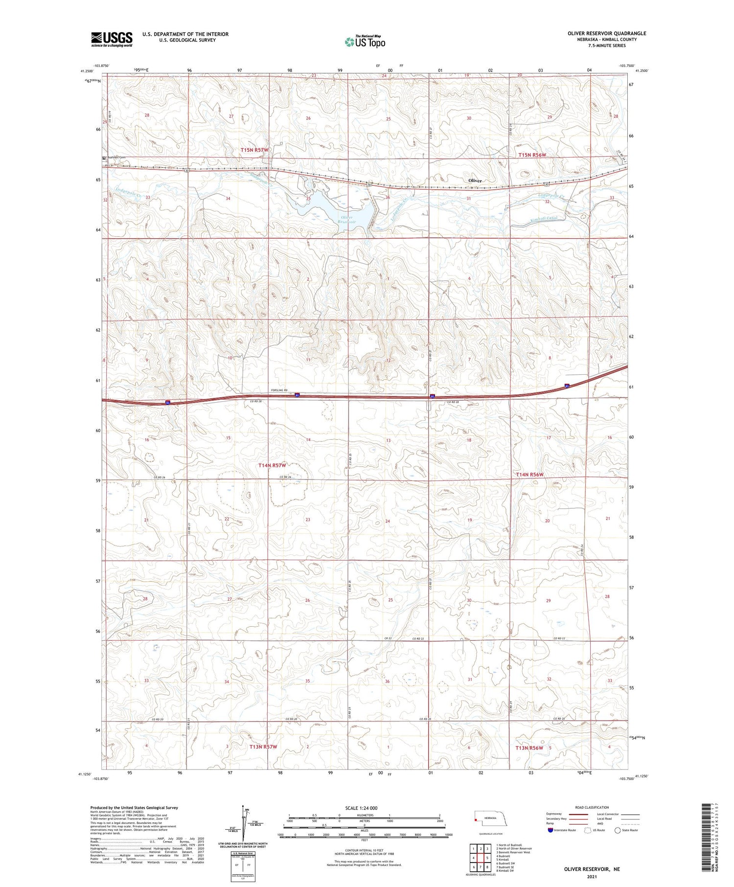
2021 topographic map quadrangle Oliver Reservoir in the state of Nebraska. Scale: 1:24000. Based on the newly updated USGS 7.5' US Topo map series, this map is in the following counties: Kimball. The map contains contour data, water features, and other items you are used to seeing on USGS maps, but also has updated roads and other features. This is the next generation of topographic maps. Printed on high-quality waterproof paper with UV fade-resistant inks.
Quads adjacent to this one:
West: Bushnell
Northwest: North of Bushnell
North: North of Oliver Reservoir
Northeast: Bennett Reservoir West
East: Kimball
Southeast: Kimball SW
South: Bushnell SE
Southwest: Bushnell SW
Contains the following named places: Bushnell Cemetery, Kimball Eastbound Travel Information Center, Kimball Irrigation District Dam, Kimball Rest Area, Lodgepole Wayside Park, Nebraska Historical Marker, Oliver, Oliver Reservoir, Oliver Reservoir Camping Area, Oliver Reservoir State Recreation Area