MyTopo
Paxton South Nebraska US Topo Map
Couldn't load pickup availability
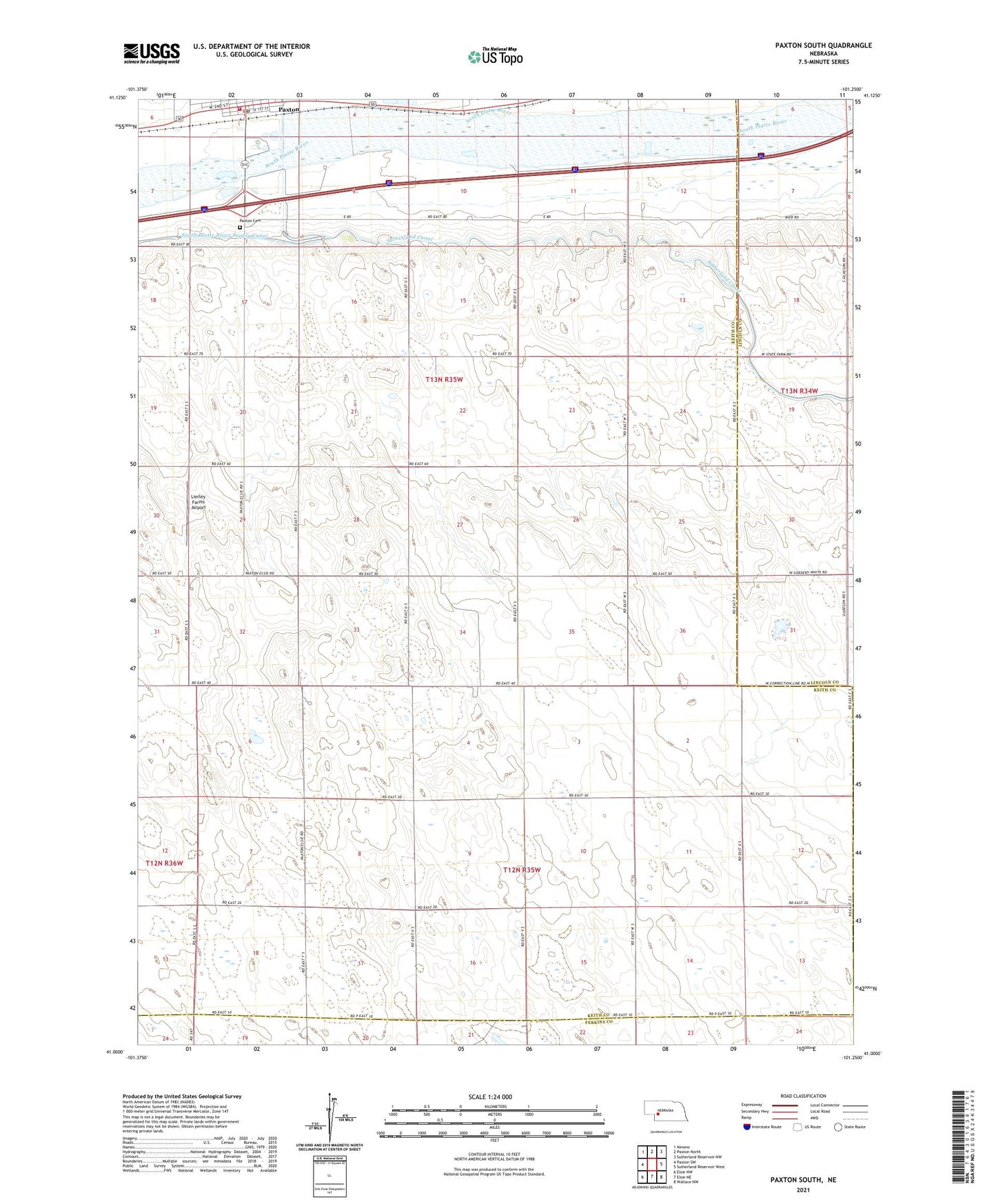
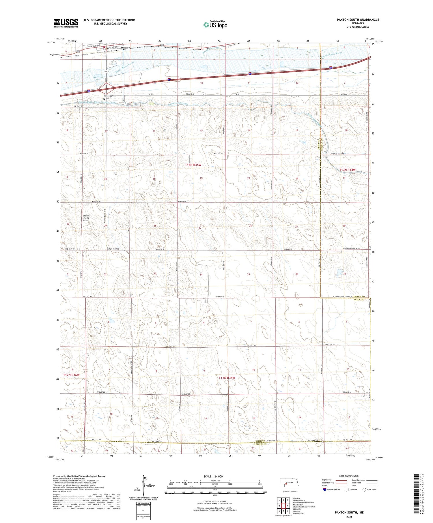
2021 topographic map quadrangle Paxton South in the state of Nebraska. Scale: 1:24000. Based on the newly updated USGS 7.5' US Topo map series, this map is in the following counties: Keith, Lincoln, Perkins. The map contains contour data, water features, and other items you are used to seeing on USGS maps, but also has updated roads and other features. This is the next generation of topographic maps. Printed on high-quality waterproof paper with UV fade-resistant inks.
Quads adjacent to this one:
West: Paxton SW
Northwest: Nevens
North: Paxton North
Northeast: Sutherland Reservoir NW
East: Sutherland Reservoir West
Southeast: Wallace NW
South: Elsie NE
Southwest: Elsie NW
Contains the following named places: KOGA-FM (Ogallala), Lierley Farms Airport, Oles Lodge RV Park, Paxton, Paxton Cemetery, Paxton Police Department, Paxton Post Office, Paxton Public Library, Paxton Volunteer Fire and Rescue, School Number 16, Village of Paxton