MyTopo
Sutherland Reservoir NW Nebraska US Topo Map
Couldn't load pickup availability
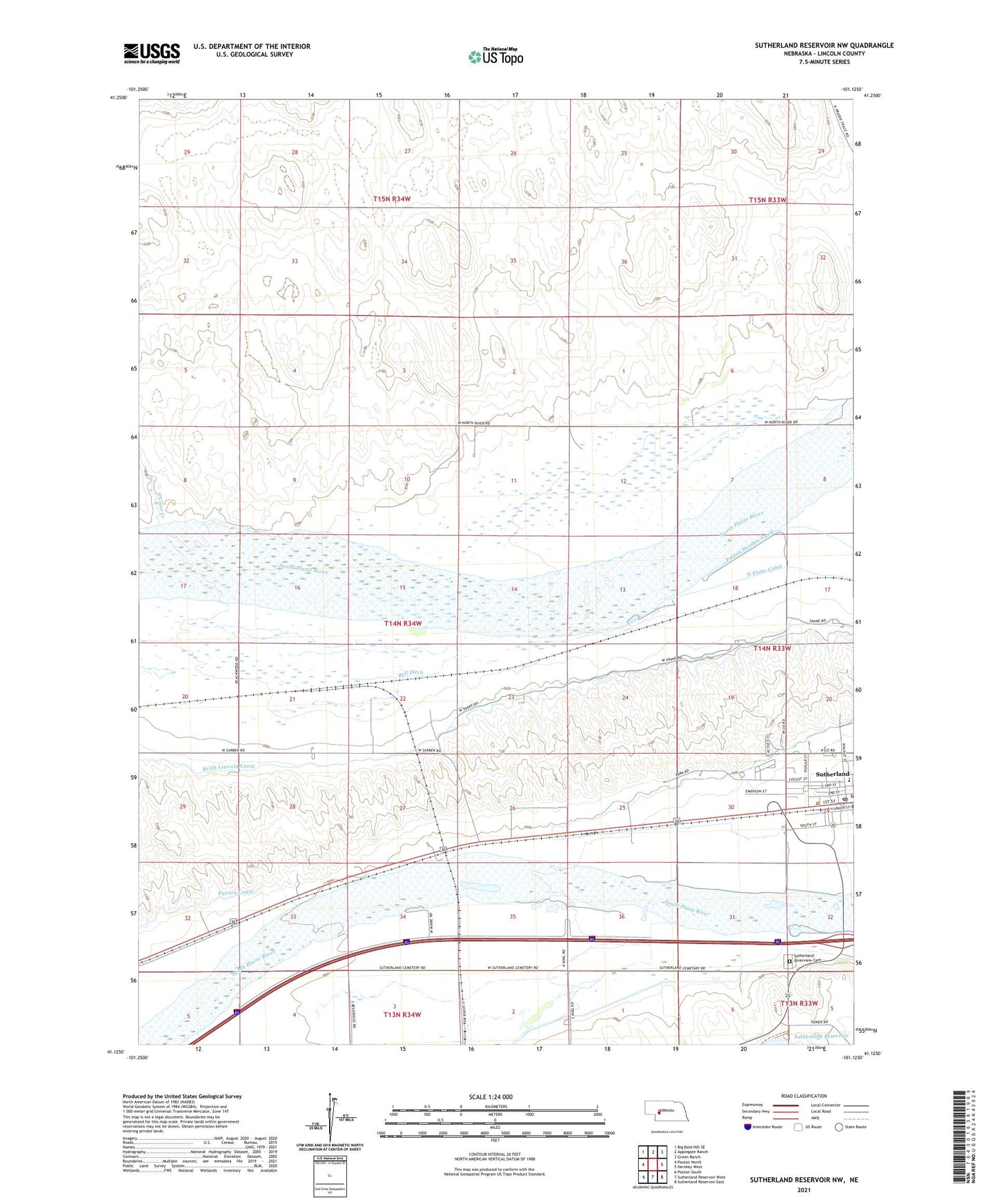
2021 topographic map quadrangle Sutherland Reservoir NW in the state of Nebraska. Scale: 1:24000. Based on the newly updated USGS 7.5' US Topo map series, this map is in the following counties: Lincoln. The map contains contour data, water features, and other items you are used to seeing on USGS maps, but also has updated roads and other features. This is the next generation of topographic maps. Printed on high-quality waterproof paper with UV fade-resistant inks.
Quads adjacent to this one:
West: Paxton North
Northwest: Big Bald Hill SE
North: Applegate Ranch
Northeast: Green Ranch
East: Hershey West
Southeast: Sutherland Reservoir East
South: Sutherland Reservoir West
Southwest: Paxton South
This map covers the same area as the classic USGS quad with code o41101b2.
Contains the following named places: Bull Ditch, Community Care at Sutherland, Danseys, Dexter, East Clear Creek, Grace Lutheran Church, Hope Baptist Church, Maxine White Public Library, Oregon Trail Park Campground, Presbyterian Church, Railroad Park, Sacred Heart Catholic Church, Scoular Grain Company Elevator, Sutherland, Sutherland Dam, Sutherland Election Precinct, Sutherland Medical Clinic, Sutherland Post Office, Sutherland Public Schools, Sutherland Reservoir Campgrounds, Sutherland Reservoir Park, Sutherland Riverview Cemetery, Sutherland Volunteer Fire and Rescue, Trego Airport, West Park