MyTopo
Potter Nebraska US Topo Map
Couldn't load pickup availability
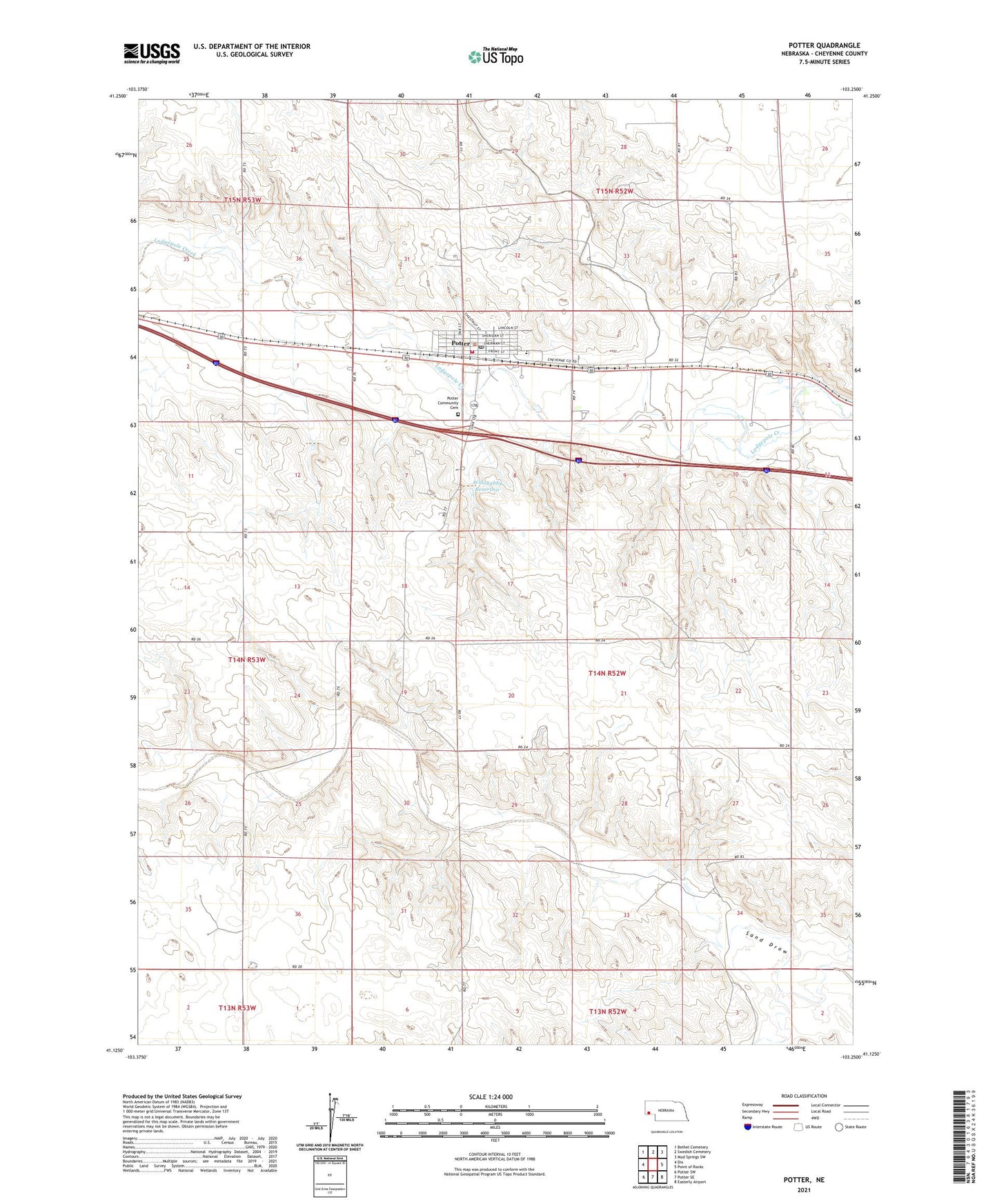
2021 topographic map quadrangle Potter in the state of Nebraska. Scale: 1:24000. Based on the newly updated USGS 7.5' US Topo map series, this map is in the following counties: Cheyenne. The map contains contour data, water features, and other items you are used to seeing on USGS maps, but also has updated roads and other features. This is the next generation of topographic maps. Printed on high-quality waterproof paper with UV fade-resistant inks.
Quads adjacent to this one:
West: Dix
Northwest: Bethel Cemetery
Northeast: Mud Springs SW
East: Point of Rocks
Southeast: Easterly Airport
South: Potter SE
Southwest: Potter SW
Contains the following named places: Crossroads Cooperative Association Elevator, First Lutheran Church, Heimer Dam, Heimer Reservoir, Jung Dam, Jung Reservoir, M and S Campground and Trailer Park, Potter, Potter Community Cemetery, Potter Election Precinct, Potter Family Clinic, Potter Fire Department, Potter Post Office, Potter Public Library, Potter-Dix Elementary School, Potter-Dix High School, Prairie Pines Golf Course, United Methodist Church, Willoughby Dam, Willoughby Reservoir