MyTopo
Dix Nebraska US Topo Map
Couldn't load pickup availability
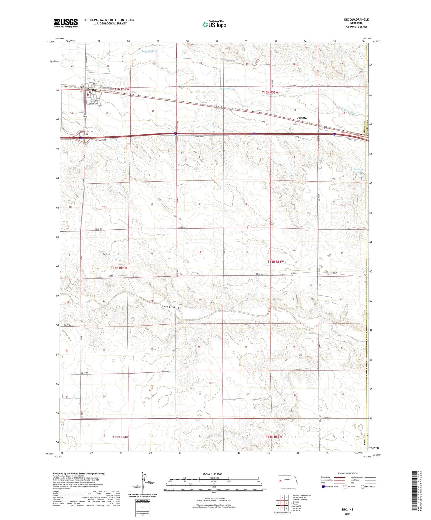
2021 topographic map quadrangle Dix in the state of Nebraska. Scale: 1:24000. Based on the newly updated USGS 7.5' US Topo map series, this map is in the following counties: Kimball, Cheyenne. The map contains contour data, water features, and other items you are used to seeing on USGS maps, but also has updated roads and other features. This is the next generation of topographic maps. Printed on high-quality waterproof paper with UV fade-resistant inks.
Quads adjacent to this one:
West: Owasco
Northwest: Bennett Reservoir East
North: Bethel Cemetery
East: Potter
Southeast: Potter SE
South: Potter SW
Southwest: Kimball SE
This map covers the same area as the classic USGS quad with code o41103b4.
Contains the following named places: Bar J Lazy V Airport, Dix, Dix Bible Church, Dix Cemetery, Dix Election Precinct, Dix Fire Department, Dix Post Office, Gadway Dam, Gadway Reservoir, Jacinto, Johnson Dam, Johnson Reservoir, Kenton Dam, Kenton Reservoir, Potter-Dix Middle School, Village of Dix, Western Nebraska Missionary Baptist Church, ZIP Code: 69133