
MyTopo
Ringgold Nebraska US Topo Map
Couldn't load pickup availability
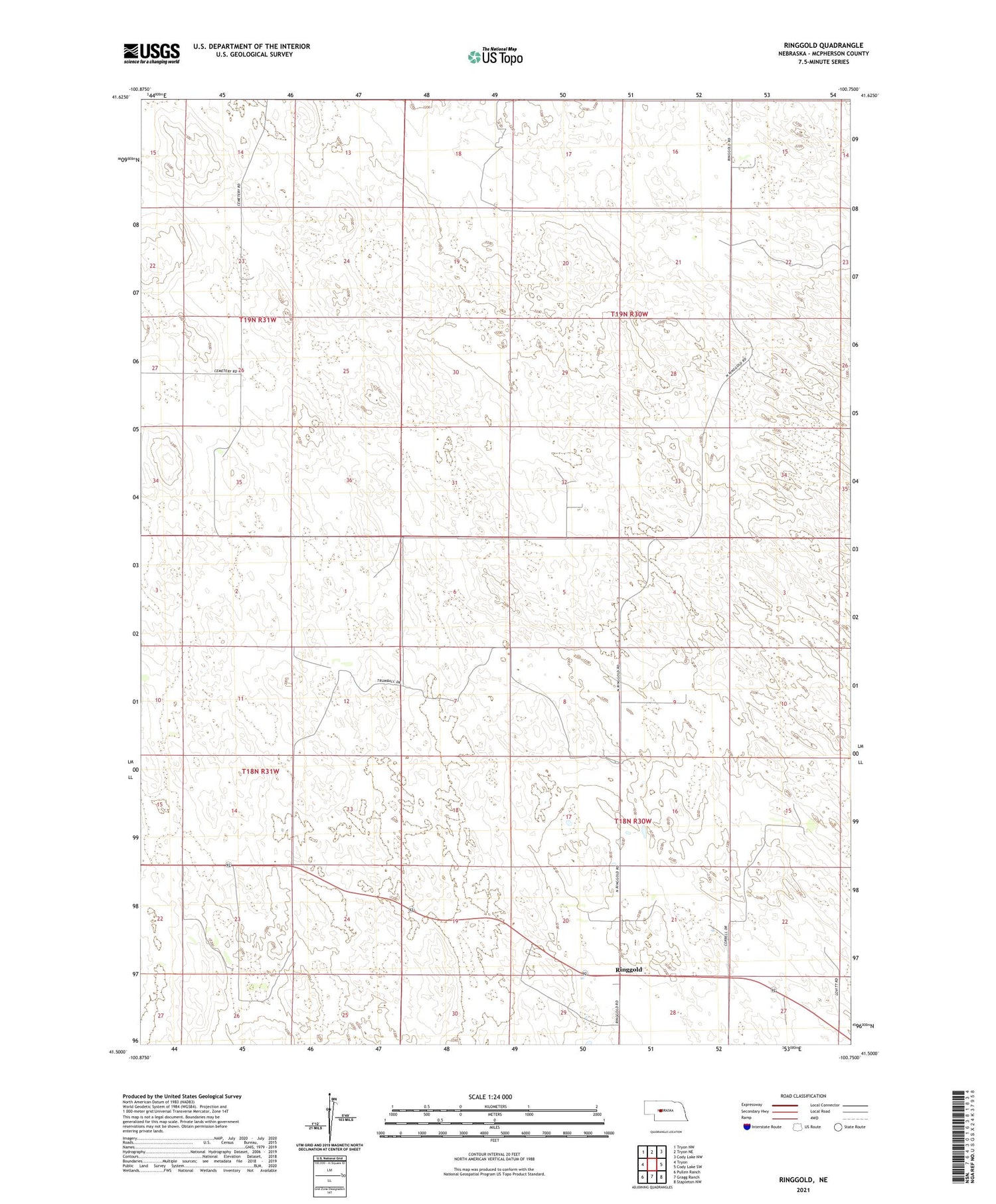
2021 topographic map quadrangle Ringgold in the state of Nebraska. Scale: 1:24000. Based on the newly updated USGS 7.5' US Topo map series, this map is in the following counties: McPherson. The map contains contour data, water features, and other items you are used to seeing on USGS maps, but also has updated roads and other features. This is the next generation of topographic maps. Printed on high-quality waterproof paper with UV fade-resistant inks.
Quads adjacent to this one:
West: Tryon
Northwest: Tryon NW
North: Tryon NE
Northeast: Cody Lake NW
East: Cody Lake SW
Southeast: Stapleton NW
South: Gragg Ranch
Southwest: Pullen Ranch
Contains the following named places: Bertrand Ranch, Cline Ranch, Doyle Ranch, G Winters Ranch, Hill Ranch, J Miller Ranch, Keesler Ranch, Kugler Ranch, Lake Ranch, Leeds Ranch, Miller Church, Neal Ranch, Ringgold, Ringgold Free Methodist Church, Ringgold Post Office, Ringgold Public School, School Number 1, School Number 3, School Number 48, Trumball Ranch, Trumbull Ranch Airport, Tupper Ranch, W Winters Ranch


