MyTopo
Tryon Nebraska US Topo Map
Couldn't load pickup availability
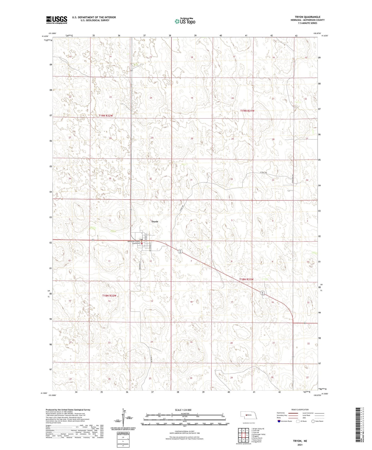
2021 topographic map quadrangle Tryon in the state of Nebraska. Scale: 1:24000. Based on the newly updated USGS 7.5' US Topo map series, this map is in the following counties: McPherson. The map contains contour data, water features, and other items you are used to seeing on USGS maps, but also has updated roads and other features. This is the next generation of topographic maps. Printed on high-quality waterproof paper with UV fade-resistant inks.
Quads adjacent to this one:
West: Schneringer Valley
Northwest: Wright Valley NE
North: Tryon NW
Northeast: Tryon NE
East: Ringgold
Southeast: Gragg Ranch
South: Pullen Ranch
Southwest: Pierson Ranch
This map covers the same area as the classic USGS quad with code o41100e8.
Contains the following named places: A Schmidt Ranch, B Schmidt Ranch, Calloway Ranch, Connell Ranch, Hall Church, Harvey Ranch, Kahoe Ranch, Kemp Ranch, McKillip Ranch, McPherson County High School, McPherson County Rural Fire Department, McPherson County Sheriff's Office, School Number 24, School Number 25, Stack Ranch, Tryon, Tryon Census Designated Place, Tryon Fire Department, Tryon Post Office, Tryon Public School, United Methodist Church, Waits Ranch, Weece Ranch