MyTopo
Roca Nebraska US Topo Map
Couldn't load pickup availability
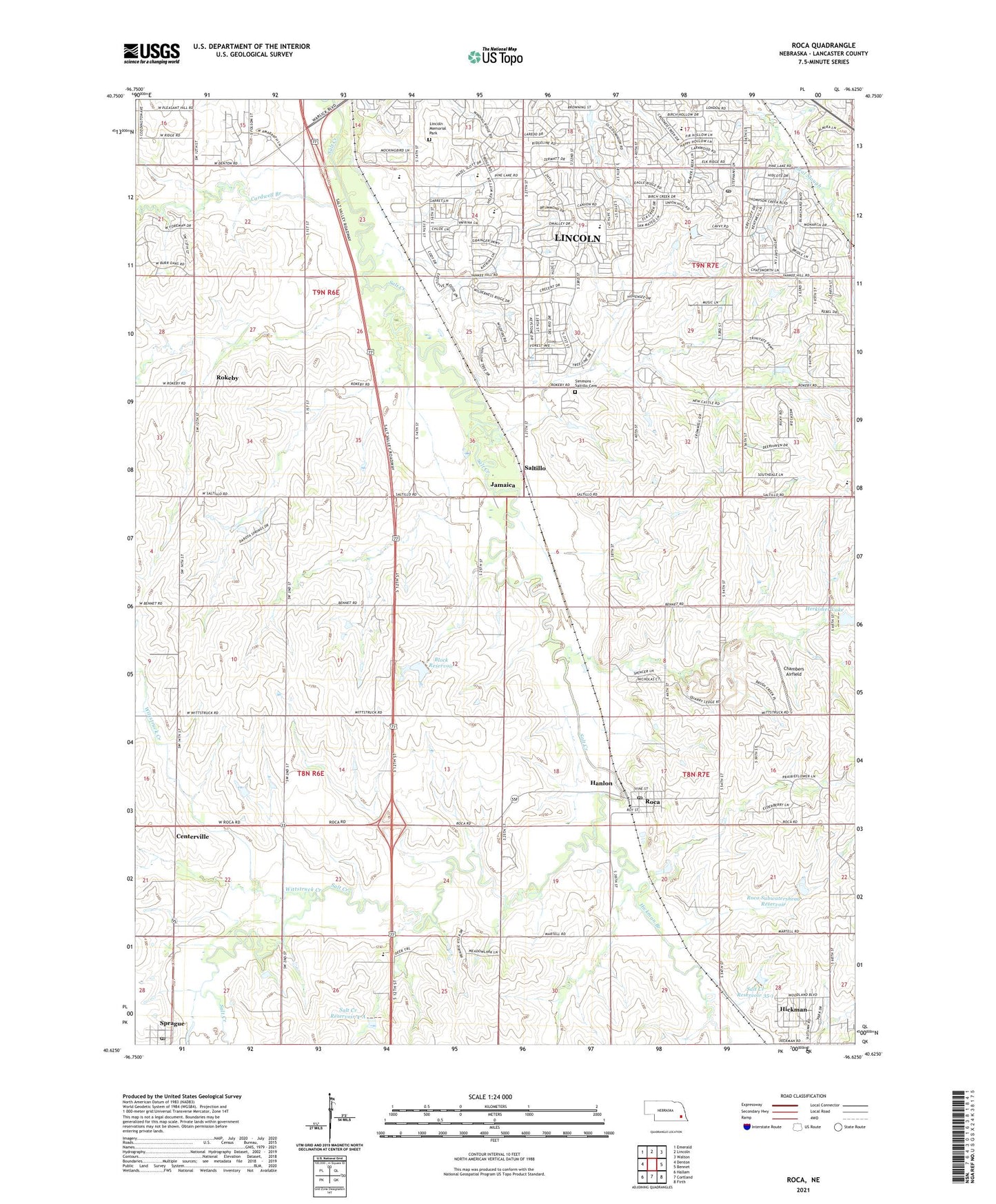
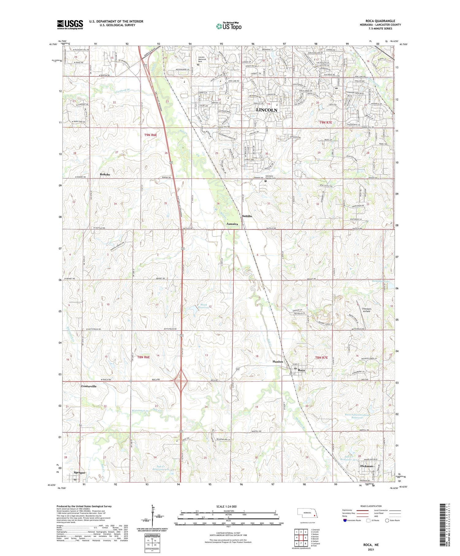
2021 topographic map quadrangle Roca in the state of Nebraska. Scale: 1:24000. Based on the newly updated USGS 7.5' US Topo map series, this map is in the following counties: Lancaster. The map contains contour data, water features, and other items you are used to seeing on USGS maps, but also has updated roads and other features. This is the next generation of topographic maps. Printed on high-quality waterproof paper with UV fade-resistant inks.
Quads adjacent to this one:
West: Denton
Northwest: Emerald
North: Lincoln
Northeast: Walton
East: Bennet
Southeast: Firth
South: Cortland
Southwest: Hallam
Contains the following named places: 1776 Bicentennial Prairie Marker Historical Marker, 68430, 68438, 68512, 68516, Aldo Junction, Bengston Dam, Block Dam, Block Reservoir, Cardwell Branch, Cavett Elementary School, Centerville, Centerville Election Precinct, Central High School, Chambers Airfield, Cripple Creek Park, Densmore Park, Hanlon, Hedge Hill School, Herkimer Lake, Hickman Branch, Hickman Trail, Humann Elementary School, Jamaica, KHAT-AM (Lincoln), Linc-Care Center, Lincoln Memorial Park, London Road and 56th Park, Meyer Jersey Farm, Pine Lake and 60th Park, Pioneer School, Porter Park, Roca, Roca Elevator Company Elevator, Roca Post Office, Roca Subwatershead Dam, Roca Subwatershead Reservoir, Roca Volunteer Fire Department, Rokeby, Rokeby Post Office, Rokeby Public School, Salt Creek Dam 35-1, Salt Creek Dam 35-A, Salt Creek Dam 4-A, Salt Creek Reservoir 35-1, Salt Creek Reservoir 4-A, Saltillo, Saltillo Election Precinct, Saltillo Post Office, School Number 43, Scott Middle School, Simmons - Saltillo Cemetery, South Pointe Pavilions, Southridge Trail, Sprague, Sprague Community Church, Sprague Post Office, Township of Centerville, Township of Yankee Hill, Trinity Chapel, Village of Roca, Village of Sprague, Weaver Airport, Williamsburg Trail, Williamsburg Village Park, Wittstruck Creek