MyTopo
Stuart Nebraska US Topo Map
Couldn't load pickup availability
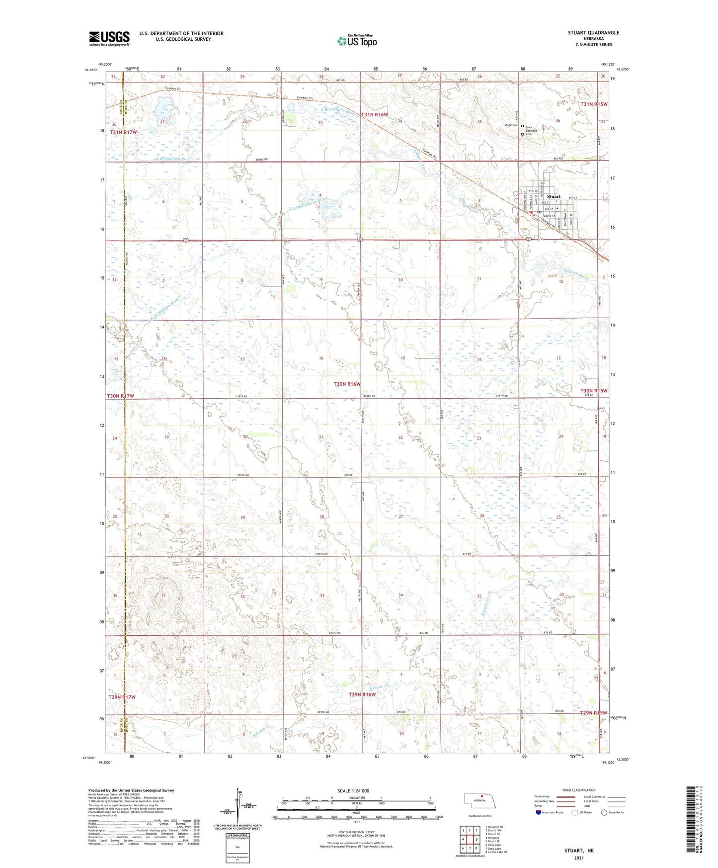
2021 topographic map quadrangle Stuart in the state of Nebraska. Scale: 1:24000. Based on the newly updated USGS 7.5' US Topo map series, this map is in the following counties: Holt, Rock. The map contains contour data, water features, and other items you are used to seeing on USGS maps, but also has updated roads and other features. This is the next generation of topographic maps. Printed on high-quality waterproof paper with UV fade-resistant inks.
Quads adjacent to this one:
West: Newport
Northwest: Newport NE
North: Stuart NW
Northeast: Stuart NE
East: Stuart SE
Southeast: Lambs Lake NE
South: Dora Lake
Southwest: Pony Lake
Contains the following named places: Community Church, Kaup Trailer Court, North Branch Elkhorn River, Parkside Manor, Saint Boniface Catholic Church, Saint Boniface School, School Number 136, School Number 183, School Number 58, School Number 70, South Fork Elkhorn River, Stuart, Stuart Clinic, Stuart Municipal Park, Stuart Municipal Park Campground, Stuart Police Department, Stuart Post Office, Stuart Public Schools, Stuart Rural Fire District, Stuart Township Library, Township of Stuart, Tri County Medical Clinic, Village of Stuart, White Horse Ranch Museum