MyTopo
Pony Lake Nebraska US Topo Map
Couldn't load pickup availability
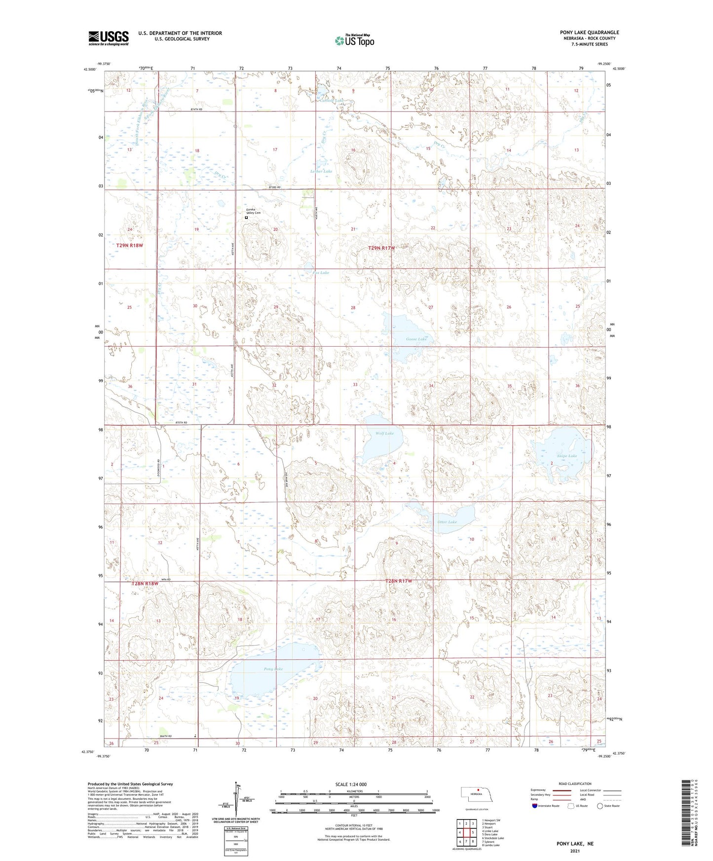
2021 topographic map quadrangle Pony Lake in the state of Nebraska. Scale: 1:24000. Based on the newly updated USGS 7.5' US Topo map series, this map is in the following counties: Rock. The map contains contour data, water features, and other items you are used to seeing on USGS maps, but also has updated roads and other features. This is the next generation of topographic maps. Printed on high-quality waterproof paper with UV fade-resistant inks.
Quads adjacent to this one:
West: Linke Lake
Northwest: Newport SW
North: Newport
Northeast: Stuart
East: Dora Lake
Southeast: Lambs Lake
South: Sybrant
Southwest: Stockdale Lake
This map covers the same area as the classic USGS quad with code o42099d3.
Contains the following named places: Blaine Election Precinct, Carlisle Lake, Eureka Valley Cemetery, Fox Lake, Goose Lake, Lay Election Precinct, Lesher Lake, Otter Lake, Pony Lake, Pony Lake Post Office, Pony Lake School, Snipe Lake, Township of Blaine, Township of Lay, Wolf Lake