MyTopo
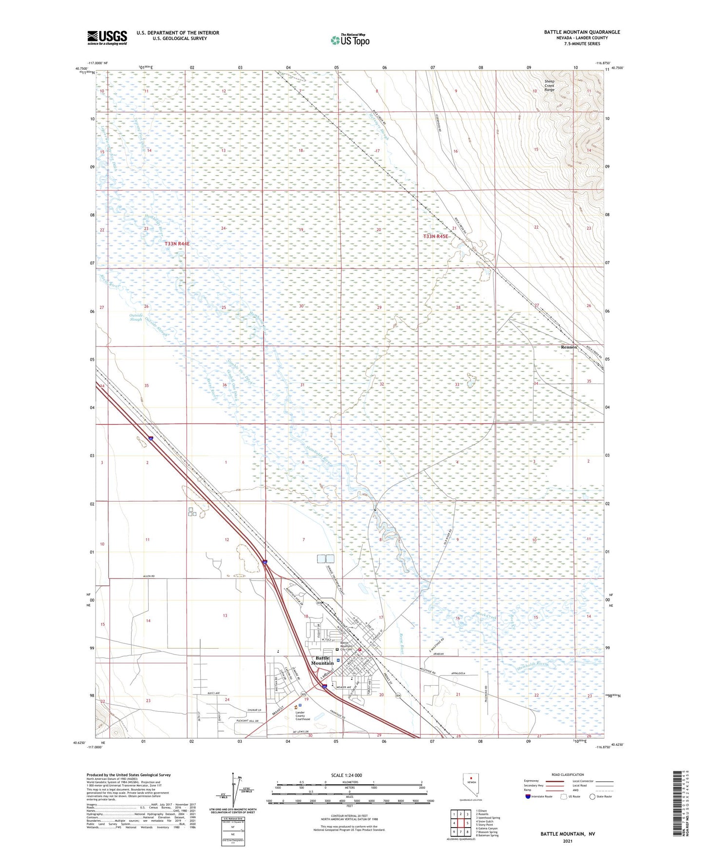
Battle Mountain Nevada US Topo Map
Couldn't load pickup availability
2021 topographic map quadrangle Battle Mountain in the state of Nevada. Scale: 1:24000. Based on the newly updated USGS 7.5' US Topo map series, this map is in the following counties: Lander. The map contains contour data, water features, and other items you are used to seeing on USGS maps, but also has updated roads and other features. This is the next generation of topographic maps. Printed on high-quality waterproof paper with UV fade-resistant inks.
Quads adjacent to this one:
West: Snow Gulch
Northwest: Ellison
North: Russells
Northeast: Izzenhood Spring
East: Stony Point
Southeast: Bateman Spring
South: Blossom Spring
Southwest: Galena Canyon
Contains the following named places: Argenta Post Office, Battle Mountain, Battle Mountain Ambulance Service, Battle Mountain Census Designated Place, Battle Mountain City Cemetery, Battle Mountain General Hospital, Battle Mountain High School, Battle Mountain Junior High School, Battle Mountain Post Office, Battle Mountain Reservation, Broyles Ranch, Buckbrush Cabin, Eleanor Lemaire Elementary School, Eliza Pierce Elementary School, Gimble Four Ditch, Gimble One Ditch, Gimble Two Ditch, Great Basin College Battle Mountain Branch Campus, Lander County Fire Department, Lander County Offices, Lander County Sheriff's Office, Lander County Yard, Licking Ranch, Lower Gimmel Field, Lower Twenty-five Ditch, Mary S Black Elementary School, Muleshoe Ranch, Nevada Highway Patrol Northern Command East Battle Mountain, North Battle Mountain, Outside Slough, Rennox, Rock Creek, Sheep Mountain Well Number One-Eleven, Slaughterhouse Field, TeMoak Indian Housing, Twenty Five Ditch, Upper Gimmel Field, Welch Ranch