MyTopo
Snow Gulch Nevada US Topo Map
Couldn't load pickup availability
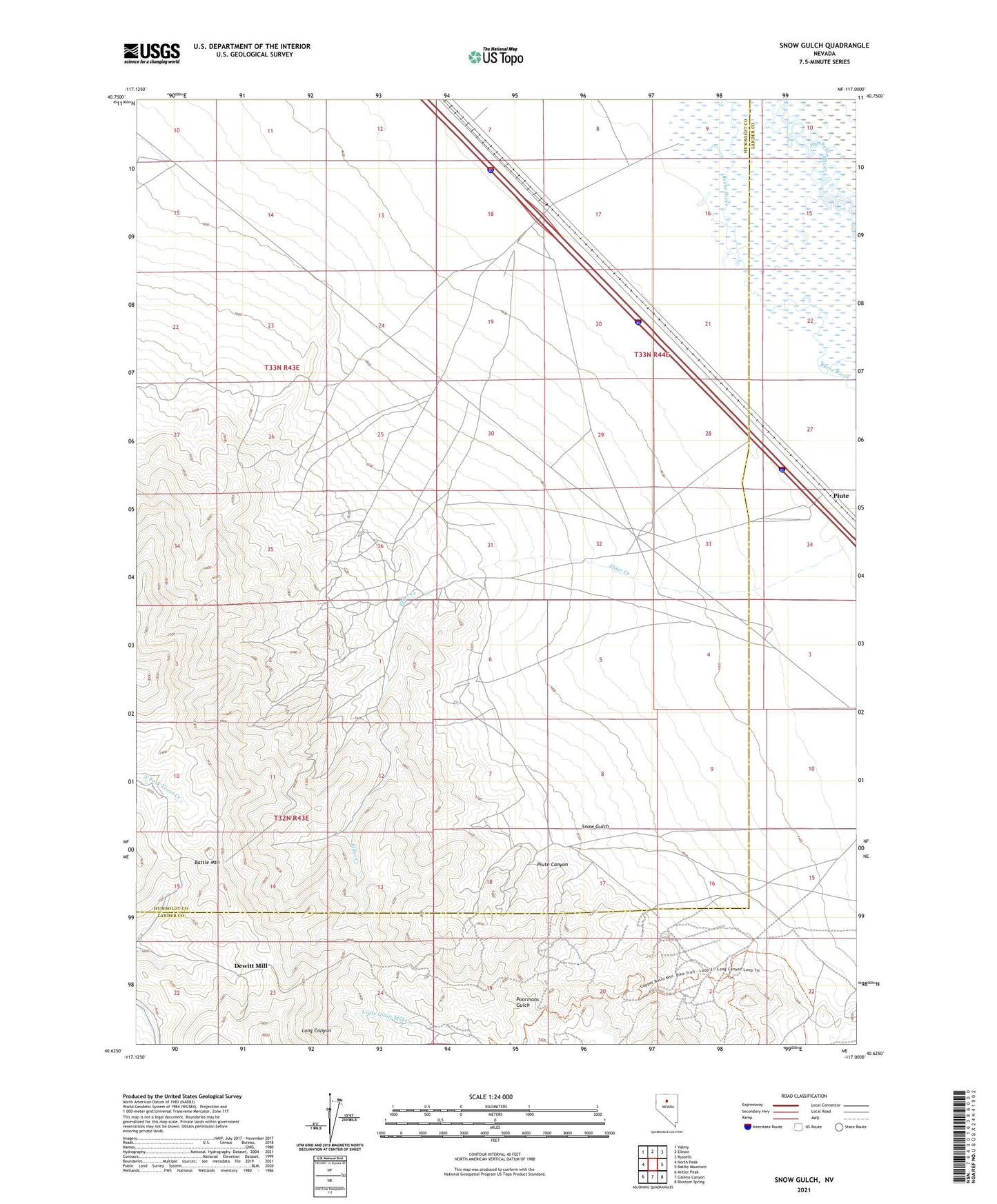
2021 topographic map quadrangle Snow Gulch in the state of Nevada. Scale: 1:24000. Based on the newly updated USGS 7.5' US Topo map series, this map is in the following counties: Humboldt, Lander. The map contains contour data, water features, and other items you are used to seeing on USGS maps, but also has updated roads and other features. This is the next generation of topographic maps. Printed on high-quality waterproof paper with UV fade-resistant inks.
Quads adjacent to this one:
West: North Peak
Northwest: Valmy
North: Ellison
Northeast: Russells
East: Battle Mountain
Southeast: Blossom Spring
South: Galena Canyon
Southwest: Antler Peak
This map covers the same area as the classic USGS quad with code o40117f1.
Contains the following named places: Big Pay Mine, BM Placers, Copper Glance Mine, Dewitt Mill, Dewitt Mine, Elder Creek, Golden Era Mine, Golden Scepter Mine, Golden Scepter Placer Mine, Good Chance Mine, Gracie Mine, Healey Cabins, Holcomb Cabin, Morning Star Mine, Mote Siding, Piute, Piute Canyon, Piute Canyon Mine, Ridge Mine, Russell Hay Camp, Snow Gulch