
MyTopo
Caliente Nevada US Topo Map
Couldn't load pickup availability
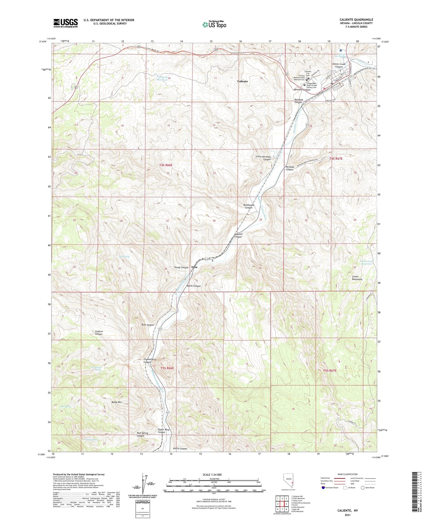
2021 topographic map quadrangle Caliente in the state of Nevada. Scale: 1:24000. Based on the newly updated USGS 7.5' US Topo map series, this map is in the following counties: Lincoln. The map contains contour data, water features, and other items you are used to seeing on USGS maps, but also has updated roads and other features. This is the next generation of topographic maps. Printed on high-quality waterproof paper with UV fade-resistant inks.
Quads adjacent to this one:
West: Chokecherry Mountain
Northwest: Caliente NW
North: Chief Mountain
Northeast: Indian Cove
East: Eccles
Southeast: Ella Mountain
South: Elgin NE
Southwest: Slidy Mountain
Contains the following named places: Acklin Canyon, Baldy Mountain, Buckboard Canyon, Bucks Canyon, C O Bastian High School, Caliente, Caliente City Cemetery, Caliente City Hall, Caliente Elementary School, Caliente Hot Springs, Caliente Post Office, Caliente Volunteer Fire Department, Caliente Volunteer Fire Department Station 2, Chokecherry Canyon, Clover Creek, Clover Creek Canyon, Cloverdale Station, Coburn Ranch, Colburn Canyon, Community College of Southern Nevada Lincoln County Center, Conaway Reservoir, Conway Memorial Park Veterans Cemetery, Conway Spring, Culverwell Reservoir, Dula Canyon, Dula Spring, Etna, Grover Dils Medical Center Hospital, Hardy Canyon, Independent Order of Odd Fellows Cemetery, Kershaw, Kershaw Canyon, Kershaw-Ryan State Park, Lincoln County Medical Clinic, Little Kershaw Canyon, Log Trough Spring, Meadow Valley Volunteer Ambulance Service - Caliente, Mud Spring, Mud Spring Canyon, Nevada Girls Training Center, Newman Canyon, Rose Memorial Park, Sawmill Canyon, Stine Post Office, Strawberry Hill, Sunset Mine, Taylor Mine Canyon


