MyTopo
Elgin NE Nevada US Topo Map
Couldn't load pickup availability
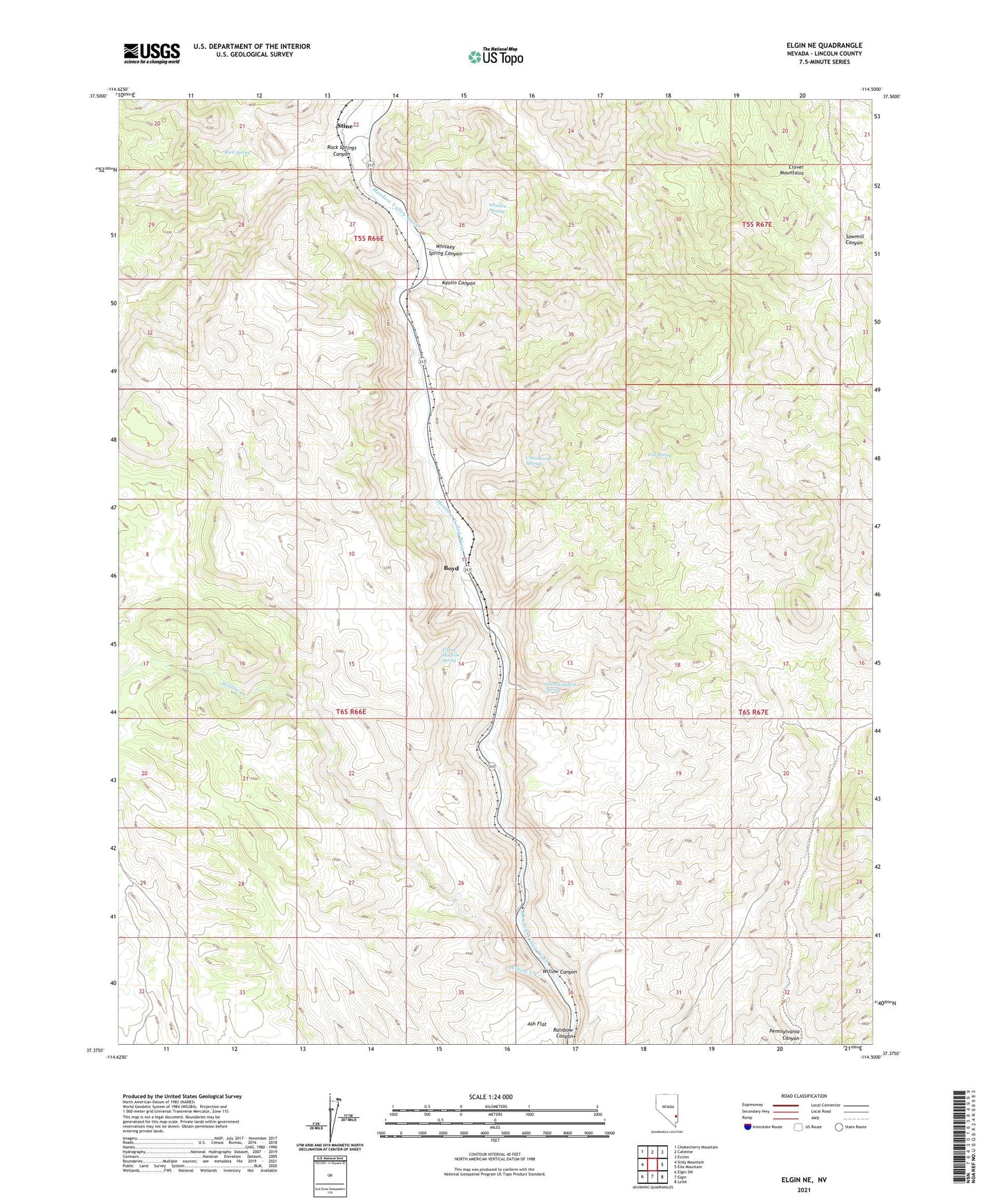
2021 topographic map quadrangle Elgin NE in the state of Nevada. Scale: 1:24000. Based on the newly updated USGS 7.5' US Topo map series, this map is in the following counties: Lincoln. The map contains contour data, water features, and other items you are used to seeing on USGS maps, but also has updated roads and other features. This is the next generation of topographic maps. Printed on high-quality waterproof paper with UV fade-resistant inks.
Quads adjacent to this one:
West: Slidy Mountain
Northwest: Chokecherry Mountain
North: Caliente
Northeast: Eccles
East: Ella Mountain
Southeast: Leith
South: Elgin
Southwest: Elgin SW
This map covers the same area as the classic USGS quad with code o37114d5.
Contains the following named places: Ash Flat, Boyd, Boyd Alunite Mine, Boyd Clay Mine, Cottonwood Springs, Elliott Ranch, Fall Spring, Flying Machine Spring, Hummingbird Spring, Kaolin Canyon, Kaolin Mine, Kaolin Spur, Robbers Roost Ranch, Rock Spring, Rock Springs Canyon, Stine, Whiskey Spring, Whiskey Spring Canyon, Willow Canyon, Willow Creek