MyTopo
Charleston Peak Nevada US Topo Map
Couldn't load pickup availability
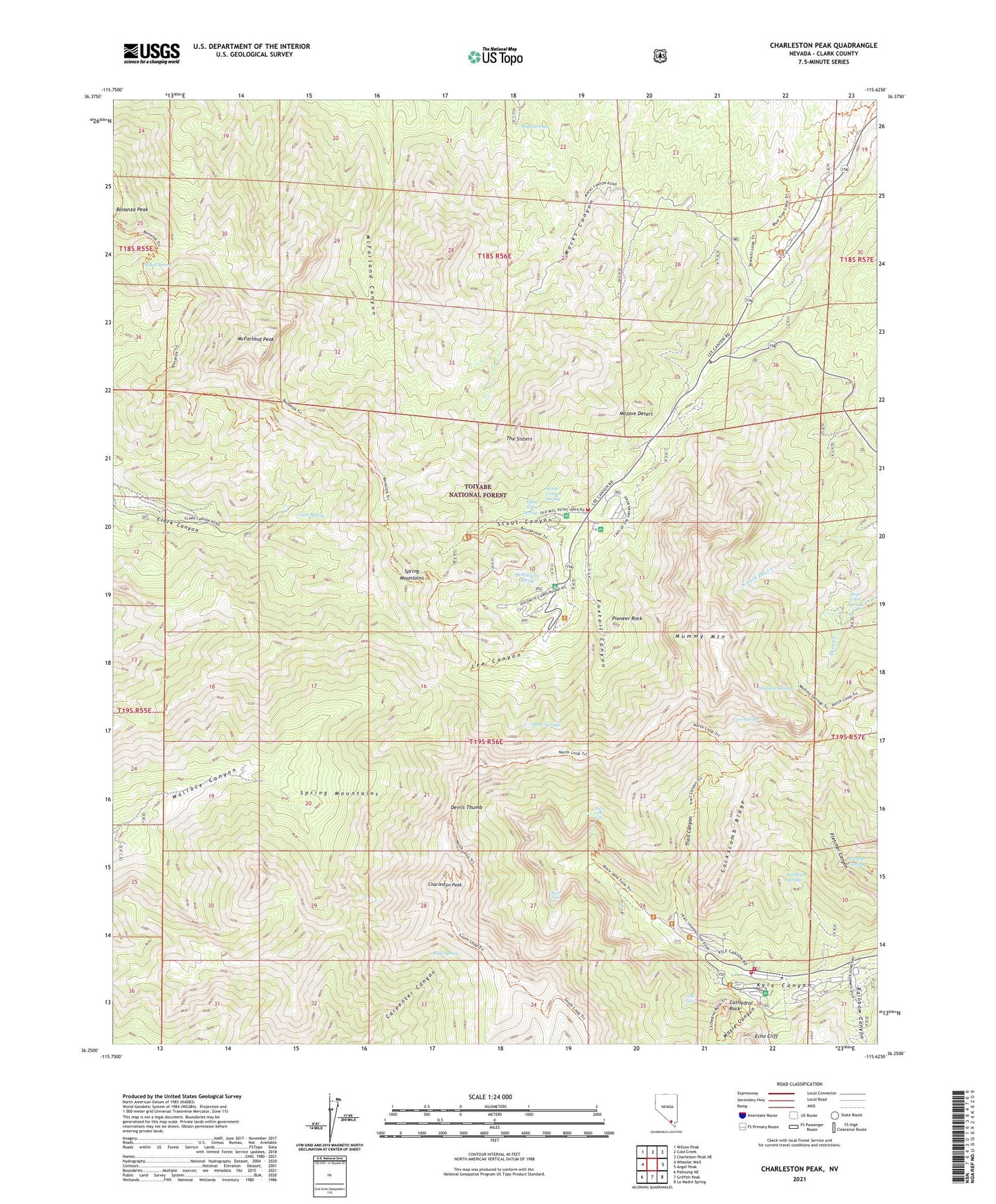
2021 topographic map quadrangle Charleston Peak in the state of Nevada. Scale: 1:24000. Based on the newly updated USGS 7.5' US Topo map series, this map is in the following counties: Clark. The map contains contour data, water features, and other items you are used to seeing on USGS maps, but also has updated roads and other features. This is the next generation of topographic maps. Printed on high-quality waterproof paper with UV fade-resistant inks.
Quads adjacent to this one:
West: Wheeler Well
Northwest: Willow Peak
North: Cold Creek
Northeast: Charleston Peak NE
East: Angel Peak
Southeast: La Madre Spring
South: Griffith Peak
Southwest: Pahrump NE
Contains the following named places: Ada and Edith Mine, Alpine Village Rural Branch Post Office, Big Falls, Bonanza Peak, Bristlecone Trail, Cathedral Rock, Cathedral Rock Picnic Area, Cathedral Rock Trail, Cave Spring, Charleston Peak, Charleston Peak Trail North Loop, Clark County Fire Department Station 81, Clark County Youth Camp, Clark Spring, Clarks Sawmill, Cockscomb Ridge, Deer Creek Spring, Deer Creek Trail, Desert View Trailhead, Desert Viewpoint, Devils Thumb, Dolomite Campground, Earl B Lundy Elementary School, Echo Cliff, Edna Grey Spring, Falls Trail, Fletcher Spring, Fox Tail Snow Play and Picnic Area, Foxtail Camp, Foxtail Canyon, Griffith Mine, Kyle Canyon Summer Home Area, Lady of the Snows Camp, Las Vegas Ranger District, Lee Canyon RV Camp, Lee Canyon Ski Area, Lee Canyon Summer Home Area, Lee Forest Service Station, Little Falls, Lundy Elementary School, Mary Jane Falls, Mary Jane Falls Campground, Mary Jane Trailhead, Mazie Canyon, McFarland Canyon, McFarland Peak, McWilliams, McWilliams Campground, McWilliams Spring, Mount Charleston, Mount Charleston Elementary School, Mount Charleston Fire Protection District Station 853, Mount Charleston Lodge, Mount Charleston National Recreation Trail, Mount Charleston Wilderness, Mud Springs, Mummy Mountain, Mummy Spring, Old Mill Cross Country Ski Area, Old Mill Picnic Area, Peak Spring, Pioneer Rock, Rainbow Canyon, Scout Canyon, Scout Canyon Spring, South Loop, Spring Mountain Divide Trail, Stanley B Springs, The Sisters, Three Springs, Trail Canyon, Wood Spring