MyTopo
Fitting Nevada US Topo Map
Couldn't load pickup availability
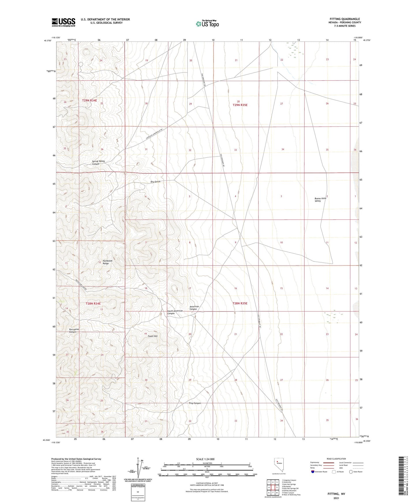
2021 topographic map quadrangle Fitting in the state of Nevada. Scale: 1:24000. Based on the newly updated USGS 7.5' US Topo map series, this map is in the following counties: Pershing. The map contains contour data, water features, and other items you are used to seeing on USGS maps, but also has updated roads and other features. This is the next generation of topographic maps. Printed on high-quality waterproof paper with UV fade-resistant inks.
Quads adjacent to this one:
West: Rochester
Northwest: Congress Canyon
North: Unionville
Northeast: Kyle Hot Springs
East: Kyle Hot Springs SW
Southeast: West of McKinney Pass
South: Fisher Canyon
Southwest: Buffalo Mountain
Contains the following named places: American Canyon, American Canyon Mines, Bonanza King Mine, Cinnabar City Mine, Dry Gulch, Dry Gulch Mines, Enterprise Mine, Fitting, Fitting Post Office, Fossil Hill, Hillside Mine, Indian Creek, Kaolinite Mine, Little Linda Mine, Pacific Matchless Mine, Pinite Mine, Porcupine Canyon, South American Canyon, South American Canyon Mines, Spring Valley Mines, Spring Valley Mining District, Stevensville, Strief Ranch, Troy Canyon, Troy Canyon Mines, Wabash Mine, Zimmershed Ranch