MyTopo
Unionville Nevada US Topo Map
Couldn't load pickup availability
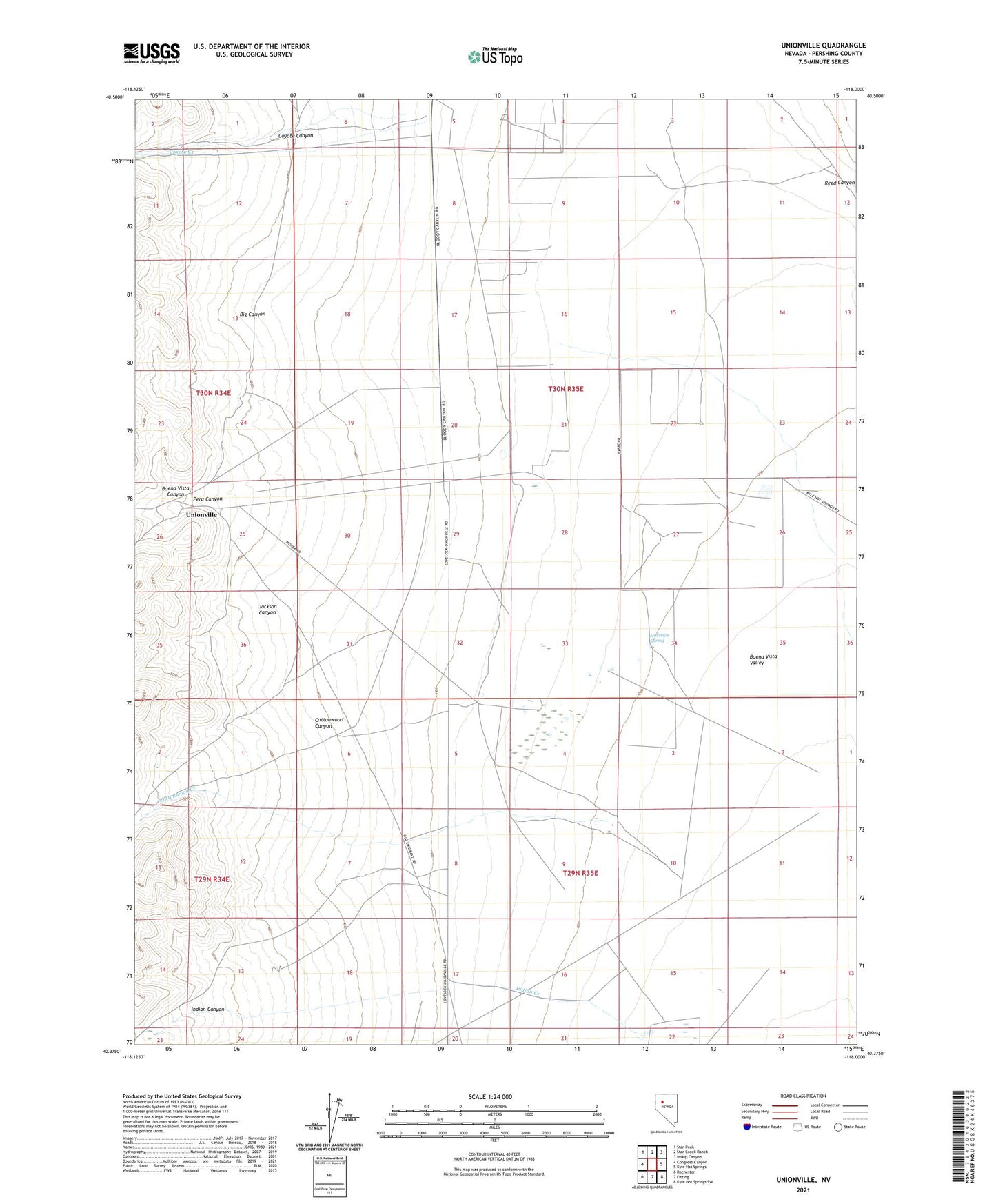
2021 topographic map quadrangle Unionville in the state of Nevada. Scale: 1:24000. Based on the newly updated USGS 7.5' US Topo map series, this map is in the following counties: Pershing. The map contains contour data, water features, and other items you are used to seeing on USGS maps, but also has updated roads and other features. This is the next generation of topographic maps. Printed on high-quality waterproof paper with UV fade-resistant inks.
Quads adjacent to this one:
West: Congress Canyon
Northwest: Star Peak
North: Star Creek Ranch
Northeast: Inskip Canyon
East: Kyle Hot Springs
Southeast: Kyle Hot Springs SW
South: Fitting
Southwest: Rochester
This map covers the same area as the classic USGS quad with code o40118d1.
Contains the following named places: Big Canyon, Black Warrior Mine, Buena Vista Canyon, Cottonwood Canyon, Cottonwood Creek, Coyote Canyon, Coyote Creek, Coyote Ranch, Davidson Ranch, Frendesen Ranch, Harrison Spring, Indian Canyon, Jackson Canyon, Peru Canyon, Thornton Ranch, Unionville, Unionville Census Designated Place, Unionville Post Office, Unionville School