MyTopo
Griffith Peak Nevada US Topo Map
Couldn't load pickup availability
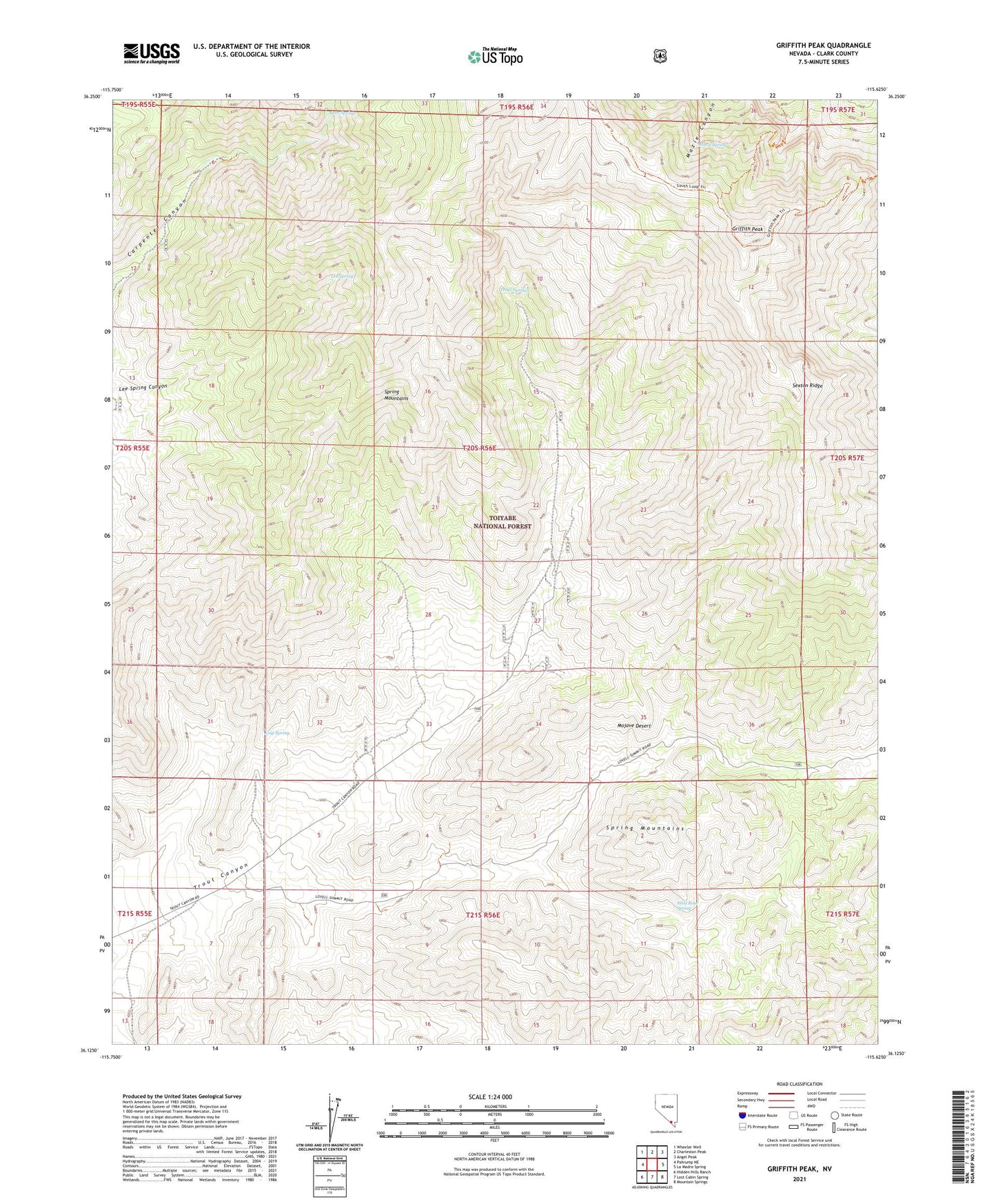
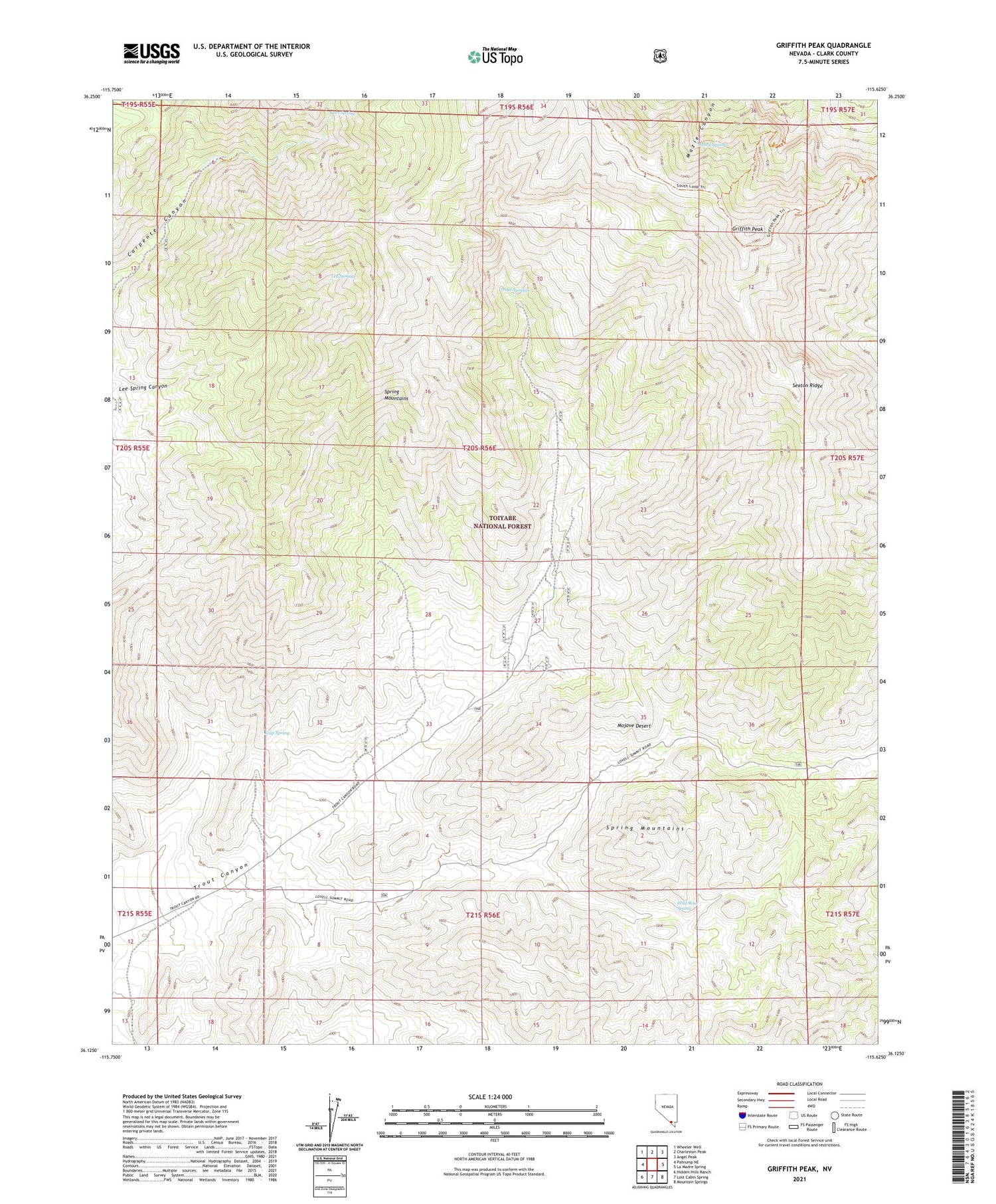
2021 topographic map quadrangle Griffith Peak in the state of Nevada. Scale: 1:24000. Based on the newly updated USGS 7.5' US Topo map series, this map is in the following counties: Clark. The map contains contour data, water features, and other items you are used to seeing on USGS maps, but also has updated roads and other features. This is the next generation of topographic maps. Printed on high-quality waterproof paper with UV fade-resistant inks.
Quads adjacent to this one:
West: Pahrump NE
Northwest: Wheeler Well
North: Charleston Peak
Northeast: Angel Peak
East: La Madre Spring
Southeast: Mountain Springs
South: Lost Cabin Spring
Southwest: Hidden Hills Ranch
Contains the following named places: Griffith Peak, Kiup Spring, Lee Spring, Lees Spring, Lower Williams Ranch, Mazie Spring, Sexton Ridge, Spring Mountains, Trout Springs, Wild Rose Spring, Williams Ranch