MyTopo
High Rock Lake Nevada US Topo Map
Couldn't load pickup availability
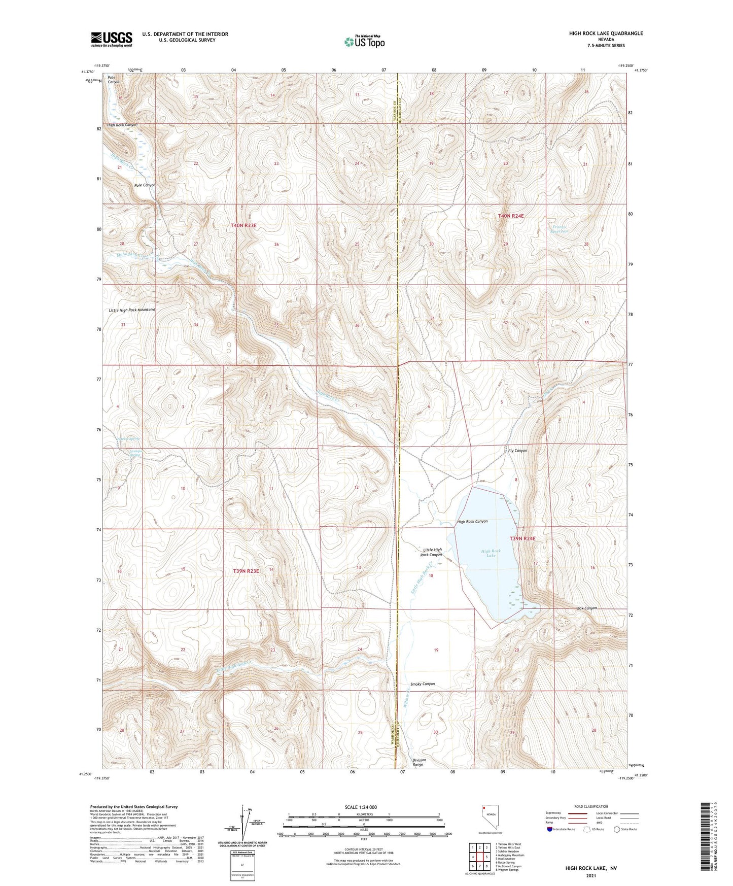
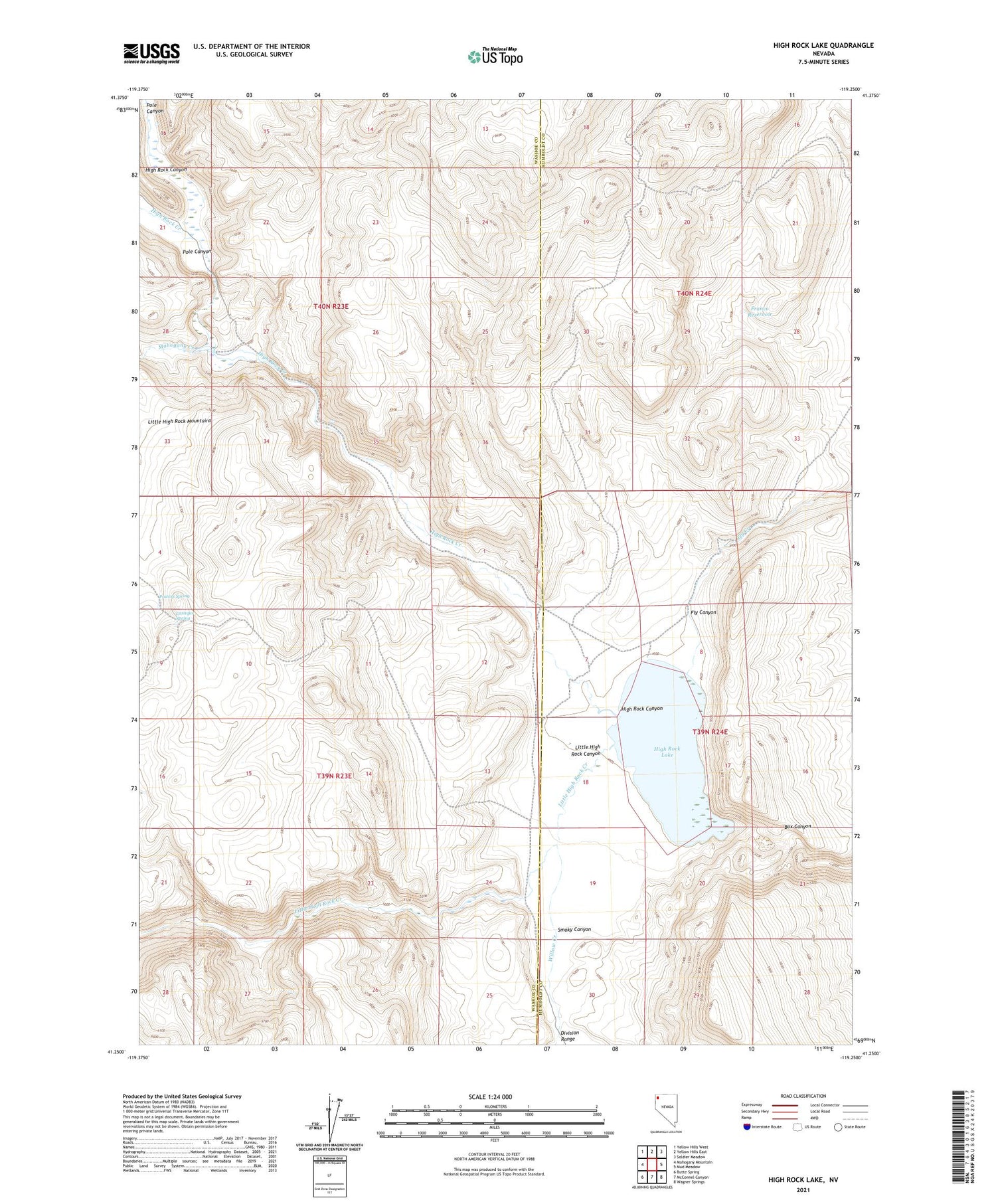
2021 topographic map quadrangle High Rock Lake in the state of Nevada. Scale: 1:24000. Based on the newly updated USGS 7.5' US Topo map series, this map is in the following counties: Washoe, Humboldt. The map contains contour data, water features, and other items you are used to seeing on USGS maps, but also has updated roads and other features. This is the next generation of topographic maps. Printed on high-quality waterproof paper with UV fade-resistant inks.
Quads adjacent to this one:
West: Mahogany Mountain
Northwest: Yellow Hills West
North: Yellow Hills East
Northeast: Soldier Meadow
East: Mud Meadow
Southeast: Wagner Springs
South: McConnel Canyon
Southwest: Butte Spring
Contains the following named places: Conlon Camp, Franco Reservoir, High Rock Canyon, High Rock Creek, High Rock Lake, Laxaque Spring, Little High Rock Canyon, Little High Rock Creek, Mahogany Creek, Mud Meadows Post Office, Pole Canyon, Powers Spring, Smoky Canyon, The Potholes, Willow Creek