MyTopo
McConnel Canyon Nevada US Topo Map
Couldn't load pickup availability
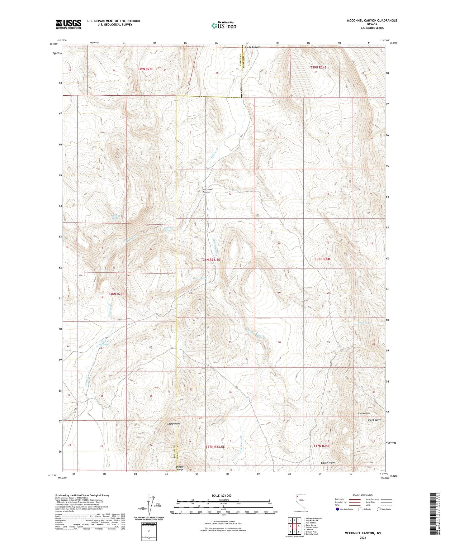
2021 topographic map quadrangle McConnel Canyon in the state of Nevada. Scale: 1:24000. Based on the newly updated USGS 7.5' US Topo map series, this map is in the following counties: Humboldt, Washoe. The map contains contour data, water features, and other items you are used to seeing on USGS maps, but also has updated roads and other features. This is the next generation of topographic maps. Printed on high-quality waterproof paper with UV fade-resistant inks.
Quads adjacent to this one:
West: Butte Spring
Northwest: Mahogany Mountain
North: High Rock Lake
Northeast: Mud Meadow
East: Wagner Springs
Southeast: Donnelly Creek
South: Division Peak
Southwest: Leadville
This map covers the same area as the classic USGS quad with code o41119b3.
Contains the following named places: Black Canyon, Flower Spring, Harry Spring, Little Smoky Creek, McConnel Canyon, McConnel Spring, Sheep Buttes, Whiskey Spring, Willow Creek Reservoir