MyTopo
Keyhole Canyon Nevada US Topo Map
Couldn't load pickup availability
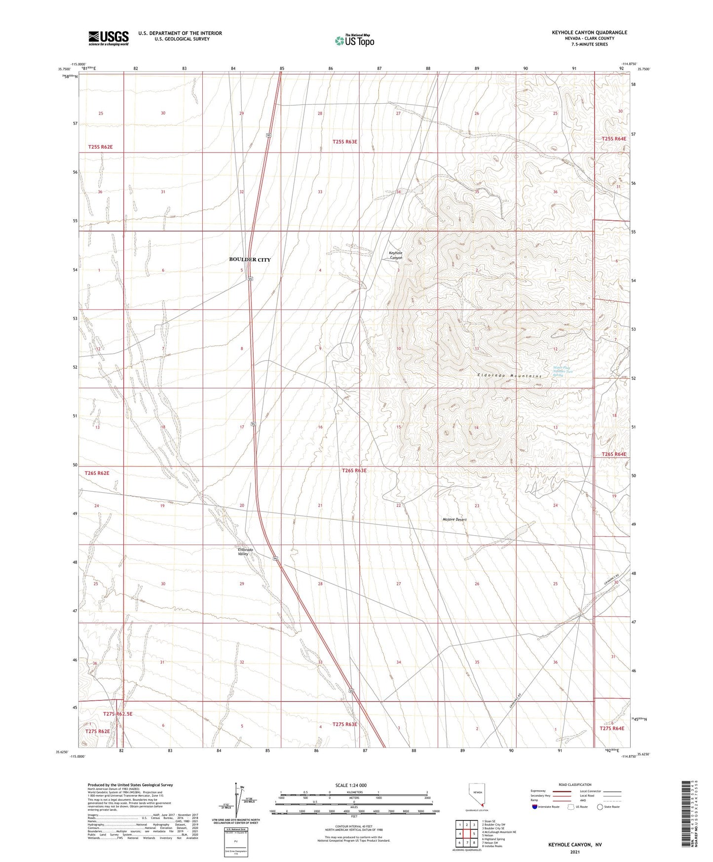
2021 topographic map quadrangle Keyhole Canyon in the state of Nevada. Scale: 1:24000. Based on the newly updated USGS 7.5' US Topo map series, this map is in the following counties: Clark. The map contains contour data, water features, and other items you are used to seeing on USGS maps, but also has updated roads and other features. This is the next generation of topographic maps. Printed on high-quality waterproof paper with UV fade-resistant inks.
Quads adjacent to this one:
West: McCullough Mountain NE
Northwest: Sloan SE
North: Boulder City SW
Northeast: Boulder City SE
East: Nelson
Southeast: Ireteba Peaks
South: Nelson SW
Southwest: Highland Spring
Contains the following named places: Clark Division, Desert Queen Well, Highland Range Crucial Bighorn Habitat Area, Keyhole Canyon, Water Plug Number Two Spring