MyTopo
Nelson Nevada US Topo Map
Couldn't load pickup availability
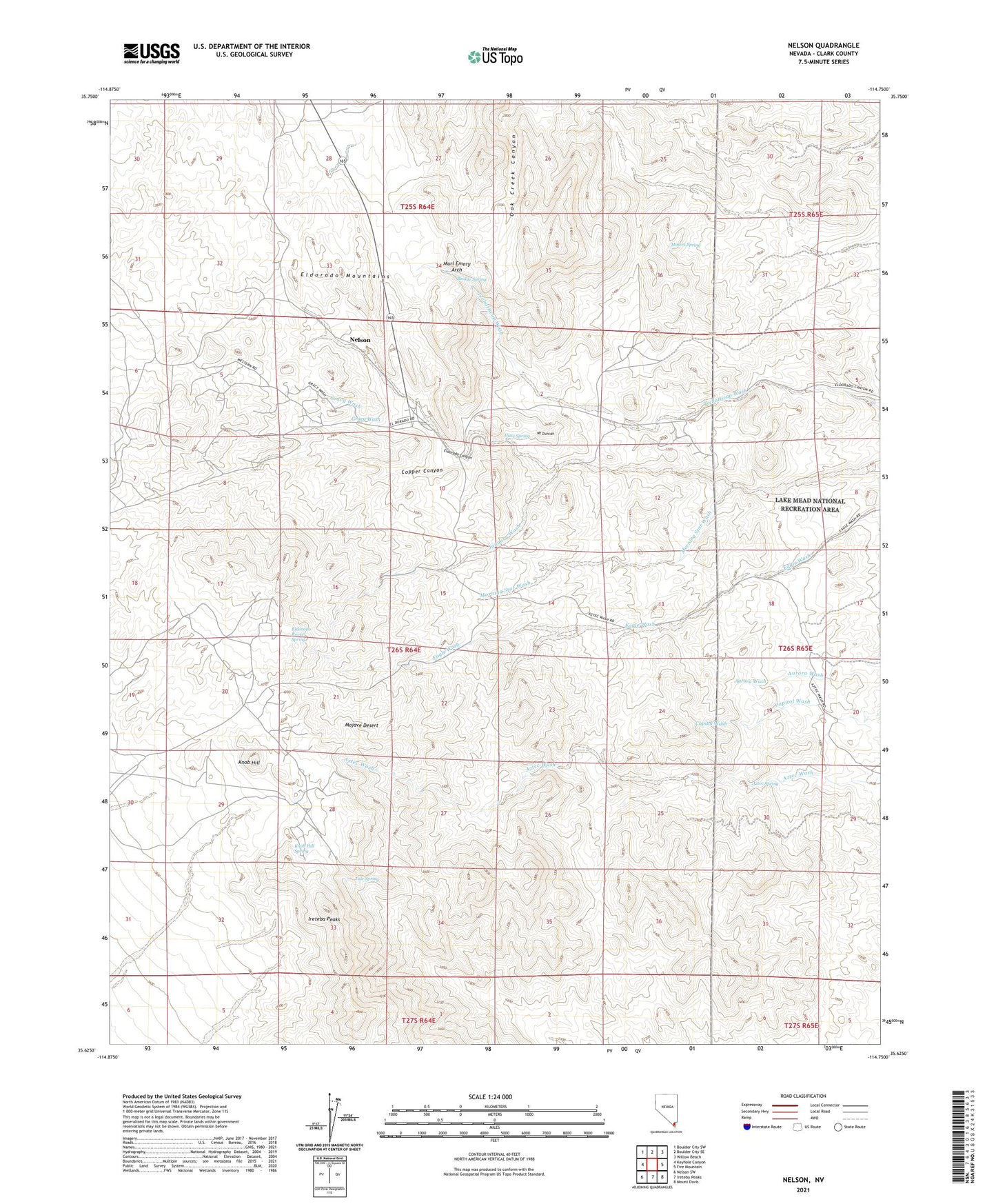
2021 topographic map quadrangle Nelson in the state of Nevada. Scale: 1:24000. Based on the newly updated USGS 7.5' US Topo map series, this map is in the following counties: Clark. The map contains contour data, water features, and other items you are used to seeing on USGS maps, but also has updated roads and other features. This is the next generation of topographic maps. Printed on high-quality waterproof paper with UV fade-resistant inks.
Quads adjacent to this one:
West: Keyhole Canyon
Northwest: Boulder City SW
North: Boulder City SE
Northeast: Willow Beach
East: Fire Mountain
Southeast: Mount Davis
South: Ireteba Peaks
Southwest: Nelson SW
This map covers the same area as the classic USGS quad with code o35114f7.
Contains the following named places: Aztec Spring, Bell Mine, Belmont-Phoenix Mine, Black Hawk Mine, Bridge Spring, Camp Booth, Camp Duncan, Capitol Camp, Capitol Hill Mine, Carnation Mine, Combination Mine, Copper Canyon, Dolores Mine, Duncan Mine, Eldorado Canyon Mining District, Eldorado City, Eldorado Crown Mines, Eldorado Empire Mines, Eldorado Mine, Eldorado Mountains, Eldorado Rand Mines, Eldorado Rover Mines, Eldorado Rover Spring, Gettysburg Mine, Golden Empire Mine, Gracy Wash, Honest Miner Mine, Huse Spring, January Wash, Jubilee Mine, Knob Hill, Knob Hill Spring, Lucky Jim Camp, Magnolia Mine, Marie Camp, McKinley Mine, Miners Spring, Mockingbird Mine, Morning Star Mine, Morning Star Wash, Mount Duncan, Murl Emery Arch, Nelson, Nelson Census Designated Place, Nelson Post Office, Nevada Eagle Mine, Nob Hill, Occidental Mine, Oro Plata Mine, Patsy Mine, Quaker City Mine, Rand Mine, Rich Hill Mine, Silver Legion Mine, Solar Mine, Techatticup Mine, Tule Spring, Wall Street Mine