
MyTopo
La Madre Mountain Nevada US Topo Map
Couldn't load pickup availability
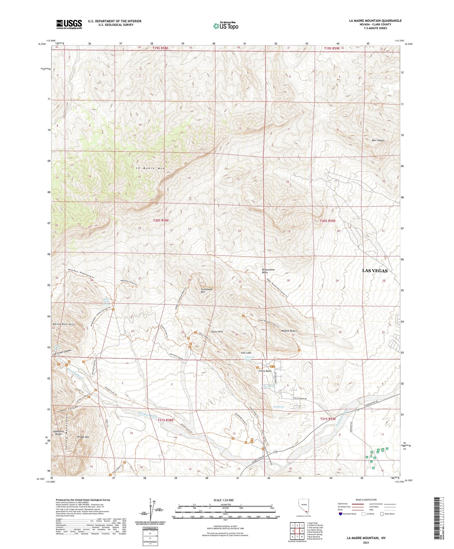
2021 topographic map quadrangle La Madre Mountain in the state of Nevada. Scale: 1:24000. Based on the newly updated USGS 7.5' US Topo map series, this map is in the following counties: Clark. The map contains contour data, water features, and other items you are used to seeing on USGS maps, but also has updated roads and other features. This is the next generation of topographic maps. Printed on high-quality waterproof paper with UV fade-resistant inks.
Quads adjacent to this one:
West: La Madre Spring
Northwest: Angel Peak
East: Blue Diamond NE
Southeast: Blue Diamond SE
South: Blue Diamond
Southwest: Mountain Springs
Contains the following named places: Ash Creek Spring, Bridge Mountain, Brownstone Basin, Calico Basin, Calico Hills, Calico Spring, Icebox Canyon, La Madre Mountain, Lost Creek Canyon, Lost Lake, Red Spring, Rocky Gap Campgrounds, Turtlehead Mountain, White Rock Hills, White Rock Spring, Willow Spring


