
MyTopo
La Madre Spring Nevada US Topo Map
Couldn't load pickup availability
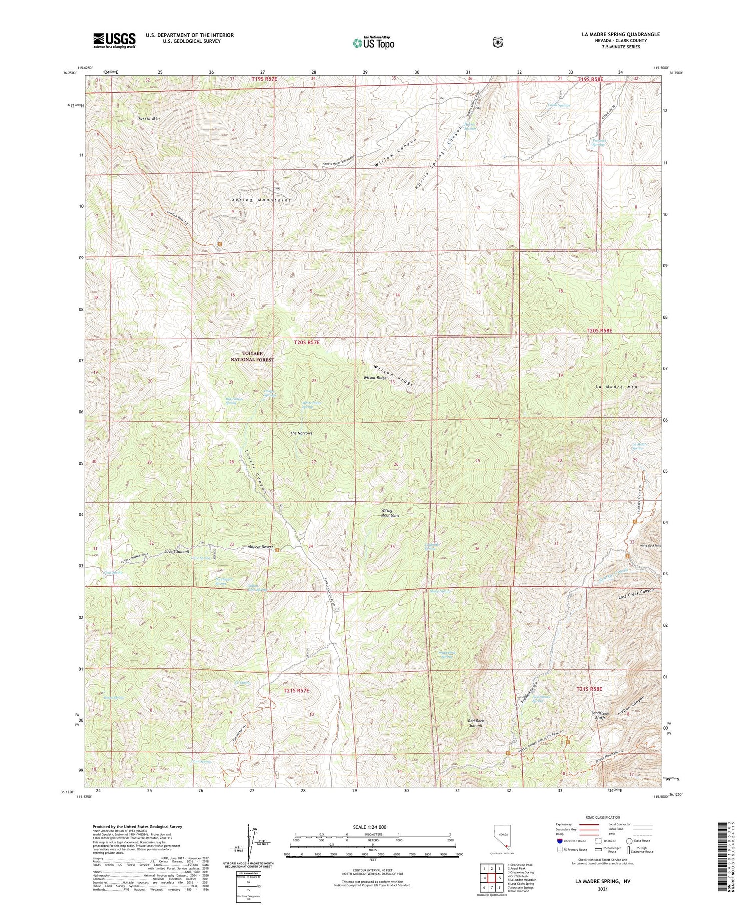
2021 topographic map quadrangle La Madre Spring in the state of Nevada. Scale: 1:24000. Based on the newly updated USGS 7.5' US Topo map series, this map is in the following counties: Clark. The map contains contour data, water features, and other items you are used to seeing on USGS maps, but also has updated roads and other features. This is the next generation of topographic maps. Printed on high-quality waterproof paper with UV fade-resistant inks.
Quads adjacent to this one:
West: Griffith Peak
Northwest: Charleston Peak
North: Angel Peak
East: La Madre Mountain
Southeast: Blue Diamond
South: Mountain Springs
Southwest: Lost Cabin Spring
Contains the following named places: Big Timber Spring, Bootlegger Spring, Cabin Springs, Cane Spring, Cave Spring, Caybank Spring, CC Spring, Center Springs, Coal Spring, Gallon Tank Spring, Griffith Peak Trail, Griffith Peak Trailhead, Harris Mountain, Harris Spring Ranch, Harris Springs, La Madre Mountain Wilderness, La Madre Spring, Lovell Summit, Pine Creek Canyon Natural Area, Prospect Springs, Red Rock Canyon, Red Rock Summit, Roberts Ranch, Roses Spring, Sandstone Bluffs, Sheep Spring, South Fork Spring, Switchback Spring, The Narrows, White Point Spring, Willow Canyon, Wilson Ridge


