MyTopo
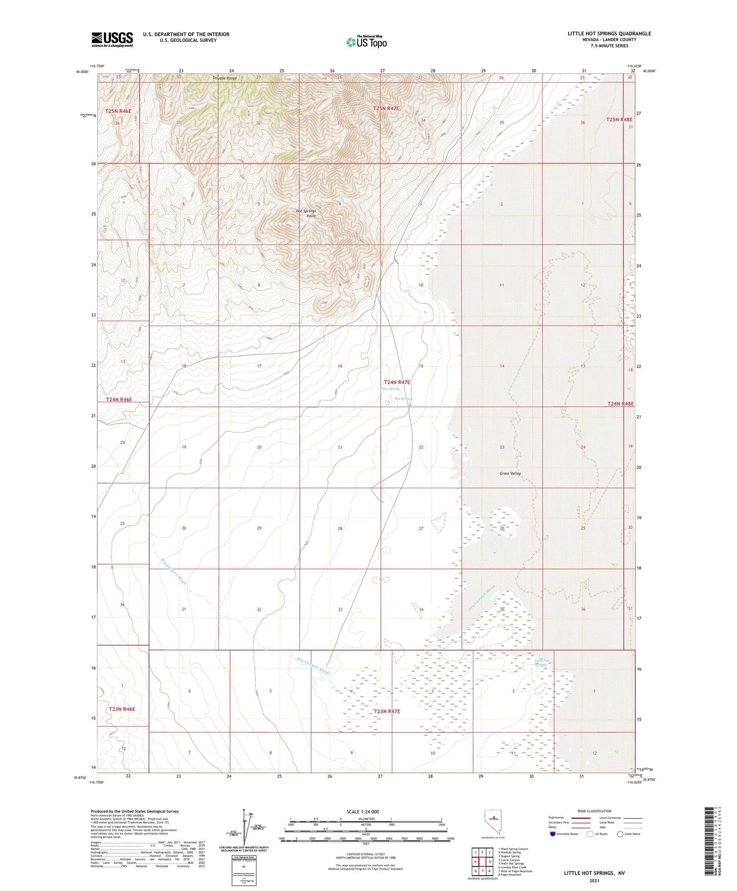
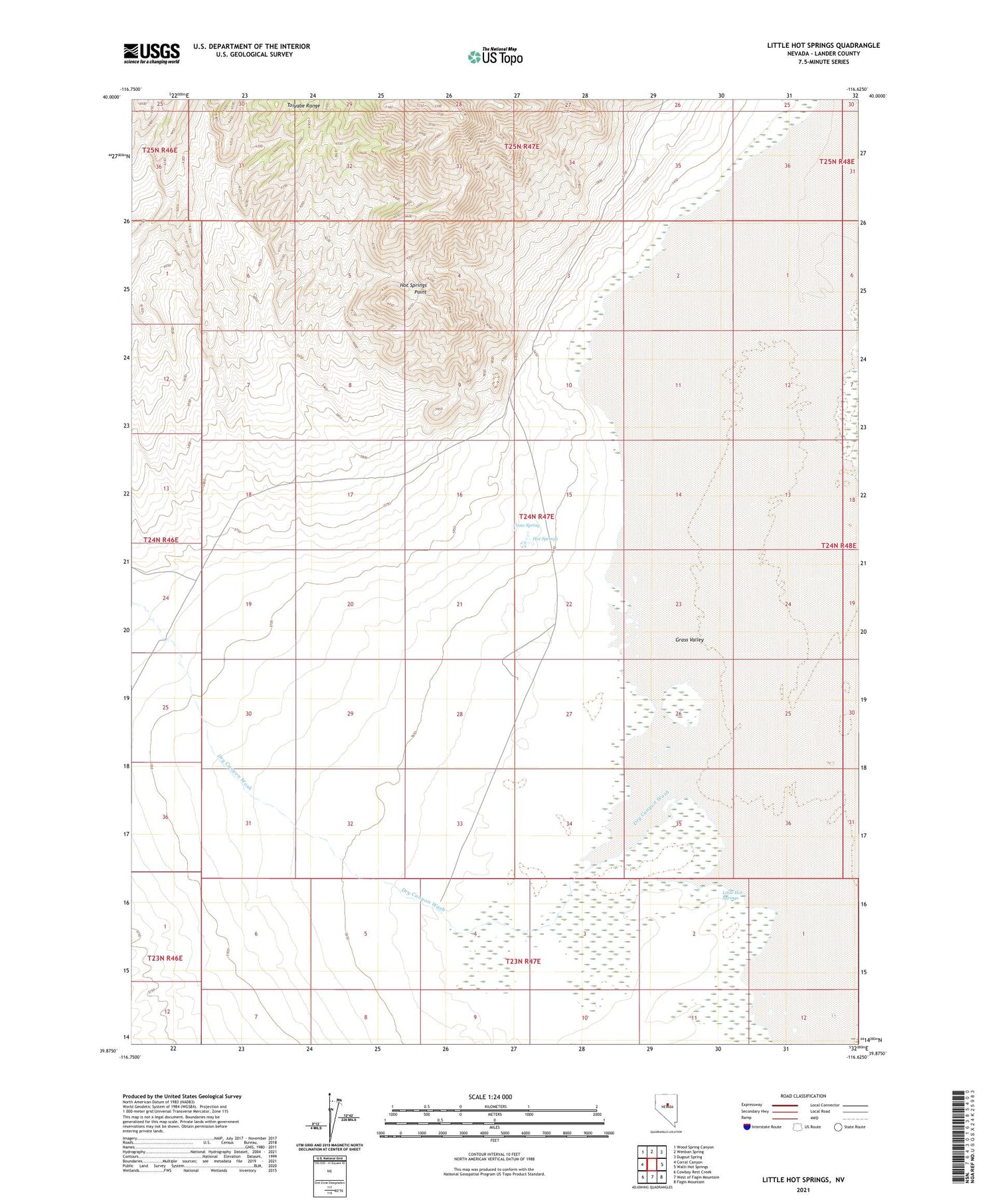
Little Hot Springs Nevada US Topo Map
Couldn't load pickup availability
2021 topographic map quadrangle Little Hot Springs in the state of Nevada. Scale: 1:24000. Based on the newly updated USGS 7.5' US Topo map series, this map is in the following counties: Lander. The map contains contour data, water features, and other items you are used to seeing on USGS maps, but also has updated roads and other features. This is the next generation of topographic maps. Printed on high-quality waterproof paper with UV fade-resistant inks.
Quads adjacent to this one:
West: Corral Canyon
Northwest: Wood Spring Canyon
North: Wenban Spring
Northeast: Dugout Spring
East: Walti Hot Springs
Southeast: Fagin Mountain
South: West of Fagin Mountain
Southwest: Cowboy Rest Creek
Contains the following named places: Blue Goose Mine, Crow Spring, Dry Canyon Wash, Hot Springs, Little Hot Springs, Toiyabe Range