MyTopo
Walti Hot Springs Nevada US Topo Map
Couldn't load pickup availability
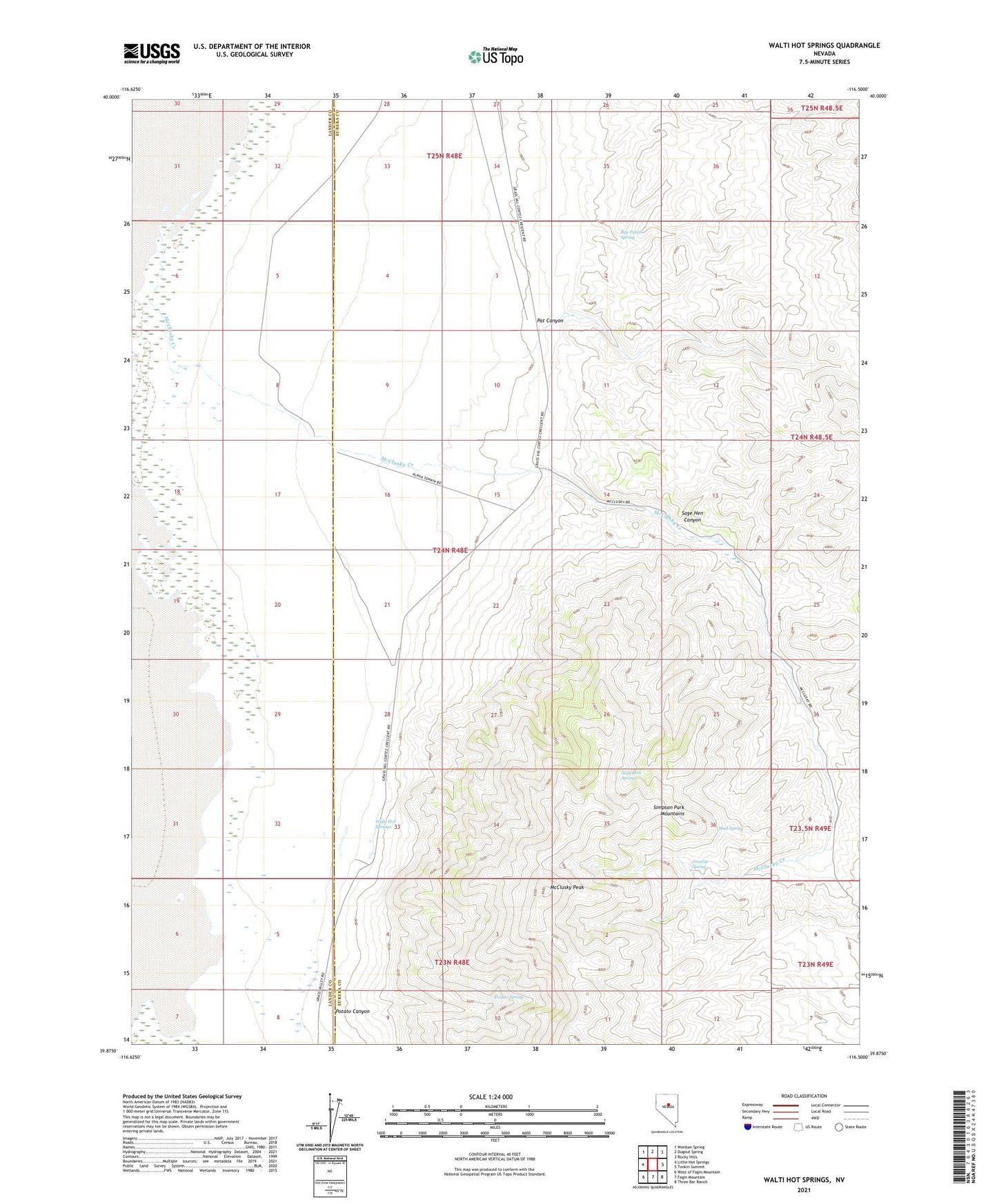
2021 topographic map quadrangle Walti Hot Springs in the state of Nevada. Scale: 1:24000. Based on the newly updated USGS 7.5' US Topo map series, this map is in the following counties: Eureka, Lander. The map contains contour data, water features, and other items you are used to seeing on USGS maps, but also has updated roads and other features. This is the next generation of topographic maps. Printed on high-quality waterproof paper with UV fade-resistant inks.
Quads adjacent to this one:
West: Little Hot Springs
Northwest: Wenban Spring
North: Dugout Spring
Northeast: Rocky Hills
East: Tonkin Summit
Southeast: Three Bar Ranch
South: Fagin Mountain
Southwest: West of Fagin Mountain
This map covers the same area as the classic USGS quad with code o39116h5.
Contains the following named places: Allen Ranch, Baumann Ranch, Granite Spring, Grass Valley School, Gund Ranch, Keystone, Keystone Mine, Keystone Post Office, McClusky Creek, McClusky Peak, Mud Spring, Nevin, Nevins Post Office, Pat Canyon, Potato Canyon, Potato Spring, Roberts Mining District, Rye Patch Spring, Sage Hen Canyon, Sage Hen Spring, Simpson Park Mountains, Walti Hot Springs, Walti Ranch