MyTopo
Moapa East Nevada US Topo Map
Couldn't load pickup availability
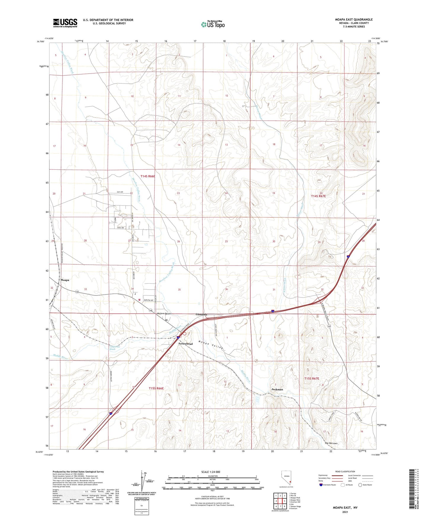
2021 topographic map quadrangle Moapa East in the state of Nevada. Scale: 1:24000. Based on the newly updated USGS 7.5' US Topo map series, this map is in the following counties: Clark. The map contains contour data, water features, and other items you are used to seeing on USGS maps, but also has updated roads and other features. This is the next generation of topographic maps. Printed on high-quality waterproof paper with UV fade-resistant inks.
Quads adjacent to this one:
West: Moapa West
Northwest: Farrier
North: Rox SE
Northeast: Moapa Peak
East: Overton NW
Southeast: Overton
South: Weiser Ridge
Southwest: Ute
Contains the following named places: Arrowhead, California Wash, Clark County Moapa Fire Station 72, Comstock, Glendale, Glendale Station, Hupton, Hupton Post Office, Jackman, Meadow Valley Wash, Moapa, Moapa Post Office, Moapa Recreation Center, Moapa Recreation Center Park, Moapa Town, Nevada Highway Patrol Southern Command Moapa, Old California Crossing, Powers Ranch, Searles Ranch, The Narrows, The Narrows Dam Site Number One, Ute Perkins Elementary School, Weiser Wash, West Ranch, White, White Star Mine, White Star Plaster Mill