MyTopo
Montezuma Peak Nevada US Topo Map
Couldn't load pickup availability
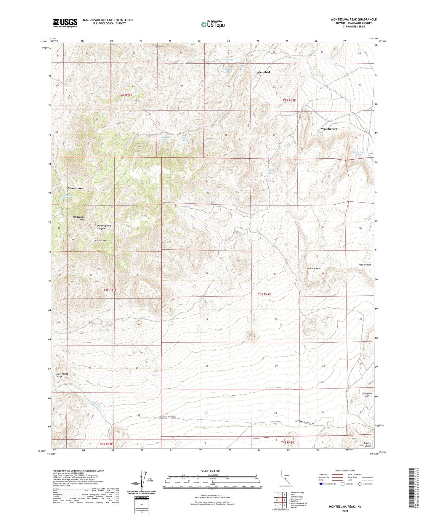
2021 topographic map quadrangle Montezuma Peak in the state of Nevada. Scale: 1:24000. Based on the newly updated USGS 7.5' US Topo map series, this map is in the following counties: Esmeralda. The map contains contour data, water features, and other items you are used to seeing on USGS maps, but also has updated roads and other features. This is the next generation of topographic maps. Printed on high-quality waterproof paper with UV fade-resistant inks.
Quads adjacent to this one:
West: Split Mountain
Northwest: Paymaster Ridge
North: Alkali
Northeast: McMahon Ridge
East: Goldfield
Southeast: Ralston
South: Montezuma Peak SE
Southwest: Montezuma Peak SW
Contains the following named places: Arizona Mine, Brewster Mine, Brickyard Spring, Bullion Mine, Burchard Mine, Caracas Mine, Carroll Peak, Congress Mine, Crocket Mine, Dago Joe Spring, Gemfield, Hubbard Mine, Indian Springs, Light Mine, Malpais Mesa, Montezuma, Montezuma Mine, Montezuma Mining District, Montezuma Peak, Montezuma Post Office, Montezuma Range, Montezuma Spring, Mountain Queen Mine, Nevada Eagle Mine, Norfolk Mine, Osceola Mine, Red Springs, Savage Mine, Slaughterhouse Spring, Southern Mine, Sulphur Spring, West Spring