MyTopo
Moss Creek Nevada US Topo Map
Couldn't load pickup availability
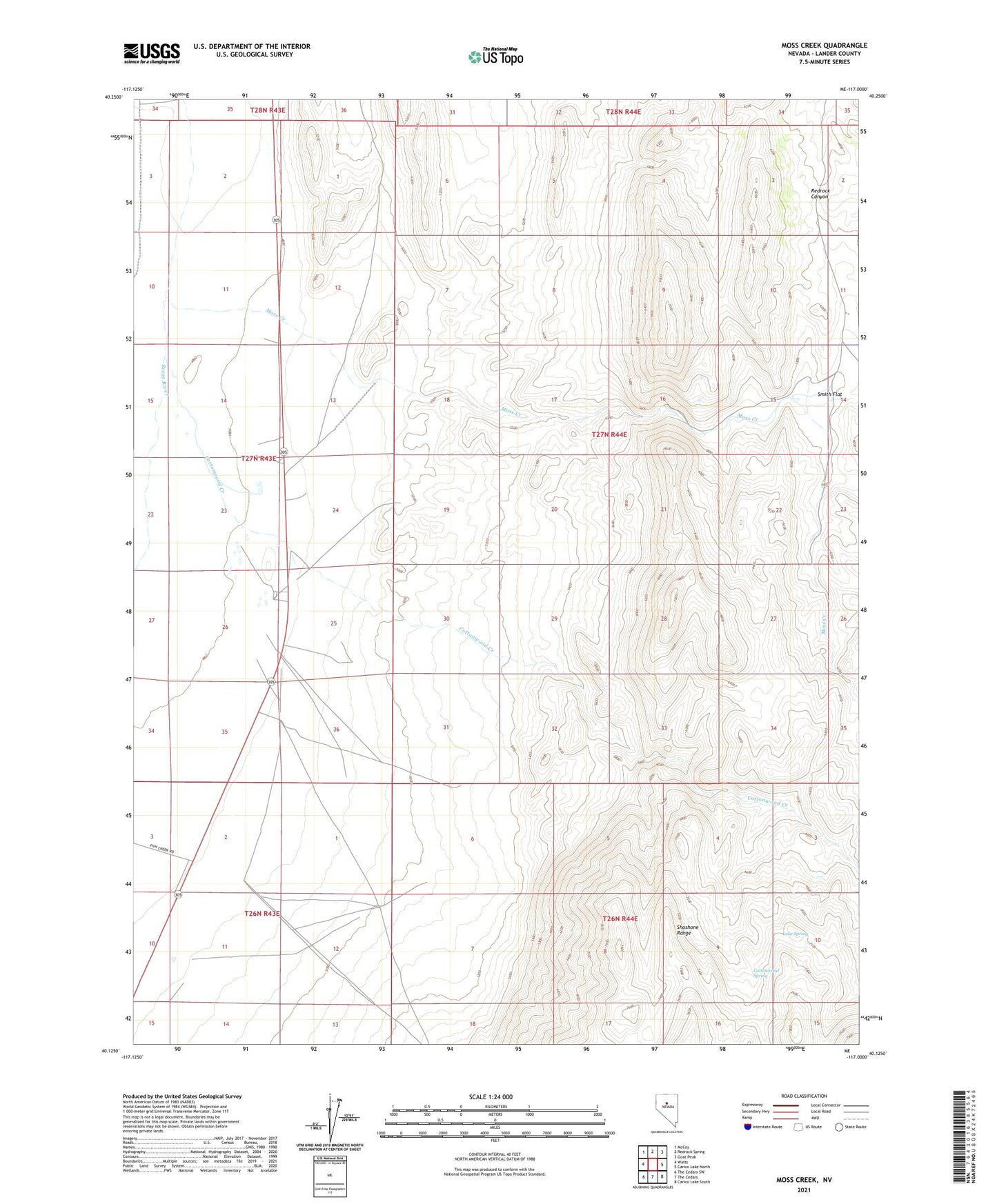
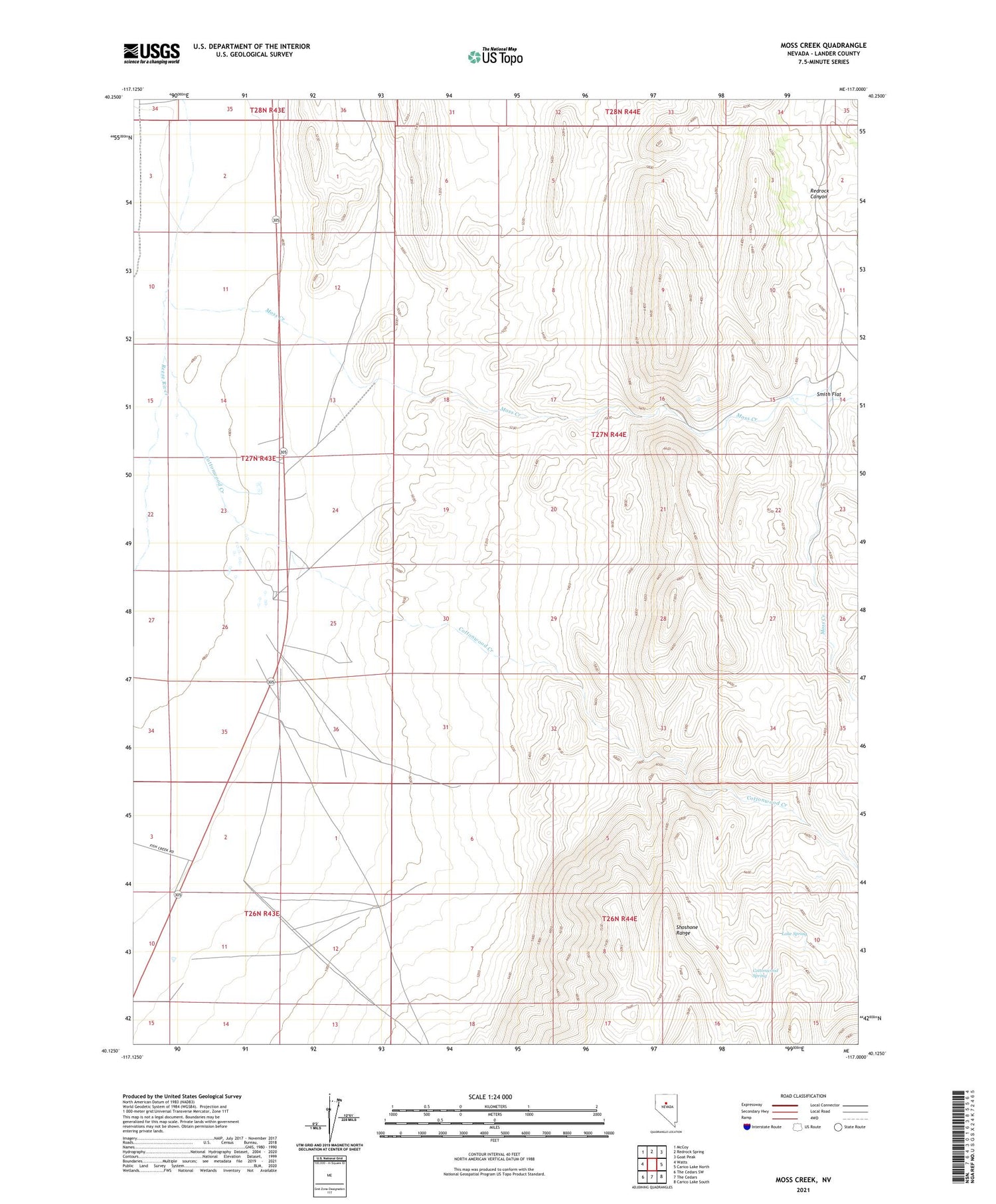
2021 topographic map quadrangle Moss Creek in the state of Nevada. Scale: 1:24000. Based on the newly updated USGS 7.5' US Topo map series, this map is in the following counties: Lander. The map contains contour data, water features, and other items you are used to seeing on USGS maps, but also has updated roads and other features. This is the next generation of topographic maps. Printed on high-quality waterproof paper with UV fade-resistant inks.
Quads adjacent to this one:
West: Watts
Northwest: McCoy
North: Redrock Spring
Northeast: Goat Peak
East: Carico Lake North
Southeast: Carico Lake South
South: The Cedars
Southwest: The Cedars SW
Contains the following named places: Cottonwood Creek, Cottonwood Spring, Hot Springs Ranch, Lake Spring, Moss Creek, Smith Flat, Valley of the Moon Ranch, Warm Springs Mine, Warm Springs Mining Area