MyTopo
Needle Peak Nevada US Topo Map
Couldn't load pickup availability
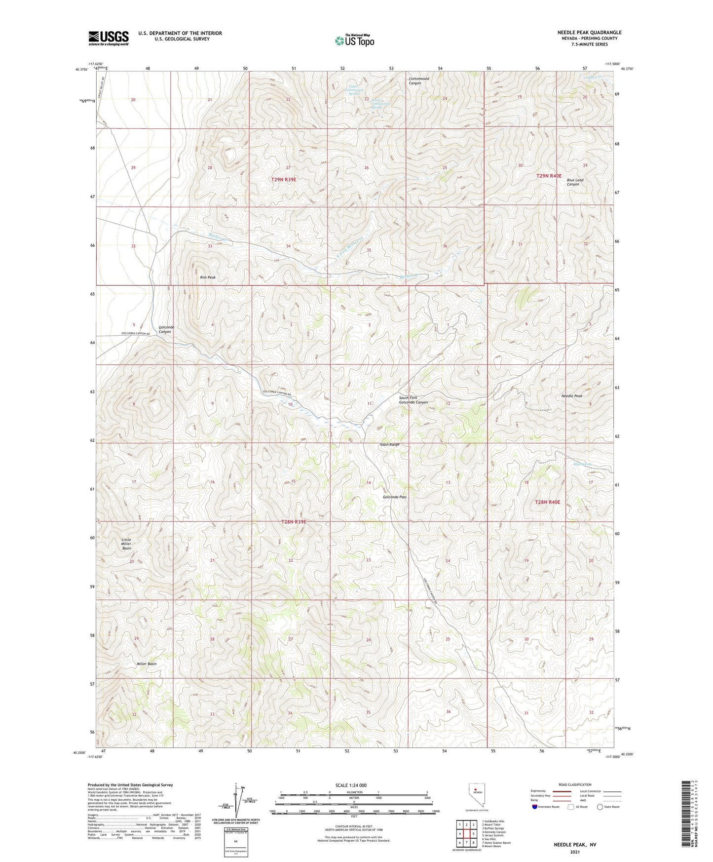
2021 topographic map quadrangle Needle Peak in the state of Nevada. Scale: 1:24000. Based on the newly updated USGS 7.5' US Topo map series, this map is in the following counties: Pershing. The map contains contour data, water features, and other items you are used to seeing on USGS maps, but also has updated roads and other features. This is the next generation of topographic maps. Printed on high-quality waterproof paper with UV fade-resistant inks.
Quads adjacent to this one:
West: Kennedy Canyon
Northwest: Goldbanks Hills
North: Mount Tobin
Northeast: Buffalo Springs
East: Jersey Summit
Southeast: Mount Moses
South: Home Station Ranch
Southwest: Sou Hills
Contains the following named places: Allard Ranch, Badger Mine, Camera Mine, Etchegoyen Ranch, Eureka Mine, Golconda Canyon, Golconda Pass, Last Chance Mine, Little Miller Basin, Lower Cottonwood Spring, Meyer Ranch, Miller Basin, Mount Tobin Mine, Mount Tobin Mining District, Mud Spring, Needle Peak, Needle Peak Mine, North Fork Bushee Creek, North Fork Mine, Pearce School, Rim Peak, South Fork Golconda Canyon, Tip Top Mine, Upper Cottonwood Spring