MyTopo
Mount Moses Nevada US Topo Map
Couldn't load pickup availability
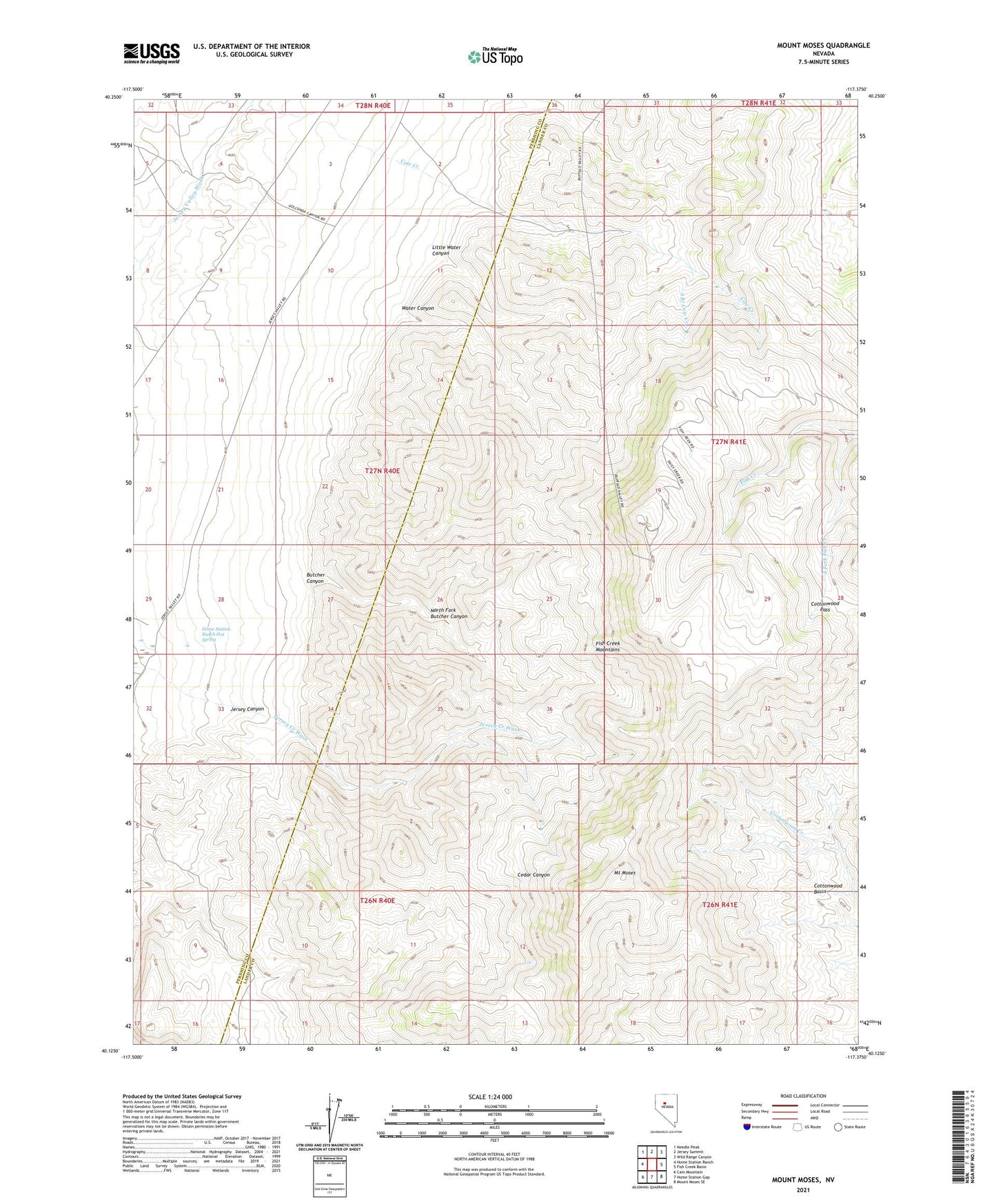
2021 topographic map quadrangle Mount Moses in the state of Nevada. Scale: 1:24000. Based on the newly updated USGS 7.5' US Topo map series, this map is in the following counties: Lander, Pershing. The map contains contour data, water features, and other items you are used to seeing on USGS maps, but also has updated roads and other features. This is the next generation of topographic maps. Printed on high-quality waterproof paper with UV fade-resistant inks.
Quads adjacent to this one:
West: Home Station Ranch
Northwest: Needle Peak
North: Jersey Summit
Northeast: Wild Range Canyon
East: Fish Creek Basin
Southeast: Mount Moses SE
South: Home Station Gap
Southwest: Cain Mountain
This map covers the same area as the classic USGS quad with code o40117b4.
Contains the following named places: Abel Ranch, Black Eagle Mines, Butcher Canyon, Cottonwood Pass, Home Station Ranch Hot Spring, Jersey, Jersey Canyon, Jersey City Post Office, Jersey Mining District, Jersey Valley-Rex Mines, Little Water Canyon, Mount Moses, North Fork Butcher Canyon, Ruby Mercury Mine, South Branch Cow Creek, South Fork Fish Creek, Water Canyon