MyTopo
Ocala Nevada US Topo Map
Couldn't load pickup availability
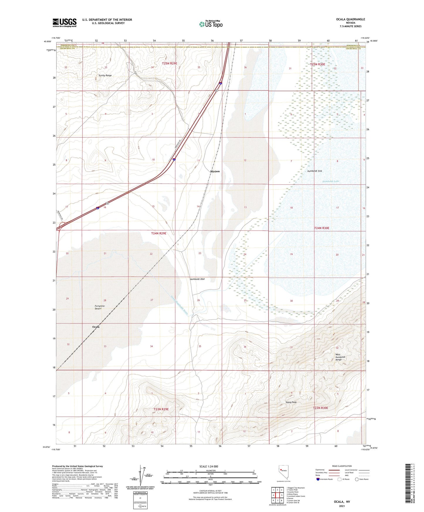
2021 topographic map quadrangle Ocala in the state of Nevada. Scale: 1:24000. Based on the newly updated USGS 7.5' US Topo map series, this map is in the following counties: Churchill, Pershing. The map contains contour data, water features, and other items you are used to seeing on USGS maps, but also has updated roads and other features. This is the next generation of topographic maps. Printed on high-quality waterproof paper with UV fade-resistant inks.
Quads adjacent to this one:
West: White Plains
Northwest: Ragged Top Mountain
North: Toulon Peak
Northeast: Granite Point
East: Lovelock Indian Caves
Southeast: Carson Sink SE
South: Carson Sink SW
Southwest: Parran
Contains the following named places: Cressid, Fanning, Hazel Mine, Humboldt Dike, Humboldt Lake, Lower Humboldt Drain, Miriam, Ocala, Old California Trail, Old California Trail East Road, Oneida Mill, Saint Anthony Mine, Topog Peak, Toy Mill, Trinity