MyTopo
Toulon Peak Nevada US Topo Map
Couldn't load pickup availability
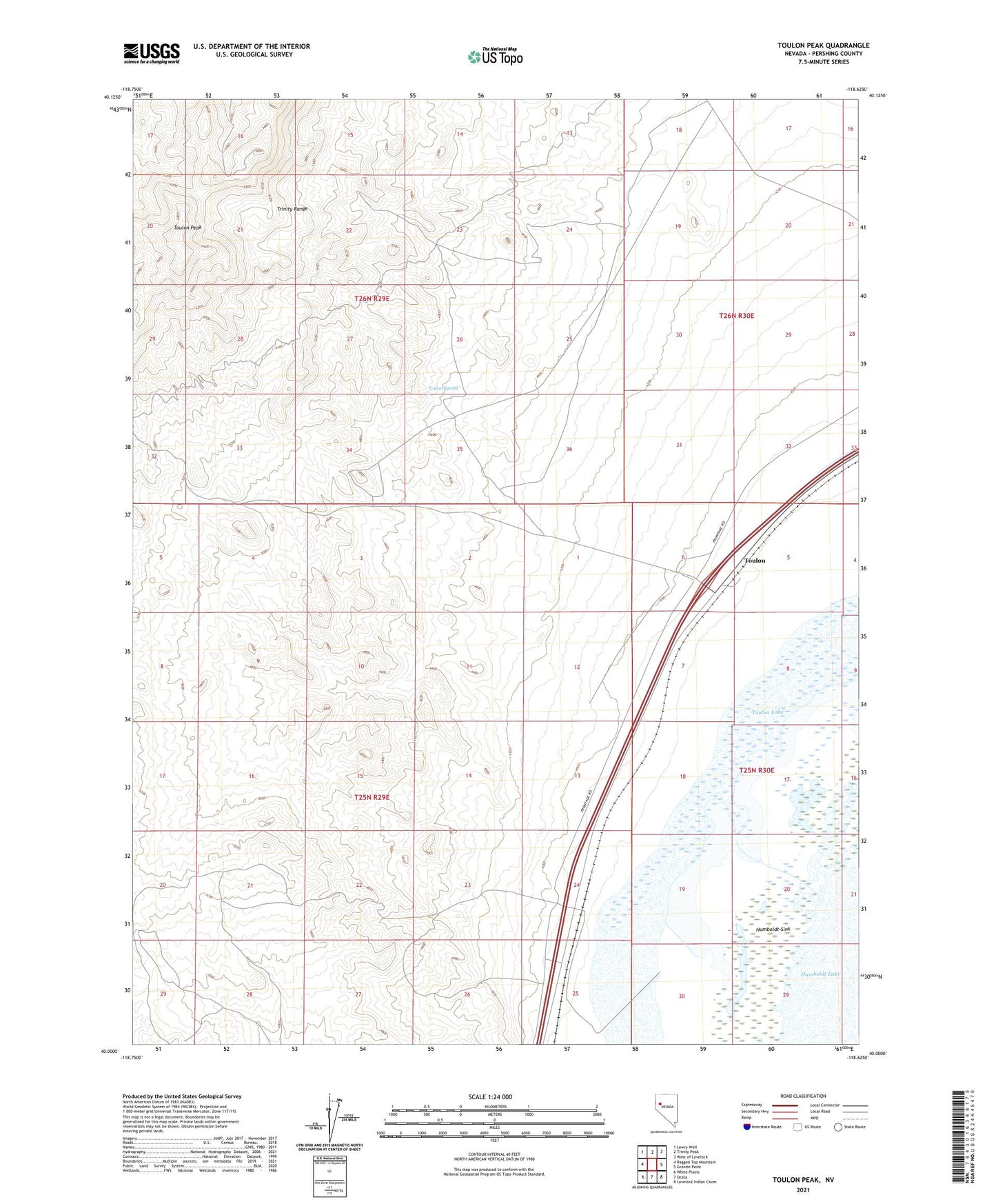
2021 topographic map quadrangle Toulon Peak in the state of Nevada. Scale: 1:24000. Based on the newly updated USGS 7.5' US Topo map series, this map is in the following counties: Pershing. The map contains contour data, water features, and other items you are used to seeing on USGS maps, but also has updated roads and other features. This is the next generation of topographic maps. Printed on high-quality waterproof paper with UV fade-resistant inks.
Quads adjacent to this one:
West: Ragged Top Mountain
Northwest: Lowry Well
North: Trinity Peak
Northeast: West of Lovelock
East: Granite Point
Southeast: Lovelock Indian Caves
South: Ocala
Southwest: White Plains
This map covers the same area as the classic USGS quad with code o40118a6.
Contains the following named places: Browns Post Office, Browns Station, Coon Can Mines, Ragged Top Mining District, Sheby Prospect, Toulon, Toulon Lake, Toulon Peak, Toulon Spring, Toy, Toy Mining District, Toyland Post Office