
MyTopo
Panther Canyon Nevada US Topo Map
Couldn't load pickup availability
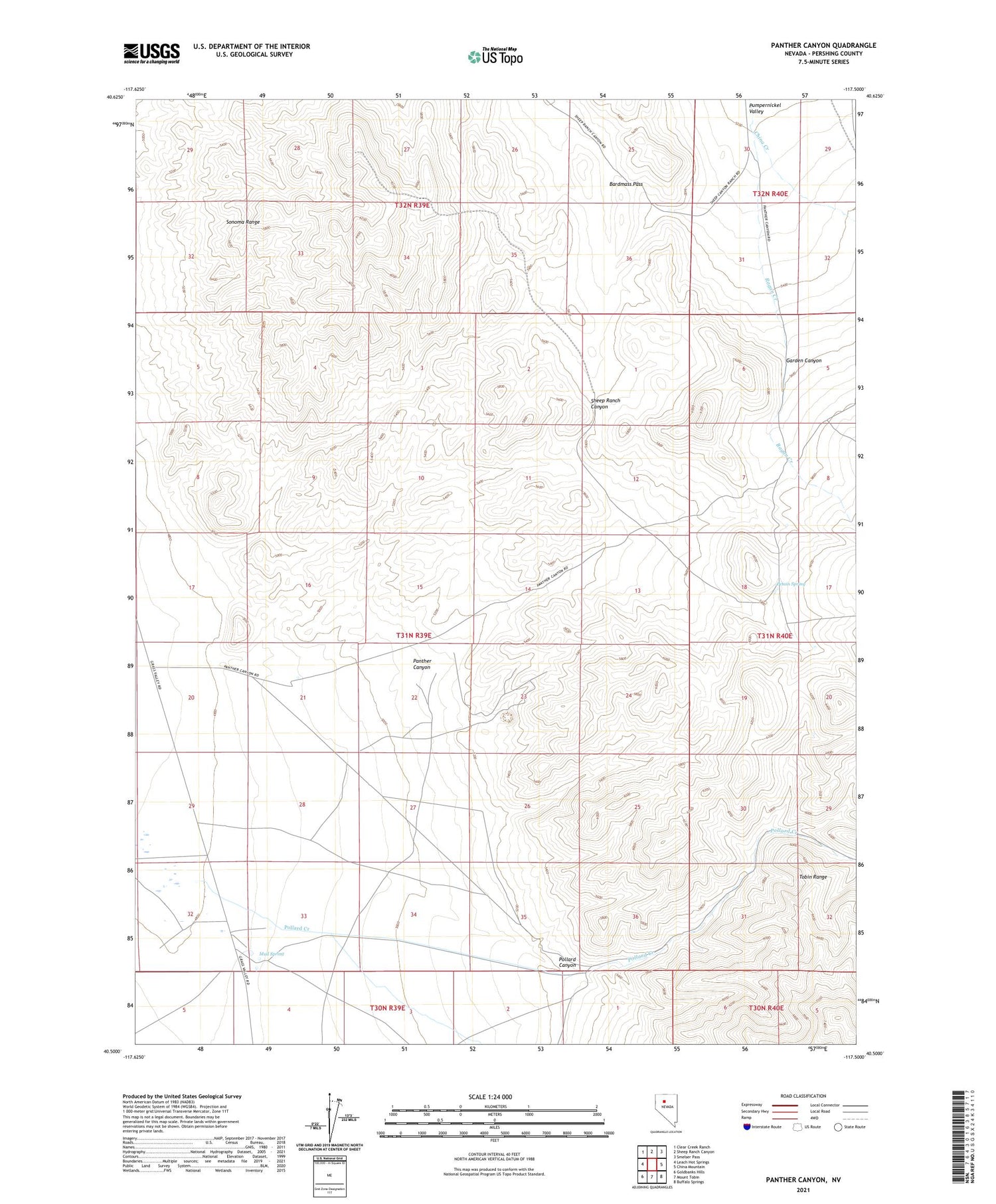
2021 topographic map quadrangle Panther Canyon in the state of Nevada. Scale: 1:24000. Based on the newly updated USGS 7.5' US Topo map series, this map is in the following counties: Pershing. The map contains contour data, water features, and other items you are used to seeing on USGS maps, but also has updated roads and other features. This is the next generation of topographic maps. Printed on high-quality waterproof paper with UV fade-resistant inks.
Quads adjacent to this one:
West: Leach Hot Springs
Northwest: Clear Creek Ranch
North: Sheep Ranch Canyon
Northeast: Smelser Pass
East: China Mountain
Southeast: Buffalo Springs
South: Mount Tobin
Southwest: Goldbanks Hills
Contains the following named places: Bardmass Pass, Big Mike Copper Mine, China Creek, Garden Canyon, Mud Spring, Mud Springs Ranch, Panther Canyon, Petain Spring, Pollard Canyon, Pollard Canyon Mine, Pollard Creek, T Nelson Ranch


