MyTopo
China Mountain Nevada US Topo Map
Couldn't load pickup availability
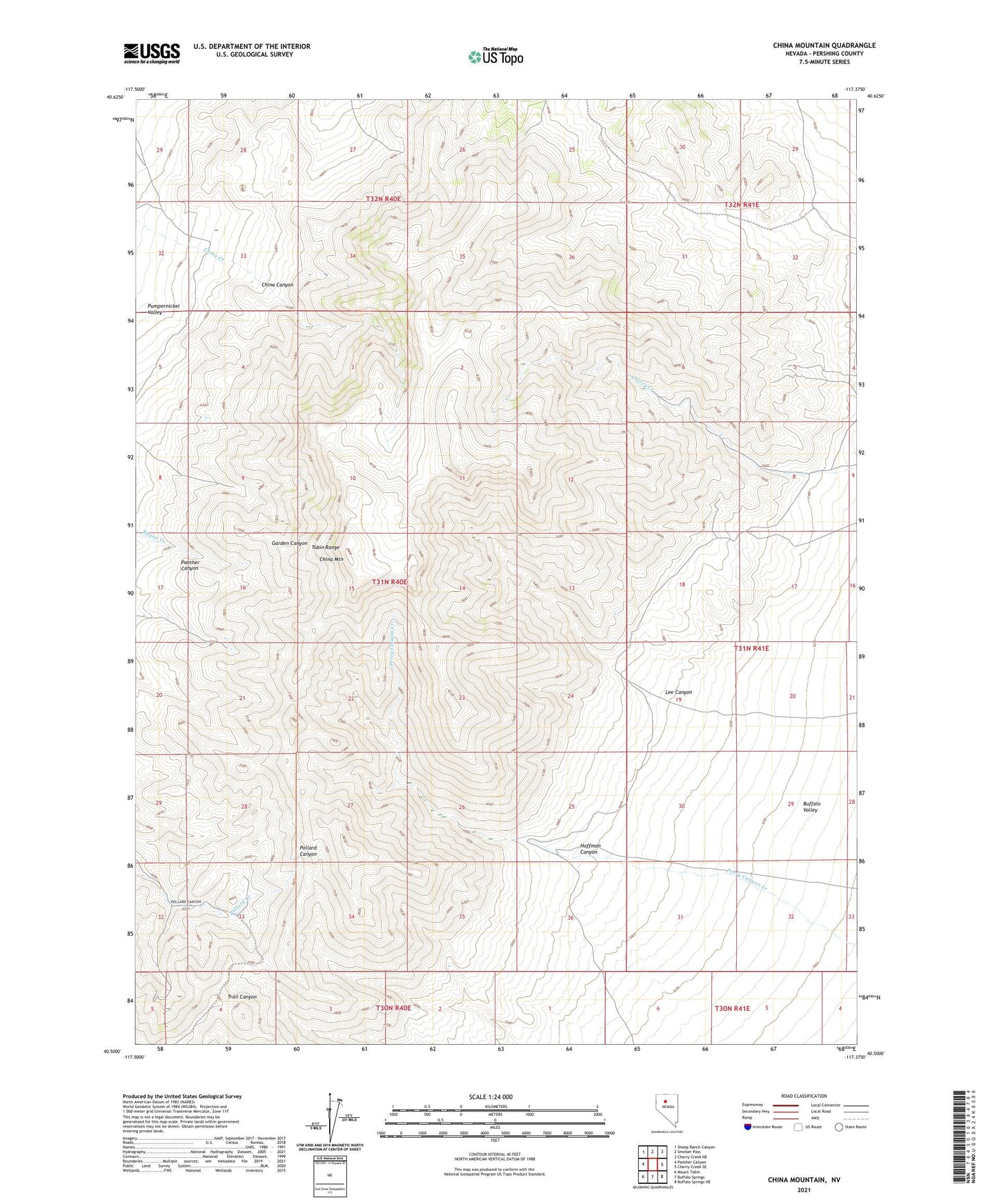
2021 topographic map quadrangle China Mountain in the state of Nevada. Scale: 1:24000. Based on the newly updated USGS 7.5' US Topo map series, this map is in the following counties: Pershing. The map contains contour data, water features, and other items you are used to seeing on USGS maps, but also has updated roads and other features. This is the next generation of topographic maps. Printed on high-quality waterproof paper with UV fade-resistant inks.
Quads adjacent to this one:
West: Panther Canyon
Northwest: Sheep Ranch Canyon
North: Smelser Pass
Northeast: Cherry Creek NE
East: Cherry Creek SE
Southeast: Buffalo Springs NE
South: Buffalo Springs
Southwest: Mount Tobin
This map covers the same area as the classic USGS quad with code o40117e4.
Contains the following named places: Aldrich Mine, China Canyon, China Mountain, Eason Gomez Smelser Mine, Hoffman Canyon, Hoffman Ranch, Iron Hat Mining District, Lee Canyon, Ore Drag Mine, Perry Canyon Creek, Silver Lead Mine, Tobin and Sonoma Range Mining Area