MyTopo
Reno NW Nevada US Topo Map
Couldn't load pickup availability
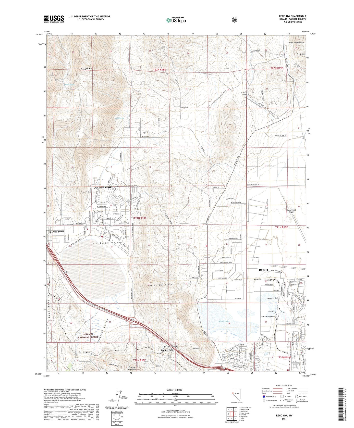
2021 topographic map quadrangle Reno NW in the state of Nevada. Scale: 1:24000. Based on the newly updated USGS 7.5' US Topo map series, this map is in the following counties: Washoe. The map contains contour data, water features, and other items you are used to seeing on USGS maps, but also has updated roads and other features. This is the next generation of topographic maps. Printed on high-quality waterproof paper with UV fade-resistant inks.
Quads adjacent to this one:
West: Evans Canyon
Northwest: Beckwourth Pass
North: Granite Peak
Northeast: Bedell Flat
East: Reno NE
Southeast: Reno
South: Verdi
Southwest: Dog Valley
Contains the following named places: Anderson Ranch, Antelope Mine, Antelope Run, Border Town, Cold Spring, Cold Spring Park, Cold Spring Valley, Cold Springs, Cold Springs Census Designated Place, Cold Springs Volunteer Fire Department, Copperfield, Desert Heights Elementary School, Dry Lake Summit, Francis Post Office, Francis Station, Granite Hill Mine, Granite Hills, Granite Peak, H Bar H Airport, Heinz, Heinz Post Office, Jones Creek, Laughton Valley, Lemmon Valley, Nancy Gomes Elementary School, North Valleys Division, Old Cedar, Pump Spring, Reno Fire Department Station 13, Reno Fire Department Station 18, Reno/Stead Airport, Reno-Stead, Serra Nevada High School, Sierra Fire Protection District Cold Springs Volunteer Fire Department, Sierra Nevada Academy Charter School, Sierra Nevada Job Corp Center, Sierra Sage Golf Course, Silver Knolls Park, Silver Lake, Silver Lake Elementary School, Silver Lake Volunteer Fire Department Station 221, Stead Air Force Base, Stead Air Force Base Branch Post Office, Stead Medical, Stead Station Post Office, White Lake