MyTopo
San Emidio Desert South Nevada US Topo Map
Couldn't load pickup availability
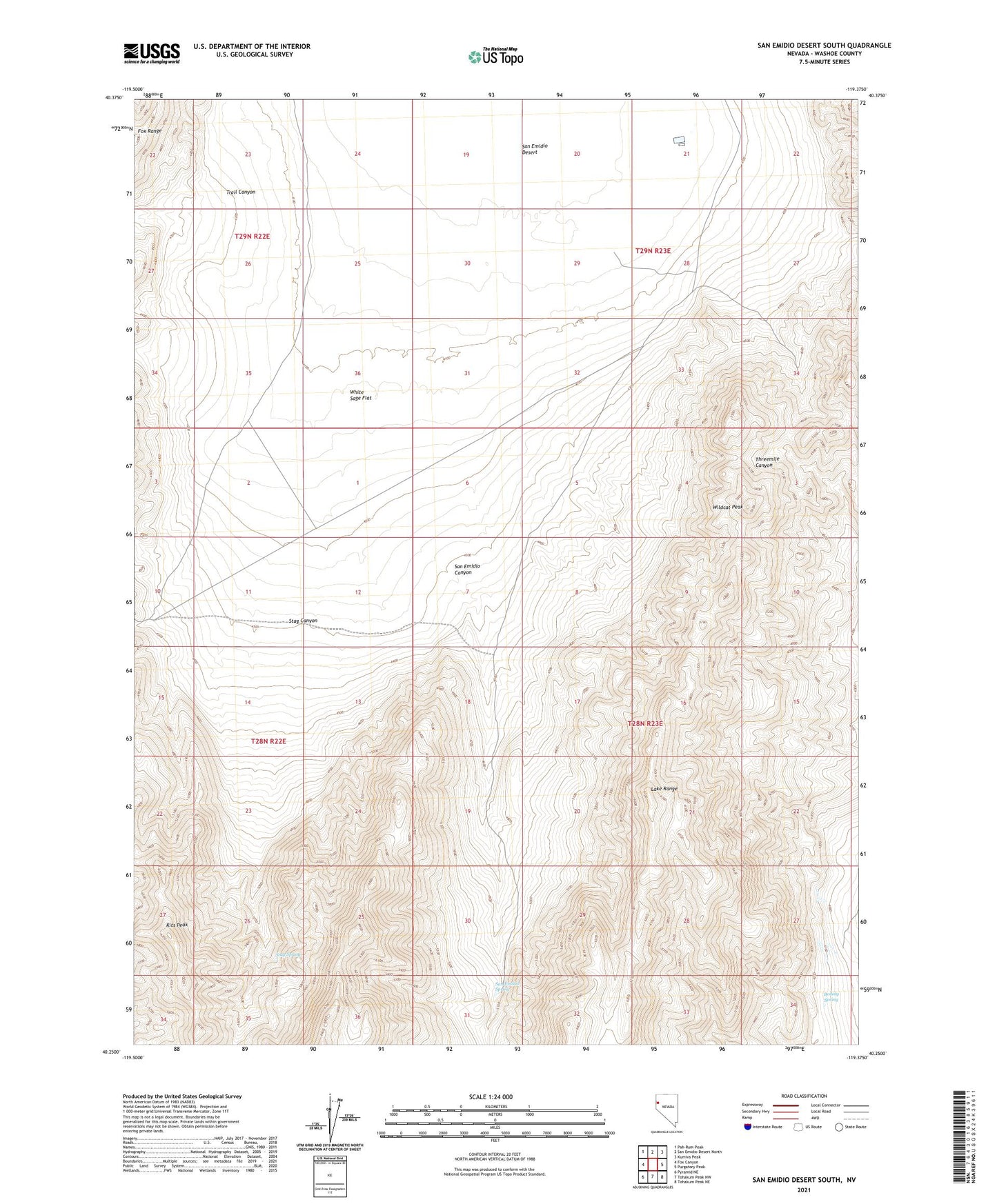
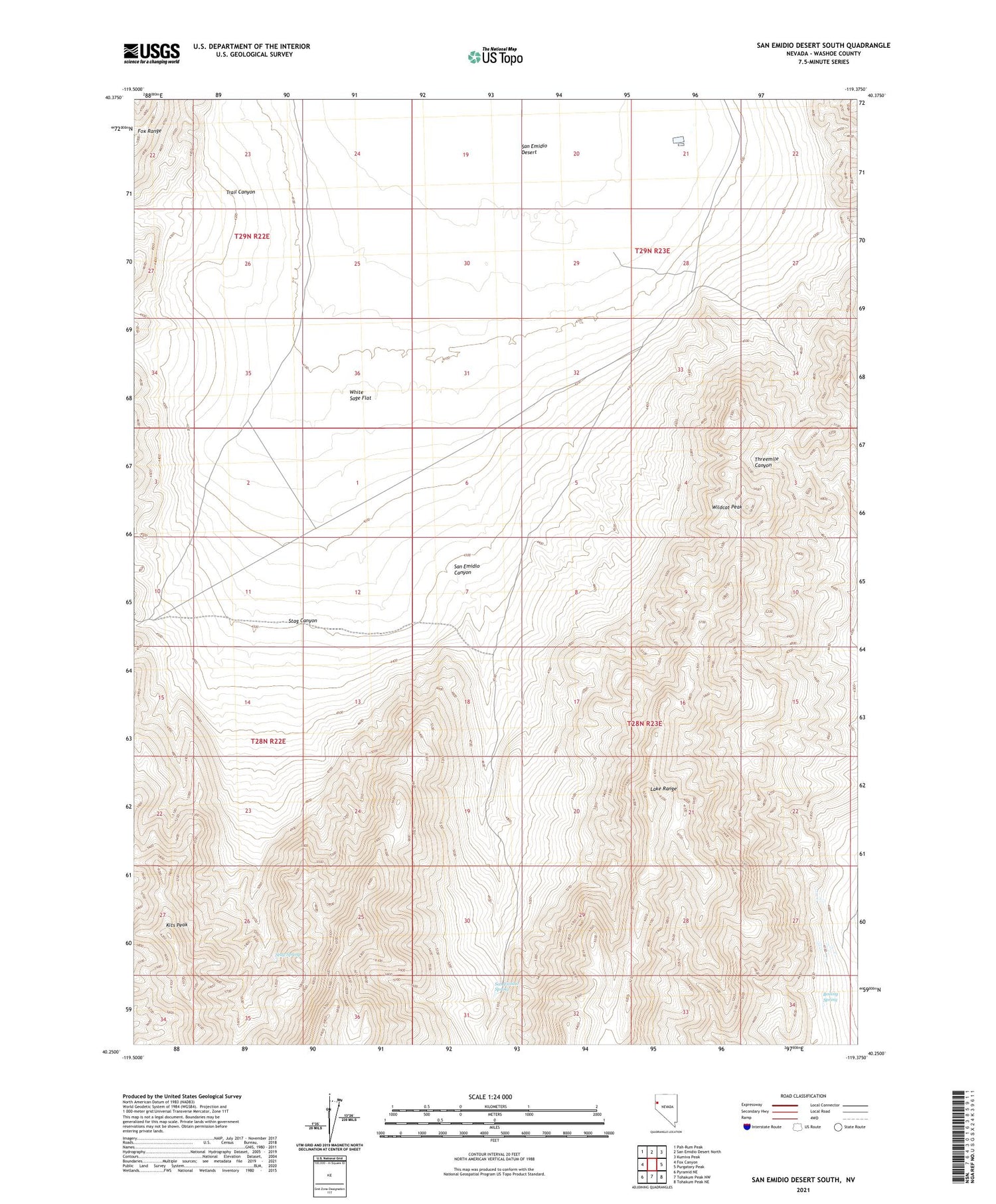
2021 topographic map quadrangle San Emidio Desert South in the state of Nevada. Scale: 1:24000. Based on the newly updated USGS 7.5' US Topo map series, this map is in the following counties: Washoe. The map contains contour data, water features, and other items you are used to seeing on USGS maps, but also has updated roads and other features. This is the next generation of topographic maps. Printed on high-quality waterproof paper with UV fade-resistant inks.
Quads adjacent to this one:
West: Fox Canyon
Northwest: Pah-Rum Peak
North: San Emidio Desert North
Northeast: Kumiva Peak
East: Purgatory Peak
Southeast: Tohakum Peak NE
South: Tohakum Peak NW
Southwest: Pyramid NE
Contains the following named places: Boiling Spring, Kits Peak, San Emidio Canyon, San Emidio Spring, Stag Canyon, Stag Spring, Threemile Canyon Well, Trail Canyon, White Sage Flat, White Sage Flat Well, Wildcat Peak