MyTopo
Well Canyon Nevada US Topo Map
Couldn't load pickup availability
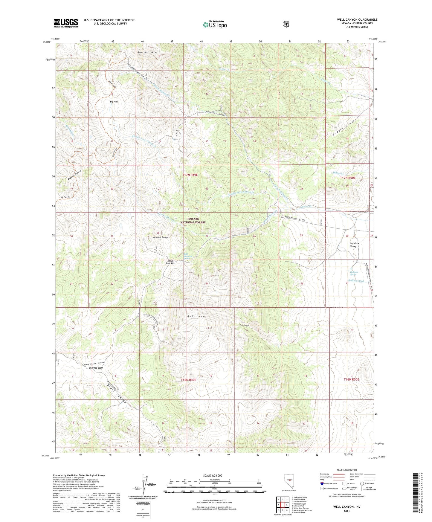
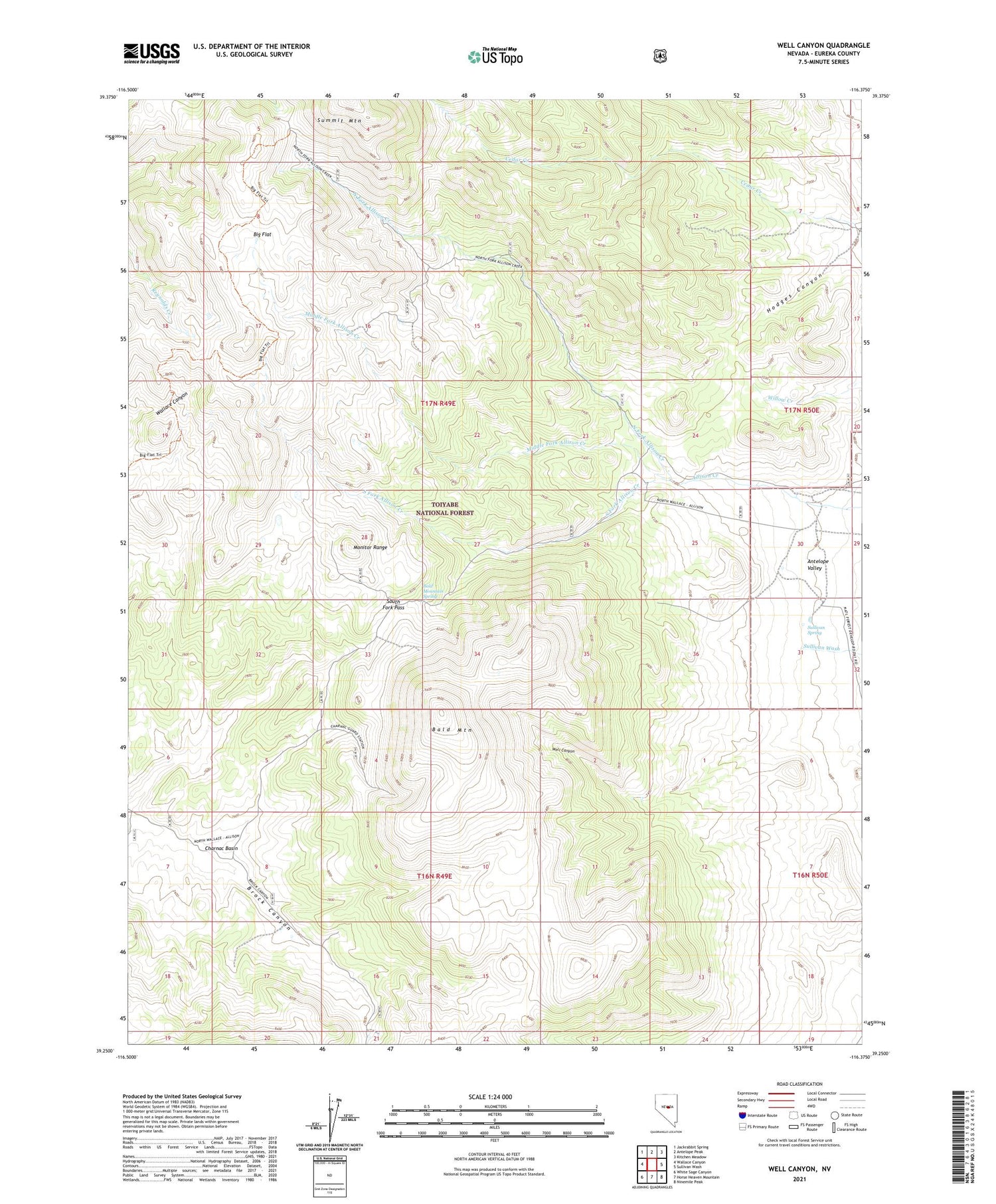
2021 topographic map quadrangle Well Canyon in the state of Nevada. Scale: 1:24000. Based on the newly updated USGS 7.5' US Topo map series, this map is in the following counties: Eureka. The map contains contour data, water features, and other items you are used to seeing on USGS maps, but also has updated roads and other features. This is the next generation of topographic maps. Printed on high-quality waterproof paper with UV fade-resistant inks.
Quads adjacent to this one:
West: Wallace Canyon
Northwest: Jackrabbit Spring
North: Antelope Peak
Northeast: Kitchen Meadow
East: Sullivan Wash
Southeast: Ninemile Peak
South: Horse Heaven Mountain
Southwest: White Sage Canyon
Contains the following named places: Ardans Ranch, Bald Mountain, Bald Mountain Spring, Big Flat, Charnac Basin, Hodges Canyon, Middle Fork Allison Creek, Morrison Ranch, North Fork Allison Creek, South Fork Allison Creek, South Fork Pass, Sullivan Spring, Well Canyon