MyTopo
Freedom New Hampshire US Topo Map
Couldn't load pickup availability
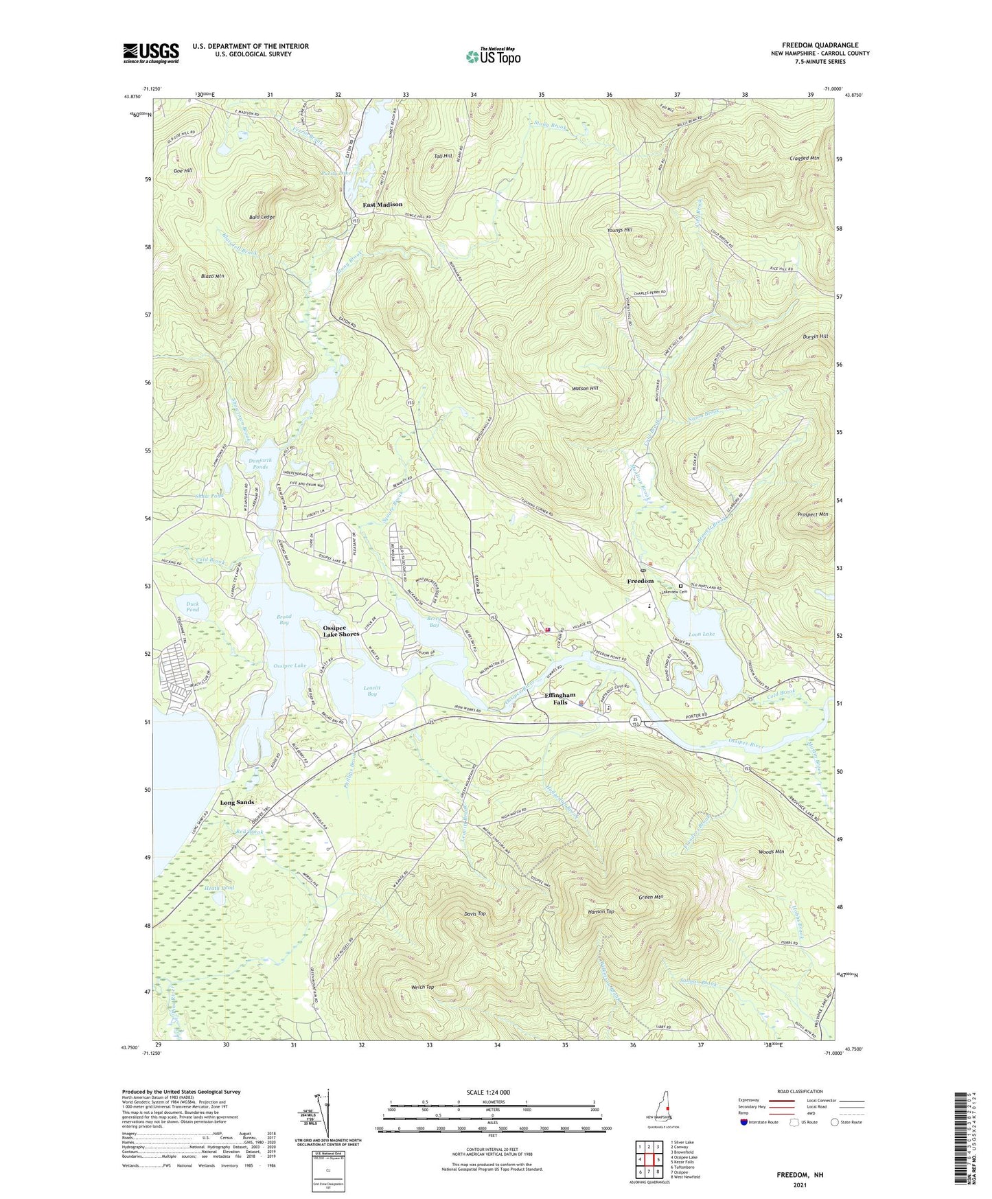
2021 topographic map quadrangle Freedom in the state of New Hampshire. Scale: 1:24000. Based on the newly updated USGS 7.5' US Topo map series, this map is in the following counties: Carroll. The map contains contour data, water features, and other items you are used to seeing on USGS maps, but also has updated roads and other features. This is the next generation of topographic maps. Printed on high-quality waterproof paper with UV fade-resistant inks.
Quads adjacent to this one:
West: Ossipee Lake
Northwest: Silver Lake
North: Conway
Northeast: Brownfield
East: Kezar Falls
Southeast: West Newfield
South: Ossipee
Southwest: Tuftonboro
Contains the following named places: Bald Ledge, Bennett Brook, Berry Bay, Berry Bay Dam, Blaisdell Brook, Blazo Mountain, Broad Bay, Camp Huckins, Camp Marist, Camp Wampineauk, Cold Brook, Cragged Mountain, Cragged Mountain Farm, Danforth Ponds, Davis Meetinghouse, Davis Top, Duck Pond, Durgin Hill, East Madison, Effingham Elementary School, Effingham Falls, Effingham Police Department, Ferrin Brook, First Christian Church, Flanders Brook, Four Corners, Freedom, Freedom Elementary School, Freedom Fire Rescue Department, Freedom Police Department, Freedom Post Office, Goe Hill, Green Mountain, Hanson Top, Head Works Dam, Heath Pond, Hodgedon Brook, King Pine Ski Area, Lakeview Cemetery, Lakeview Learning Center, Leavitt Bay, Leavitt Brook, Long Sands, Loon Lake, Lords Hill, Lords Hill Historic District, Lovering Brook, Mastin Brook, Moulton Brook, Nason Brook, Ossipee Lake Shores, Phillips Brook, Prospect Mountain, Purity Lake, Purity Lake Dam, Red Brook, Salmon Brook, Shaw Pond, Shawtown Brook, Square Brook, Stony Brook, Toll Hill, Town of Freedom, Unitarian Universalist Church, Watson Hill, Welch Top, Woods Mountain, Youngs Hill, ZIP Code: 03836