MyTopo
West Newfield Maine US Topo Map
Couldn't load pickup availability
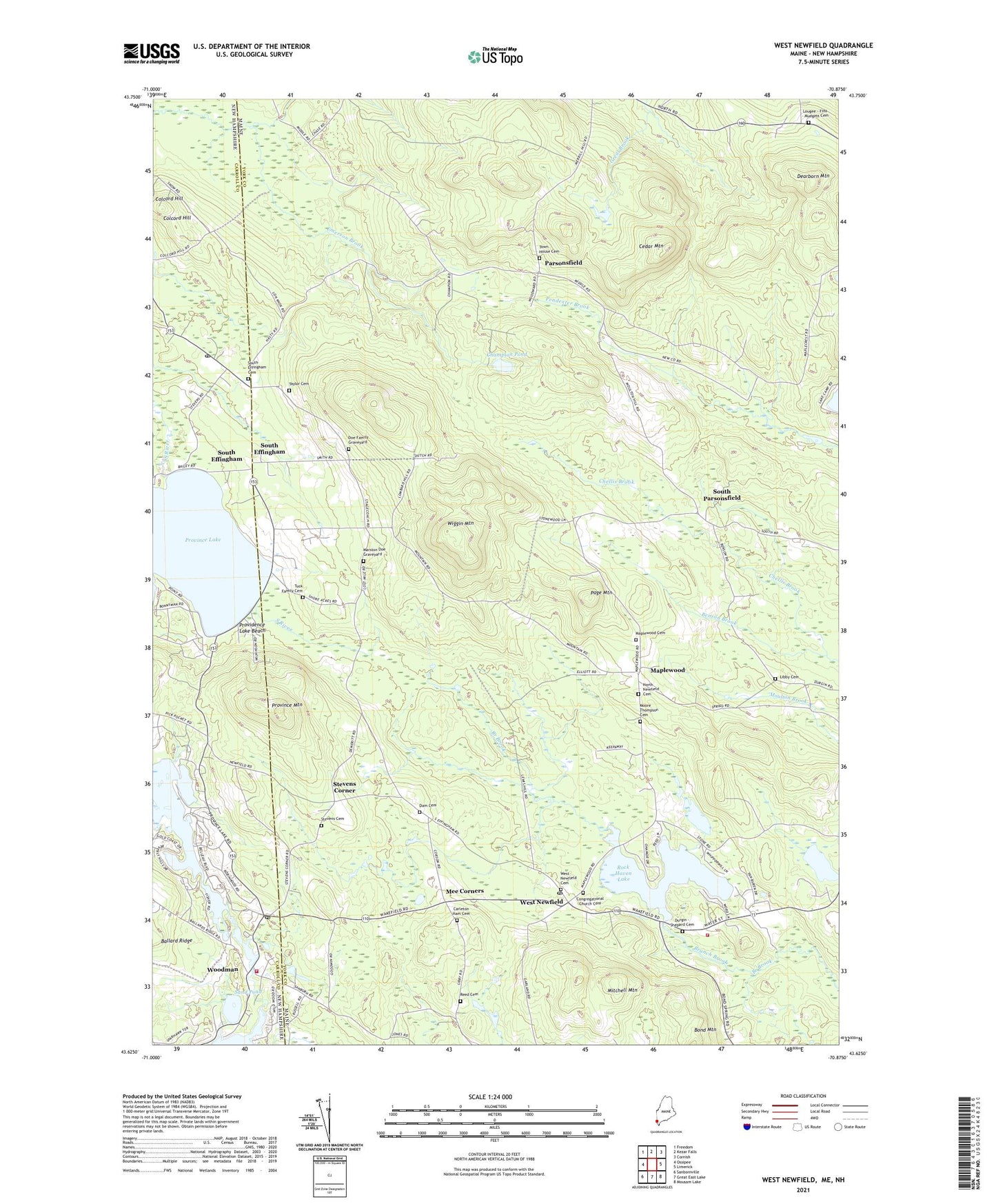
2024 topographic map quadrangle West Newfield in the states of Maine, New Hampshire. Scale: 1:24000. Based on the newly updated USGS 7.5' US Topo map series, this map is in the following counties: York, Carroll. The map contains contour data, water features, and other items you are used to seeing on USGS maps, but also has updated roads and other features. This is the next generation of topographic maps. Printed on high-quality waterproof paper with UV fade-resistant inks.
Quads adjacent to this one:
West: Ossipee
Northwest: Freedom
North: Kezar Falls
Northeast: Cornish
East: Limerick
Southeast: Mousam Lake
South: Great East Lake
Southwest: Sanbornville
Contains the following named places: Bally-Hoo Campground, Belleau Lake, Belleau Lake Dam, Carleton Ham Cemetery, Cedar Mountain, Champion Pond, Colcord Hill, Congregational Church Cemetery, Dearborn Mountain, Drew Pond, East Wakefield Post Office, Effingham Post Office, Emerson Brook, Hobbs Brook, Jacob L Taylor Cemetery, Libby Cemetery, Little Ossipee River Reservoir, Maplewood, Mee Corners, Mitchell Mountain, Moore Thompson Cemetery, Newfield Volunteer Fire Department, North Newfield Cemetery, Page Mountain, Parsonsfield, Providence Lake Beach, Province Lake, Province Lake Country Club, Province Mountain, Reed Cemetery, Roberts Corner, Rock Haven Lake, Rock Haven Lake Dam, Sand Pond, South Effingham, South Parsonsfield, South Parsonsfield Free Baptist Church, Stevens Cemetery, Stevens Corner, Symmes Pond, Town House Cemetery, Town of Newfield, Town of Parsonsfield, Tuck Family Cemetery, Wakefield Fire Rescue Station 2, West Newfield, Wiggin Mountain, Woodman, Woodman Dam, ZIP Codes: 04047, 04056, 04095