MyTopo
Barnegat Light New Jersey US Topo Map
Couldn't load pickup availability
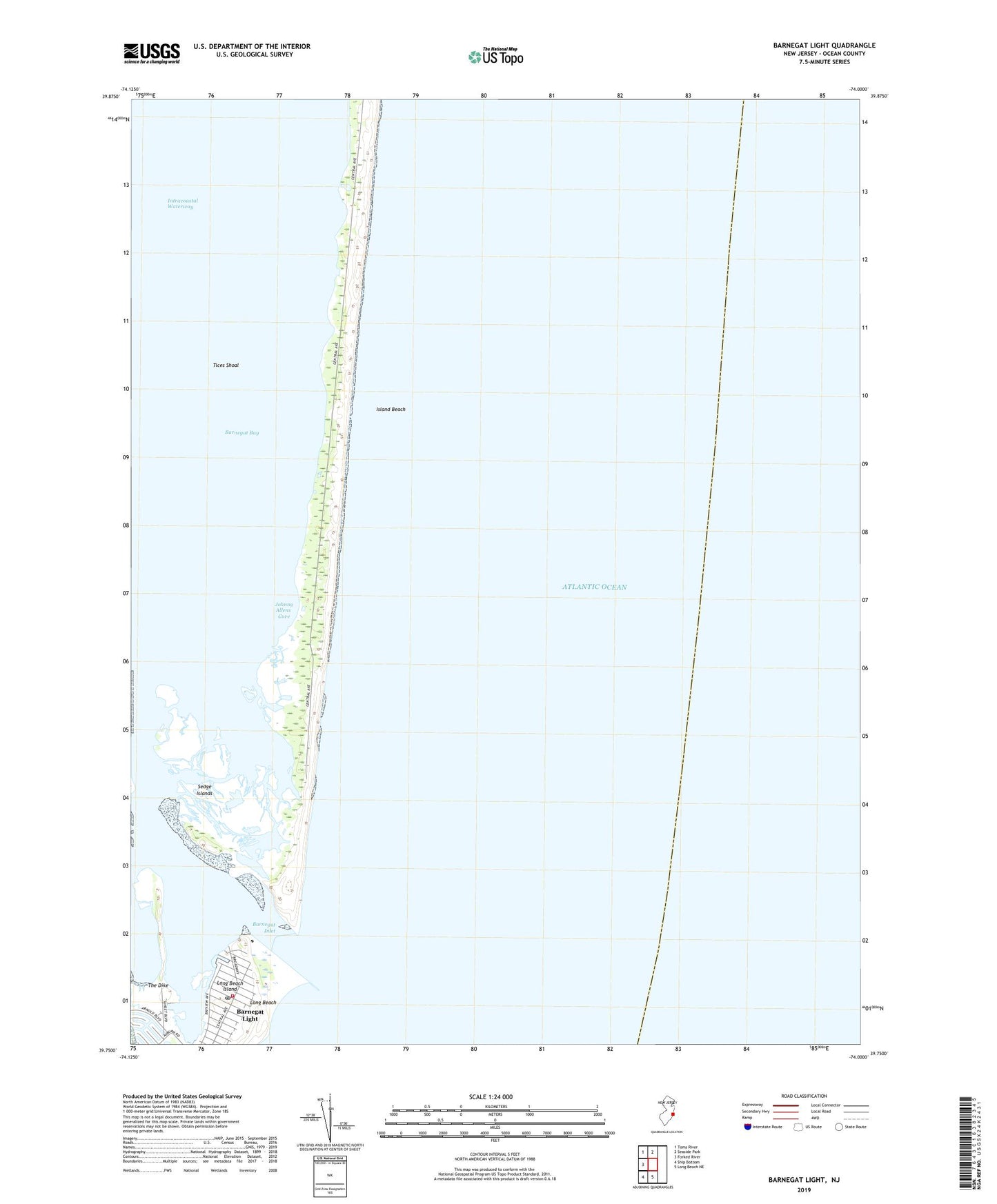
2019 topographic map quadrangle Barnegat Light in the state of New Jersey. Scale: 1:24000. Based on the newly updated USGS 7.5' US Topo map series, this map is in the following counties: Ocean. The map contains contour data, water features, and other items you are used to seeing on USGS maps, but also has updated roads and other features. This is the next generation of topographic maps. Printed on high-quality waterproof paper with UV fade-resistant inks.
Quads adjacent to this one:
West: Forked River
Northwest: Toms River
North: Seaside Park
South: Long Beach NE
Southwest: Ship Bottom
Contains the following named places: Barnegat, Barnegat Inlet, Barnegat Light, Barnegat Light First Aid Squad, Barnegat Light Post Office, Barnegat Light Volunteer Fire Company Station 13, Barnegat Lighthouse State Park, Borough of Barnegat Light, Island Beach, Island Beach State Park, Johnny Allens Cove, Sedge Islands, Sedge Islands State Wildlife Management Area, The Dike, Tices Shoal, ZIP Codes: 08006, 08752