MyTopo
Ship Bottom New Jersey US Topo Map
Couldn't load pickup availability
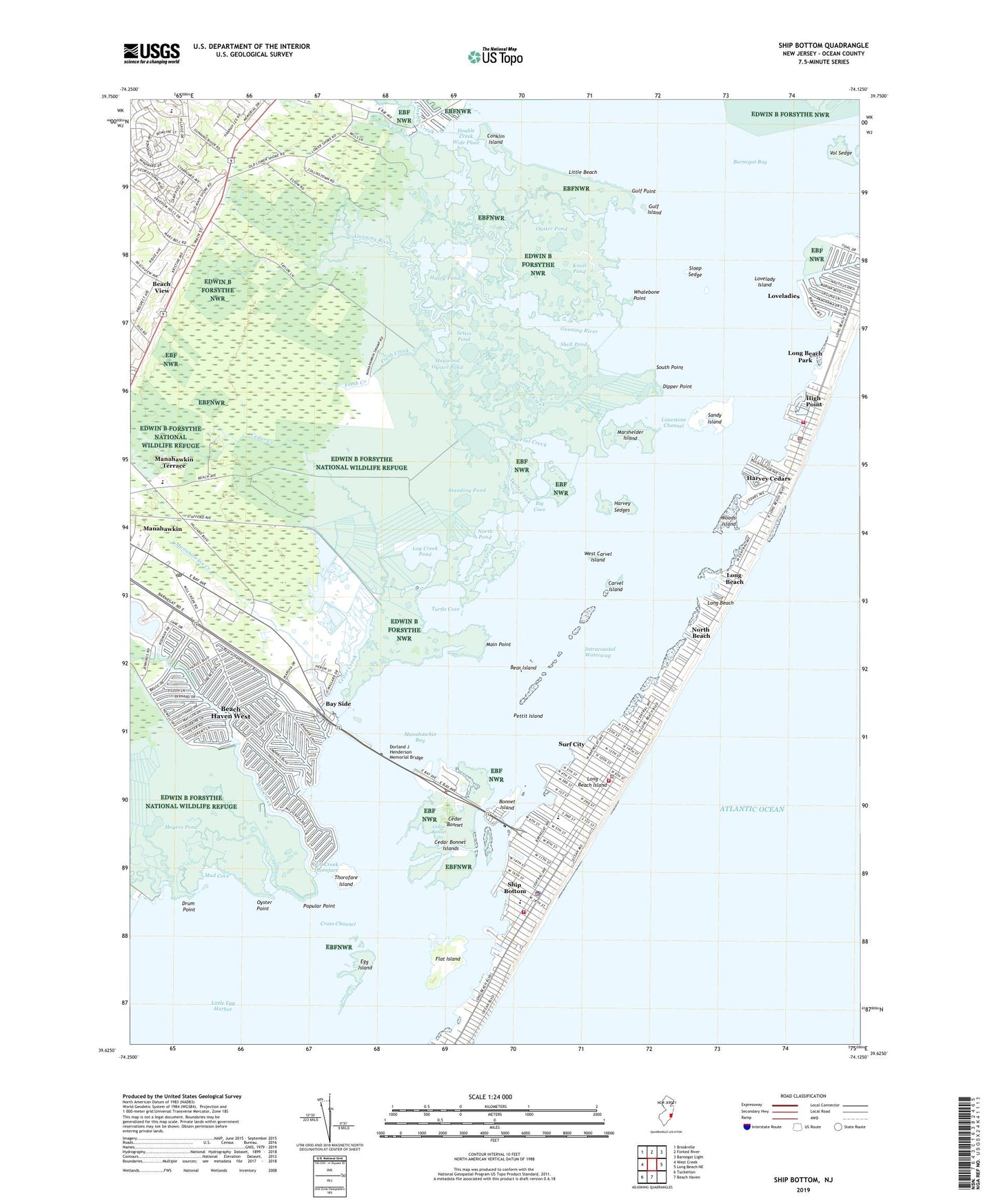
2023 topographic map quadrangle Ship Bottom in the state of New Jersey. Scale: 1:24000. Based on the newly updated USGS 7.5' US Topo map series, this map is in the following counties: Ocean. The map contains contour data, water features, and other items you are used to seeing on USGS maps, but also has updated roads and other features. This is the next generation of topographic maps. Printed on high-quality waterproof paper with UV fade-resistant inks.
Quads adjacent to this one:
West: West Creek
Northwest: Brookville
North: Forked River
Northeast: Barnegat Light
East: Long Beach NE
South: Beach Haven
Southwest: Tuckerton
This map covers the same area as the classic USGS quad with code o39074f2.
Contains the following named places: Arnold Pond, ASH Personal Heliport, Barnegat National Wildlife Refuge, Bay Side, Beach Haven First Aid Squad Ship Bottom Division, Beach Haven West, Beach Haven West Census Designated Place, Beach View, Bear Island, Big Cove, Big Flat Creek, Bonnet Island, Borough of Harvey Cedars, Borough of Ship Bottom, Borough of Surf City, Carvel Island, Cedar Bonnet, Cedar Bonnet Islands, Cedar Creek, Cedar Run County Park, Collins Lower Tide Pond, Collins Upper Tide Pond, Conklin Island, Crooked Creek, Cross Channel, Dipper Point, Dorland J Henderson Memorial Bridge, Double Creek, Double Creek Wide Place, Drum Point, Egg Island, Ethel A Jacobsen Elementary School, Flat Island, Fresh Creek, Gulf Island, Gulf Point, Gunning River, Harry Pond, Harvey Cedars, Harvey Cedars Police Department, Harvey Cedars Post Office, Harvey Sedges, Haywood Oyster Pond, High Point, High Point Volunteer Fire Company, Kinseys Pond, Knoll Pond, Lighthouse Christian Academy, Lillian M Dunfee Elementary School, Limestone Channel, Lincoln Park, Little Beach, Log Creek, Log Creek Pond, Long Beach, Long Beach Island, Long Beach Island Elementary School, Long Beach Park, Long Beach Township Beach Patrol, Loveladies, Loveladies Harbor, Lovelady Island, Main Point, Manahawkin Bay, Manahawkin Census Designated Place, Manahawkin Creek, Manahawkin Post Office, Manahawkin Terrace, Manahawkin Wildlife Management Area, Marshelder Island, Marshelder Pond, Meyers Pond, Mill Creek, Mill Creek Thorofare, Mud Cove, North Beach, North Pond, Oyster Point, Oyster Pond, Pettit Island, Popular Point, Sandy Island, Settin Pond, Shell Pond, Ship Bottom, Ship Bottom Police Department, Ship Bottom Post Office, Ship Bottom Volunteer Fire Company, Sloop Sedge, South Point, Stafford Township Emergency Medical Services Station 1 Headquarters, Standing Pond, Surf City, Surf City Police Department, Surf City Volunteer Fire Company 1 and Emergency Medical Services, Thorofare Island, Turtle Cove, Turtle Creek, Vol Sedge, West Carvel Island, Whalebone Point, WJRZ Radio Heliport, Woods Island, ZIP Code: 08050


